
Tropical Depression Two is expected to gradually strengthen and could bring tropical storm conditions to the Florida Panhandle beginning late Monday. Areas of flash flooding will be possible through Thursday along the eastern and central Gulf Coast. Severe thunderstorms will develop and move along a cold front crossing the Upper Midwest Monday, and through the Ohio Valley/Mid-Atlantic on Tuesday. Read More >
|
National Weather Service Lubbock Significant Weather Events
April 28, 2016: Severe Storms
|
|
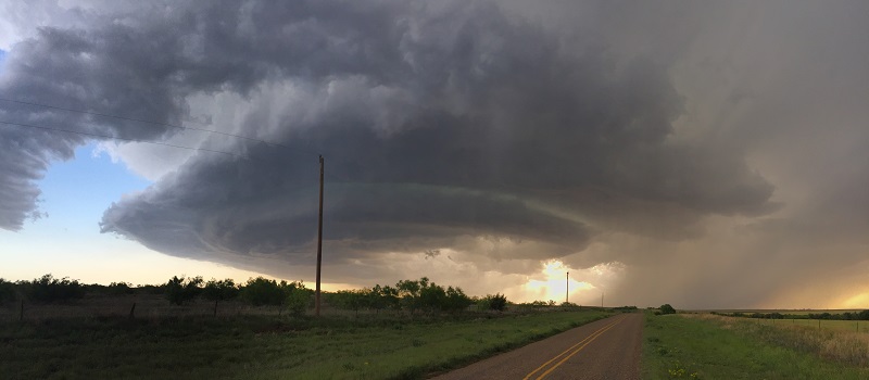
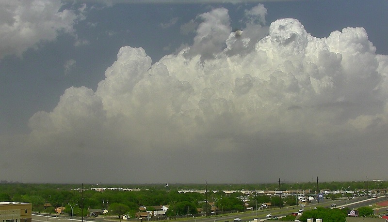
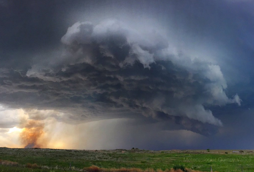
April 28th saw several thunderstorms develop in the vicinity of a dryline and cold front in West Texas. Two of the storms became supercellular and moved east-northeast from the east-central South Plains through the northern Rolling Plains and far southern Texas Panhandle. These storms were prolific hail producers, and also occasionally produced damaging wind gusts. Persistent wall clouds and several brief funnels were reported by storm spotters, and a possible brief tornado over open country. The southern supercell developed over southwest Floyd and northwest Crosby county. Our office webcam was able to get some nice pictures of the developing storm: |
|
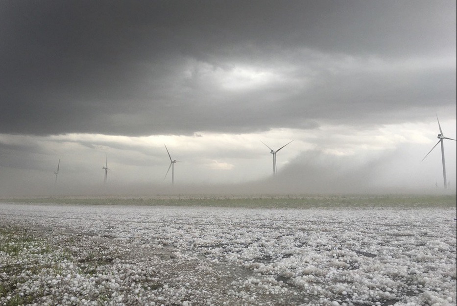
Hail up to the size of hen eggs (about two inches in diameter) was widely reported with the supercells. In some areas the hail piled up to such a degree that "hail fog" formed. Hail (ice) on the ground will begin to evaporate, cooling the air immediately above it. This can cause fog to develop in some instances. |
|
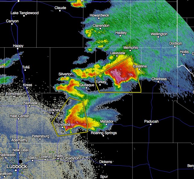
The image below is reflectivity from the Lubbock radar at 6 pm Thursday evening. It shows a snapshot of the two supercells in Floyd and Hall Counties. |
|
Lightning from thunderstorms can cause fires which in times of drought can grow to become large wildfires. |
|
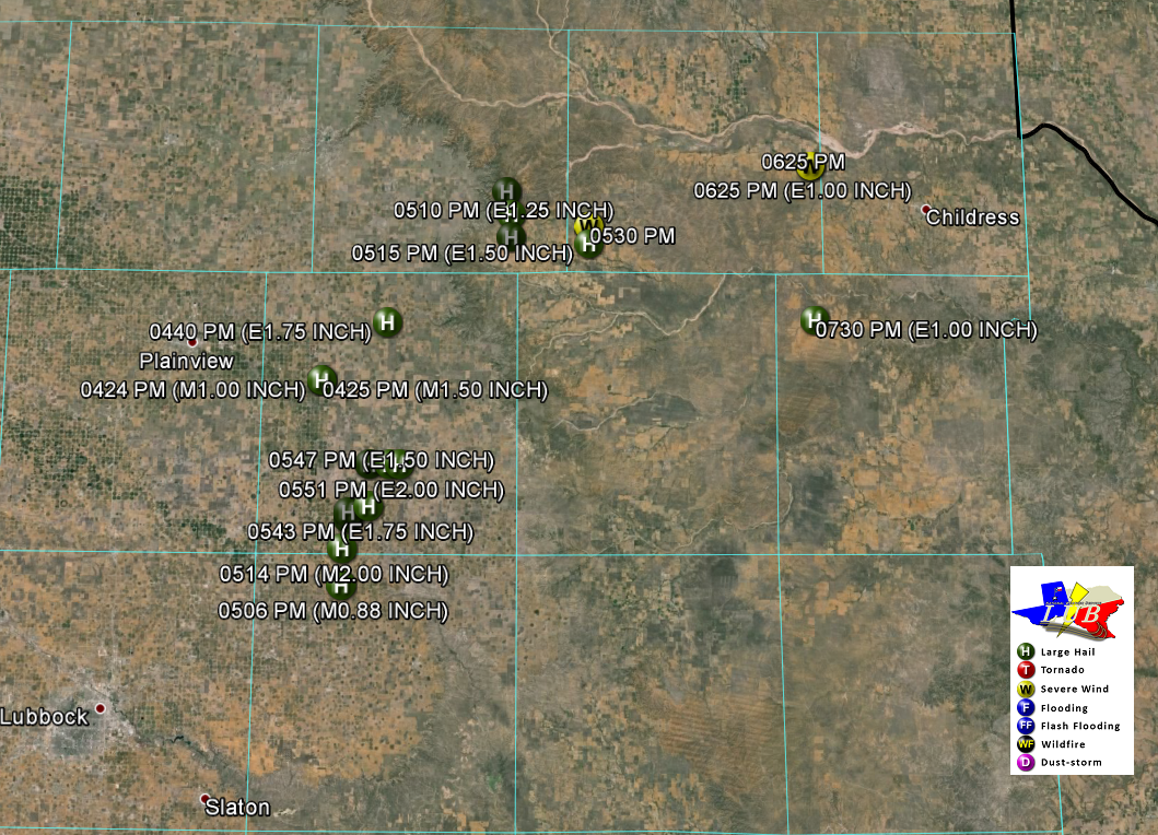
Here is a map showing the preliminary storm reports received by our office from this event. |
|
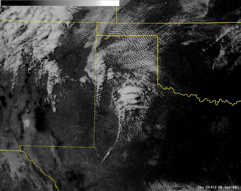
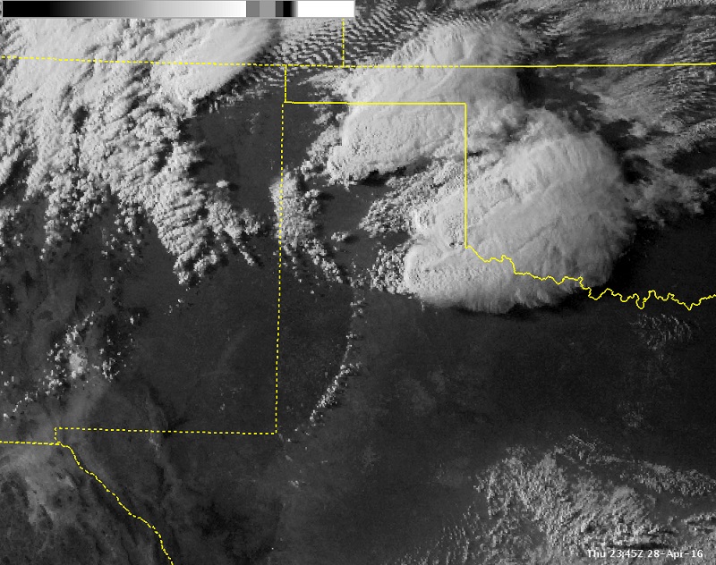
Finally, here are two satellite images from the event. The one on the left shows the thunderstorms in their developing stages at about 3:45 pm. The image on the right shows the mature supercells moving into the northern Rolling plains and eastern Texas Panhandle around 6:45 pm. The dryline can also be seen in both images, which had remained nearly stationary during this three-hour period. |
|
 |
 |

