| Late Season Storms and Heavy Rain 2 November 2016 |
 |
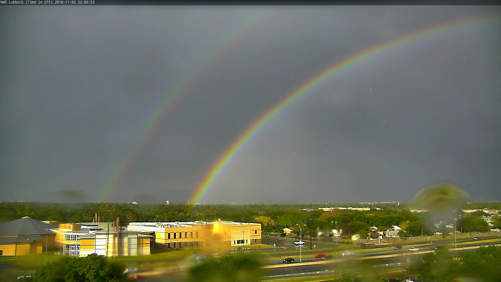
| A double rainbow observed on the back side of the storms during the evening of 2 November 2016. |
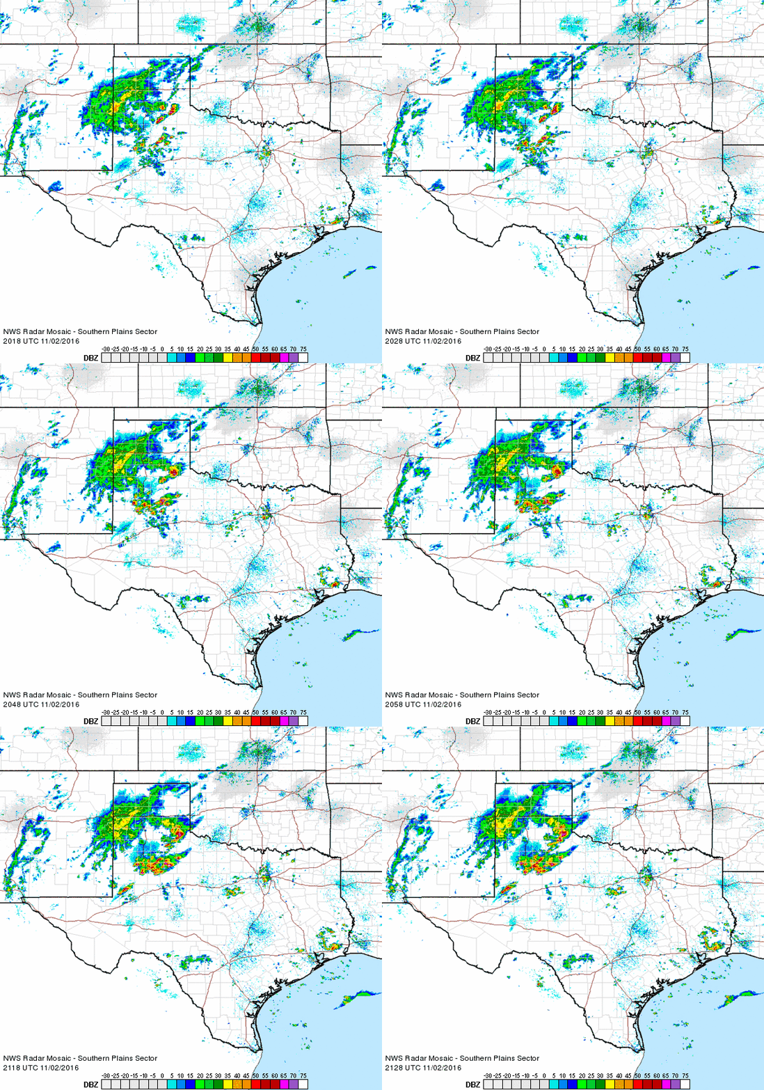
| Impressive warmth, moisture and instability (by November standards) combined with a cold front and approaching upper level storm system to produce a round of strong and severe storms during the late afternoon and evening of the Wednesday, November 2nd. The storms erupted during the mid-afternoon from the eastern Texas Panhandle into the Rolling Plains and southern South Plains, then quickly moved eastward through the evening. |
 |
| Regional radar animation valid from 3:18 to 4:28 pm on 2 November, 2016. |
|
Early on, the strongest storms produced large hail and damaging wind gusts. O'Donnell reported hail as large as golf balls, while the nearby West Texas Mesonet Station also recorded a wind gust to 60 mph. The combination of the wind and hail knocked out windows in O'Donnell. A separate storm generated a wind gust to 66 mph at the Childress Airport. A list of the preliminary storm reports for the event can be FOUND HERE. |
 |
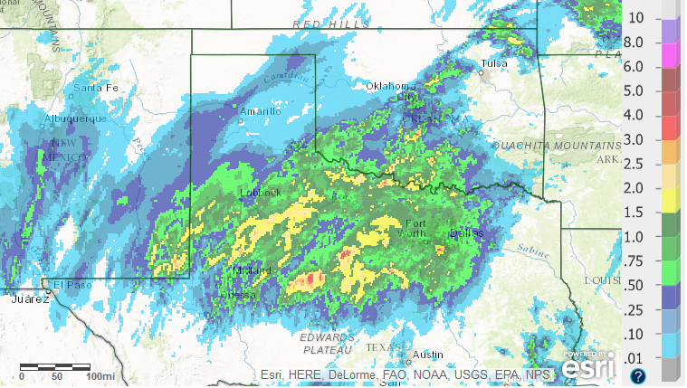
| 24-hour radar-estimated and bias-corrected rainfall totals ending on the morning of 3 November 2016. Click on the image for a zoomed in view on the South Plains region. |
| In addition to the severe weather, the storms dumped torrential rain. The heavy rain flooded roadways near Ralls and Childress. Rain totals of 1 to 2.50 inches were common from the southeast Panhandle through much of the Rolling Plains and the southern South Plains, with generally lighter totals further to the west on the Caprock. A few spots recorded in excess of 2.50 inches, including near Jayton, Snyder and north of Aspermont. |