National Weather Service United States Department of Commerce
 
 
National Weather Service Lubbock Significant Weather Events
May 29-30, 2016: Severe storms bring hail, wind, dust and heavy rainfall
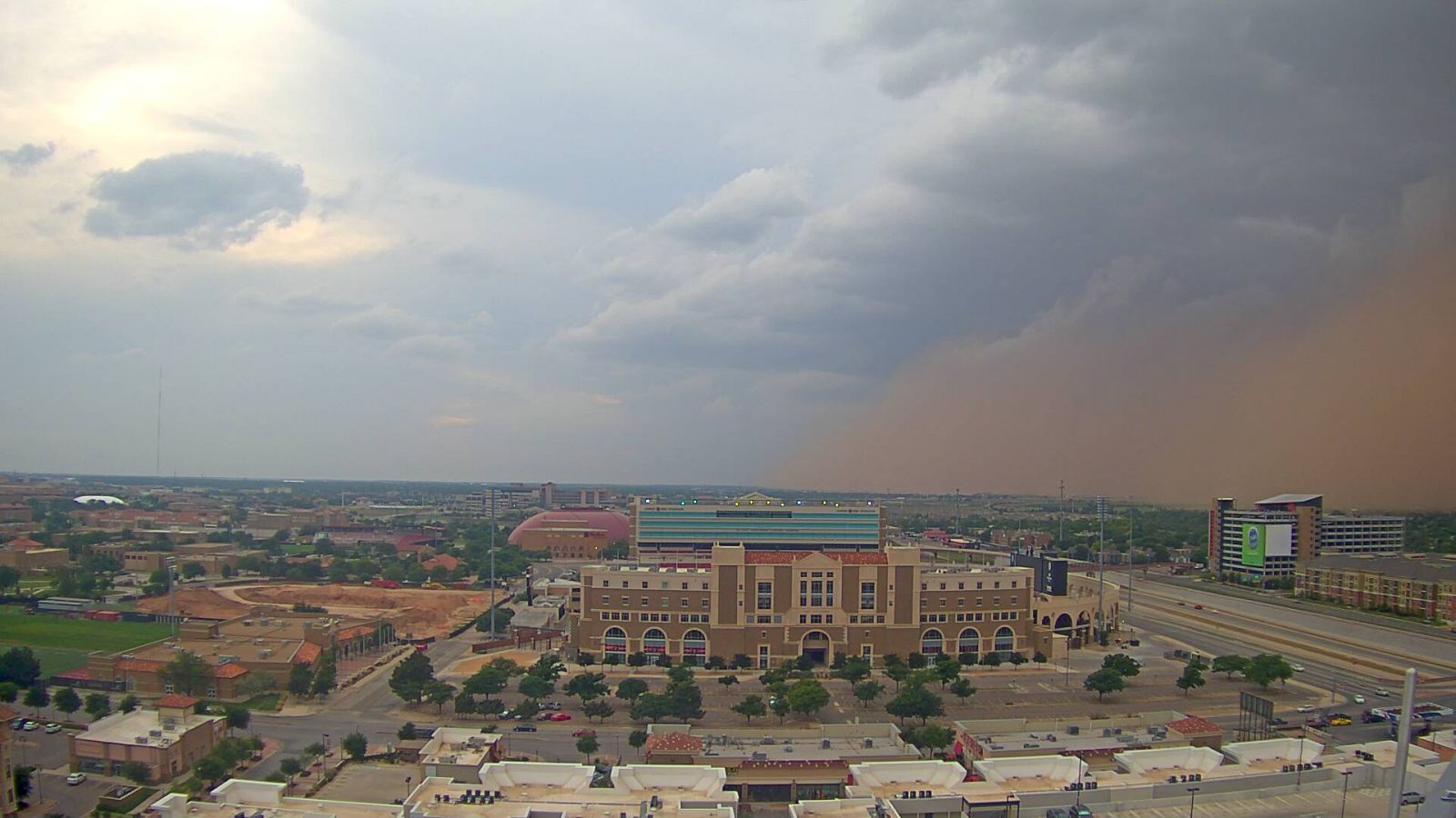
Leading edge of a dusty thunderstorm outflow rolls into north Lubbock during the evening of 29 May 2016. The image is courtesy of KAMC.

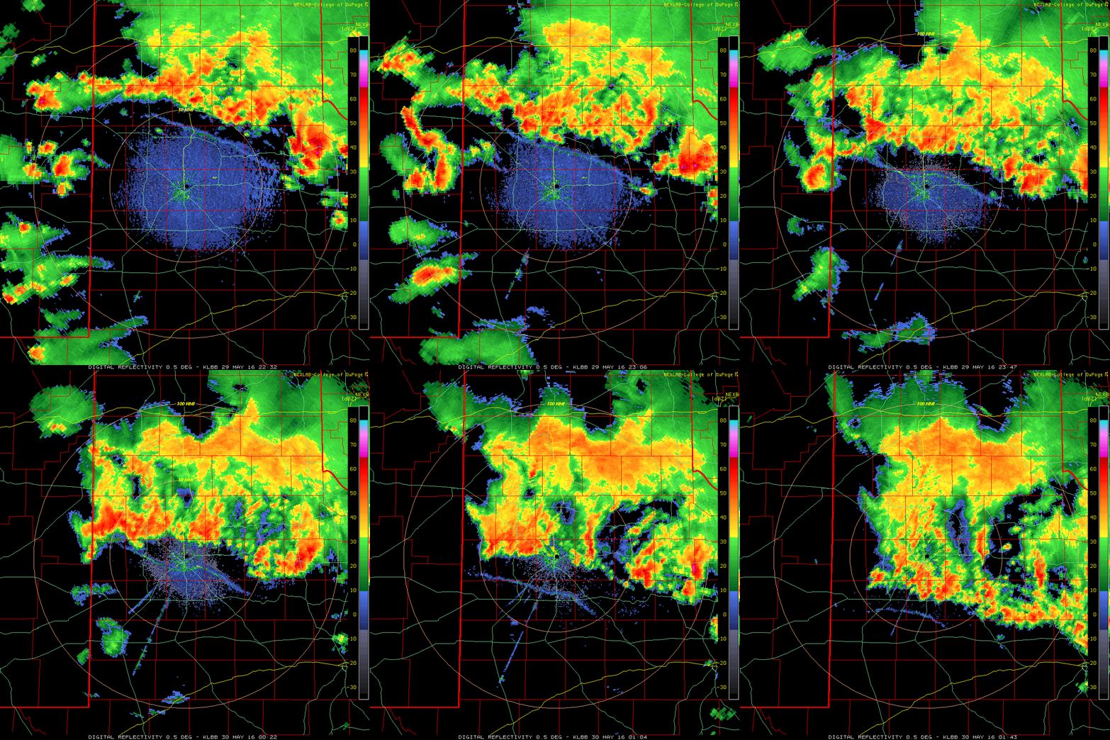
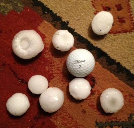
Late May provided another stretch of active weather for West Texas. The thunderstorm activity was driven by a return of abundant moisture and instability along with occasional weak upper level disturbances emanating from a slow moving storm system across the Desert Southwest. Widespread thunderstorms developed over the Texas Panhandle during Sunday afternoon (29 May 2016) with more scattered activity stretching down into the northern Rolling Plains. A particularly intense storm did produce hail as large as baseballs just north of Paducah around 5 pm before gradually weakening, while the slow-moving storms dumped very heavy rain over portions of the southeast Texas Panhandle into the northern Rolling Plains. However, the more widespread show for the South Plains was provided by a large complex of storms that congealed over the Texas Panhandle and then developed southward along and behind a strong outflow boundary that surged out of the afternoon and early evening activity.
 
Radar loop from the Lubbock WSR-88D valid from 5:32 pm to 8:43 pm on 29 May 2016.

Wind gusts of 50+ mph were fairly common behind this outflow boundary, and temperatures quickly plunged from the 80s into the 50s and 60s. The strong winds lofted abundant amounts of dust and generated a haboob (wall of dust) that raced southward across the South Plains mid-evening. Visibilities briefly dropped to near zero in spots as the haboob moved through.  In addition, as the boundary plowed into much warmer and more humid air, thunderstorms readily regenerated above and behind the surface outflow. The storms that formed produced frequent lightning and brief heavy rain in addition to the strong winds and pockets of small hail.
 
Large hail that fell about 10 miles north of Paducah on the evening 29 May 2016. The image is courtesy of KVII.

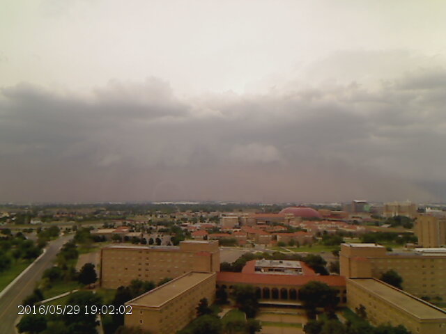
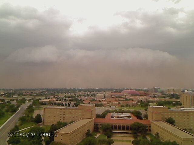
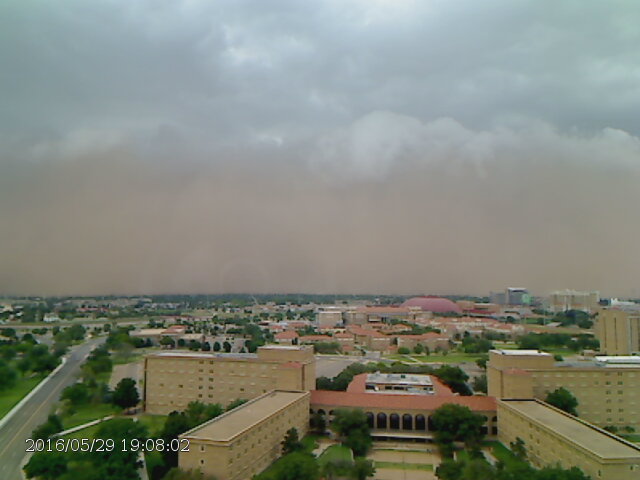
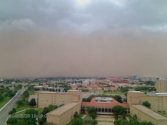
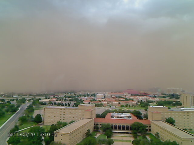
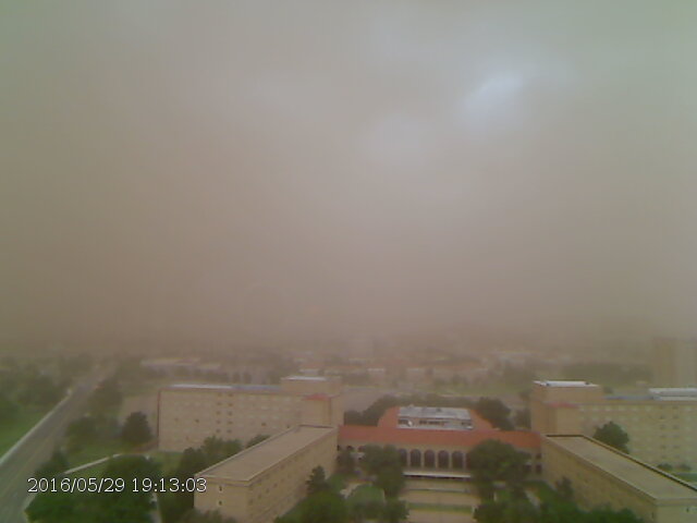
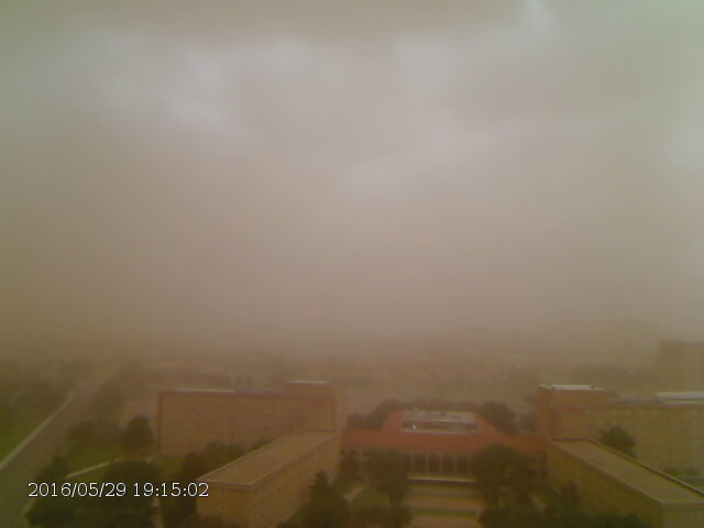
The passing thunderstorm outflow and associated wall of dust (haboob) produced a dramatic scene, as visualized in the below series of images captured at Texas Tech University.
 
Time series of a haboob as it approached and passed Texas Tech University during the evening of 29 May 2016. The images were captured between 7:02 pm and 7:15 pm and are courtesy of the Texas Tech Atmospheric Science Group. Time series of a haboob as it approached and passed Texas Tech University during the evening of 29 May 2016. The images were captured between 7:02 pm and 7:15 pm and are courtesy of the Texas Tech Atmospheric Science Group.Time series of a haboob as it approached and passed Texas Tech University during the evening of 29 May 2016. The images were captured between 7:02 pm and 7:15 pm and are courtesy of the Texas Tech Atmospheric Science Group.Time series of a haboob as it approached and passed Texas Tech University during the evening of 29 May 2016. The images were captured between 7:02 pm and 7:15 pm and are courtesy of the Texas Tech Atmospheric Science Group.Time series of a haboob as it approached and passed Texas Tech University during the evening of 29 May 2016. The images were captured between 7:02 pm and 7:15 pm and are courtesy of the Texas Tech Atmospheric Science Group.Time series of a haboob as it approached and passed Texas Tech University during the evening of 29 May 2016. The images were captured between 7:02 pm and 7:15 pm and are courtesy of the Texas Tech Atmospheric Science Group.Time series of a haboob as it approached and passed Texas Tech University during the evening of 29 May 2016. The images were captured between 7:02 pm and 7:15 pm and are courtesy of the Texas Tech Atmospheric Science Group.Time series of a haboob as it approached and passed Texas Tech University during the evening of 29 May 2016. The images were captured between 7:02 pm and 7:15 pm and are courtesy of the Texas Tech Atmospheric Science Group.
Time series of a haboob as it approached and passed Texas Tech University during the evening of 29 May 2016. The images were captured between 7:02 pm and 7:15 pm (from upper left to lower right) and are courtesy of the Texas Tech Atmospheric Science Group.
 

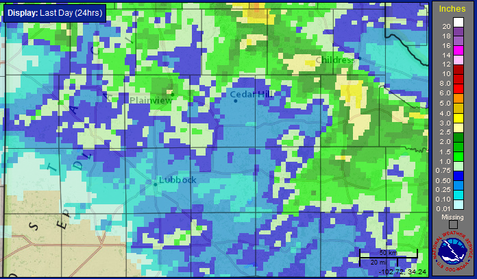
Outside of the strong winds and spotty hail, much of the region, save the southwest South Plains, saw at least some rain. A good chunk of the southern Texas Panhandle into parts of the northern South Plains and Rolling Plains recorded 1 to 2+ inches of rain. The heaviest rain, from 2 to 3 inches, fell from parts of northeast Swisher through western and southern Hall and much of Cottle Counties.
 
Radar-estimated and bias-adjusted 24-hr rain total ending at 11 am on 30 May 2016. For a wider regional perspective click on the image.

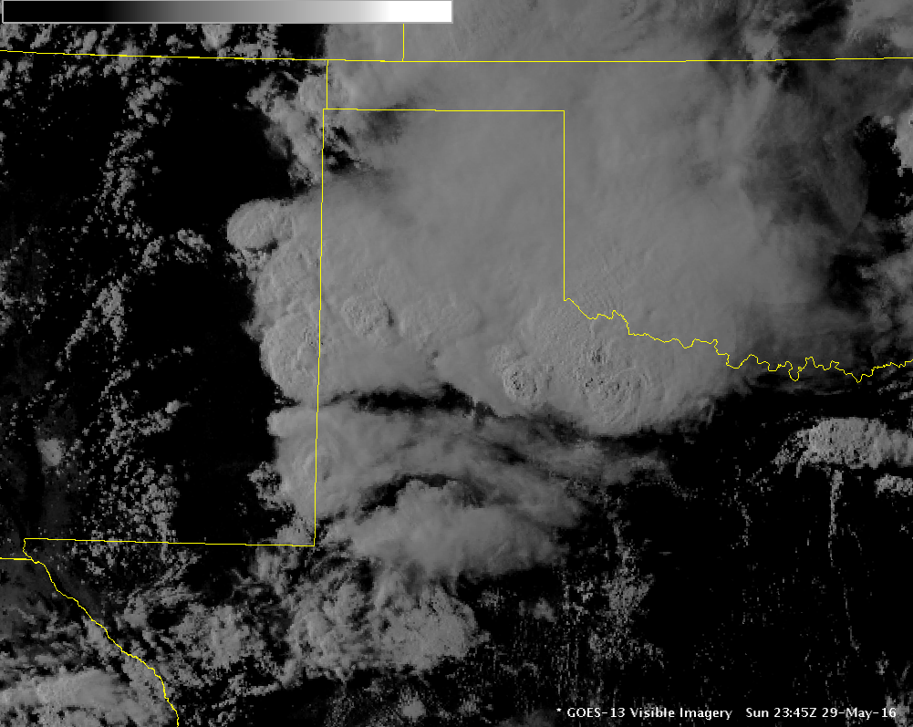
The thunderstorms quickly shifted southeast of the area late Sunday evening, but the complex continue all night and even into the next day, traversing Central Texas and eventually emerging over the northwest Gulf of Mexico Memorial Day morning. 
 
Visible satellite image showing all of the tall thunderstorm clouds over northwest Texas at 6:45 pm on 29 May 2016.

The large and long-lasting complex of thunderstorms late Sunday into early Monday (29-30 May) did stabilize the atmosphere over the South Plains through much of Memorial Day. That changed by late in the day though as temperatures eventually warmed into the 80s and plenty of residual moisture and instability lingered in the region.
 
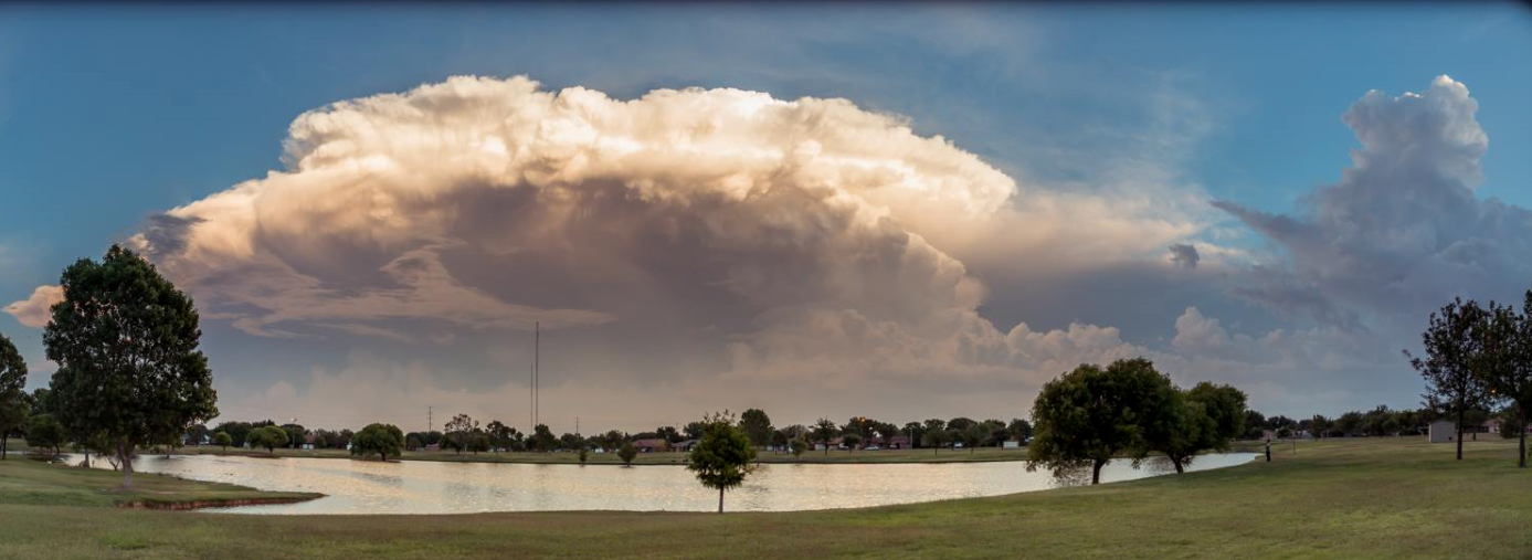
View of storms developing south of Lubbock during the evening of 30 May 2016. This Memorial Day storm was captured by Erin Shaw.

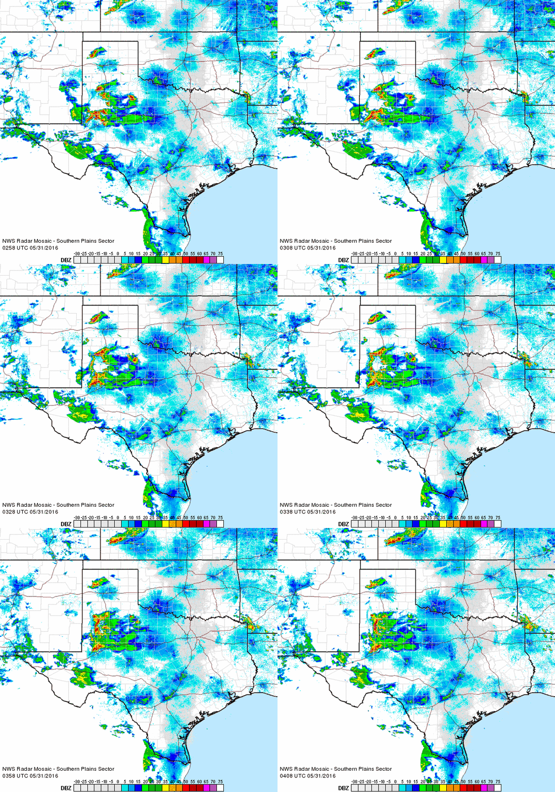
Initially thunderstorms were isolated to widely scattered during the early evening hours of Memorial Day. One stout storm did produce hail as large as golf balls to baseballs north of Dimmitt, while another slow-moving storm dumped torrential rainfall near Anton. The thunderstorms gradually expanded in coverage though the mid-late evening hours, developing on additional outflows that moved into the South Plains from storms that affected the Permian Basin. 
 
Regional radar animation valid from 9:58 pm to 11:08 pm on 30 May 2016.

One small cluster of storms development near Lubbock and dropped quarter to half dollar size hail across the southwest side of town, while locations in and around Tahoka experienced similarly sized hail. In addition to the hail, the storms dropped brief heavy rains that resulted in minor flooding. The exception to this was near Anton where a particularly intense and slow-moving storm dumped a couple of inches of rain or more in a very short period of time, causing more extensive flooding.
 
Hail observed 7 miles north of Dimmitt on the evening of 30 May 2016. The picture is courtesy of Rodney Hunter and KVIIHail that fell near 75th St. and Homestead Ave. in southwest Lubbock around 9:30 pm on 30 May 2016. The picture is from Tim Berry.
(left) Hail observed 7 miles north of Dimmitt on the evening of 30 May 2016. The picture is courtesy of Rodney Hunter and KVII. (right) Hail that fell near 75th St. and Homestead Ave. in southwest Lubbock around 9:30 pm on 30 May 2016. The picture is from Tim Berry.

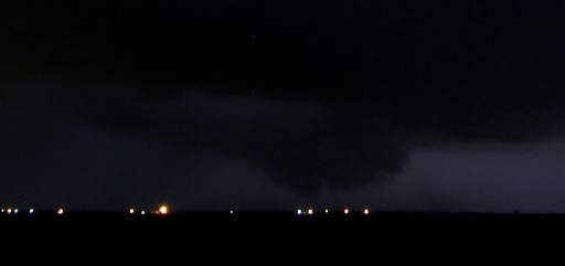
The storm near Anton also began to rotate strongly and produced the low-hanging wall cloud seen below. A few reports of a strongly rotating wall cloud were received with this storm too, and an unconfirmed report of a funnel cloud and possible brief tornado touchdown. This storm eventually weakened but still went on to dump torrential rain and produce flooding in and around Anton before diminishing.
 
Wall cloud associated with and intense thunderstorm near Anton, Texas, during the late evening of 30 May 2016. The image was taken by Bruce Haynie.
Wall cloud associated with and intense thunderstorm near Anton, Texas, during the late evening of 30 May 2016. The image was taken by Bruce Haynie. 


A final round of storms then formed and swept through the central South Plains, producing a wind gust as high as 53 mph, and a half inch of rain in 10 minutes as it moved through Reese Center shortly before midnight. This activity quickly faded shortly after midnight, bringing an end to another active weather day.

Text listing of the preliminary storm reports for the active stretch can be viewed at: May 29, 2016 and May 30, 2016.