| Widespread Heavy Rain for West Texas 21-22 October 2015 |
 |
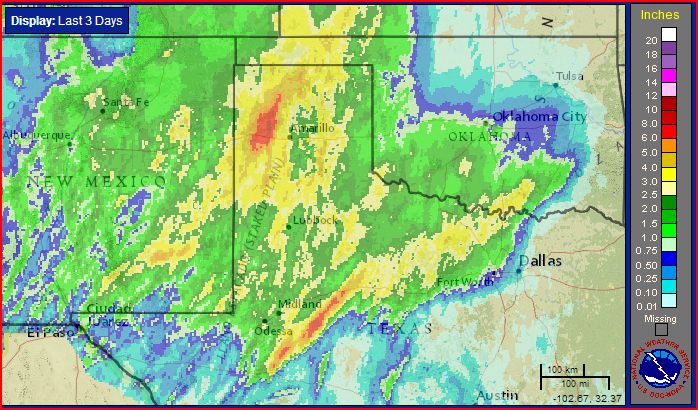
| Three-day radar-estimated and bias-adjusted rain totals ending at 7 pm on 23 October 2015 (Thursday). Click on the image for a close up version of the South Plains region. |
| A powerful and moisture-rich upper level storm system brought widespread heavy rain to the region in late October. The storm system slowly approached from the Desert Southwest during the week. Initially, well ahead of the system, several spots saw localized but heavy thunderstorms Monday (19 October) and Tuesday (20 October). However, the big show waited until late Wednesday into early Thursday, when the upper level low drew closer to West Texas. |
 |
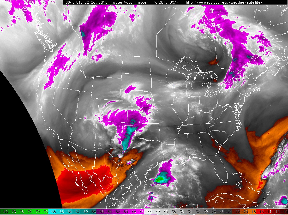
| Water vapor image captured at 12:45 am on 22 October 2015 (Thursday). An infrared satellite image taken at 3:45 am can be VIEWED HERE. |
| The above imagery shows the storm system churning over the southwestern United States. This system provided strong lift which when coupled with abundant Gulf moisture, produced widespread showers and thunderstorms. Early on, heavy rain tracked repeated across eastern New Mexico into the western Texas Panhandle late Tuesday into Wednesday. This is when portions of the western Texas Panhandle received the bulk of its rain, including the Boys Ranch West Texas Mesonet which recorded an impressive 7.87 inches. |
 |
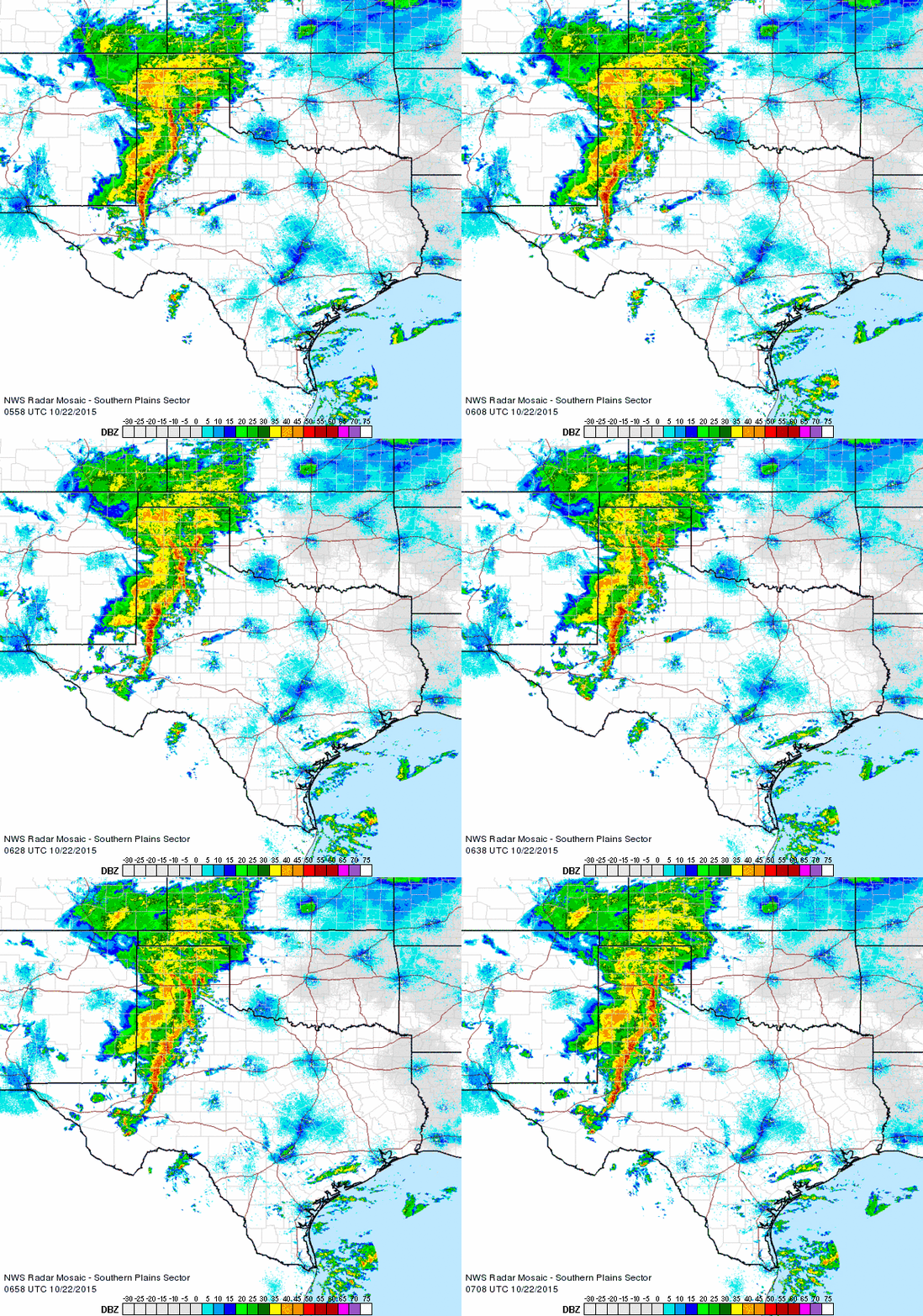
| Regional radar animation valid from 12:58 am to 2:08 am on 22 October 2015 (Thursday). Additional radar animations can be found at: 11:08 pm to 12:18 am on 22 October 2015; and 2:38 am to 3:48 am on 22 October 2015. |
| A large complex of thunderstorms then formed across eastern New Mexico Wednesday evening and rolled across the South Plains and the Rolling Plains late Wednesday night into Thursday morning. A few of the thunderstorms were on the strong side, producing wind gusts as high as 63 mph near Tulia and 60 mph near Graham. The strong winds did down some trees in Tulia. However, the more widespread impact was the heavy rain, with most of the South and Rolling Plains recording 1 to 3 inches, with localized 3 to 4 inch amounts. Runoff from the heavy rain did produce minor increases in area reservoirs, while also helping to squash the drought that was trying to make a modest return. The bulk of the heavy rain quickly shifted into Central and North Texas by late Thursday, where some spots there recorded 6 inches to more than a foot of rain. |