| Another Round of Early October Rain 7-8 October 2015 |
 |
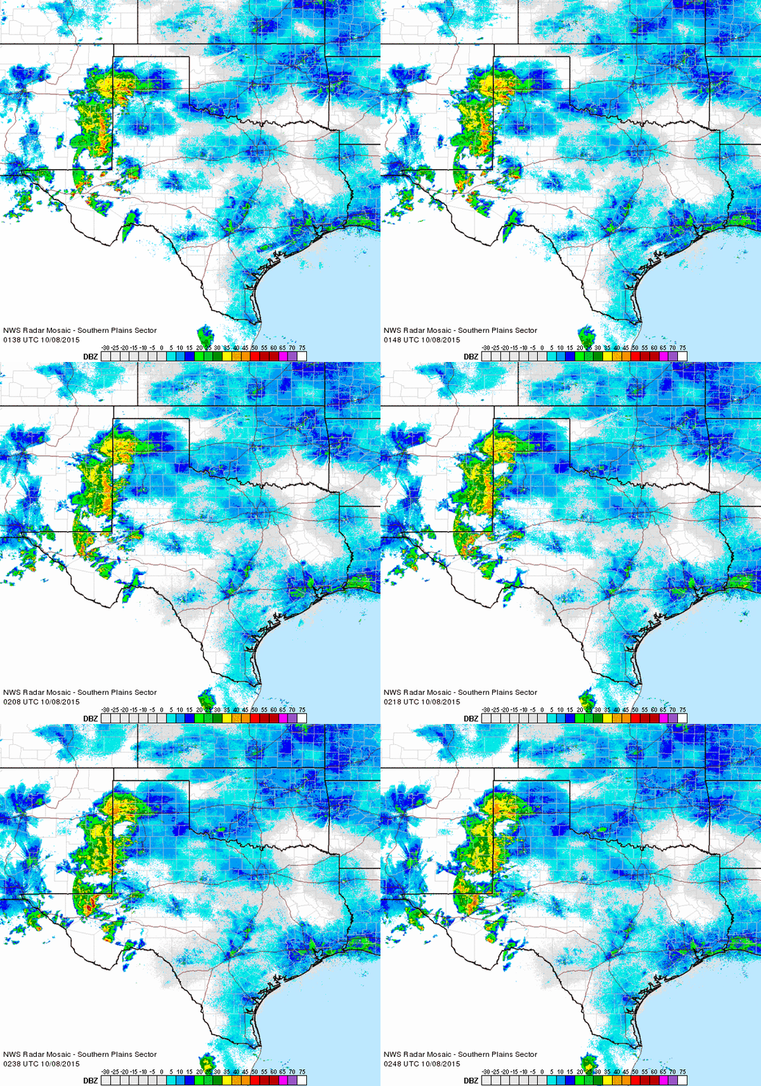
| Regional radar animation valid from 8:38 pm to 9:48 pm on Wednesday, 7 October 2015. |
| A large upper level storm system came just close enough to help provide another round of widespread rain to eastern New Mexico and the western South Plains on Wednesday and Thursday (7-8 October 2015). Although the center of the upper level low never came closer than southeast Arizona, it did provide enough lift to take advantage of the relatively moist atmosphere in place. Widespread showers and thunderstorms developed over eastern New Mexico Wednesday afternoon and evening. This activity advanced slowly eastward into West Texas while producing very heavy rain (see above). A couple of the storms early on were even on the strong side, producing a 58 mph wind gust near Friona and nickel size hail north of Bovina. |
 |
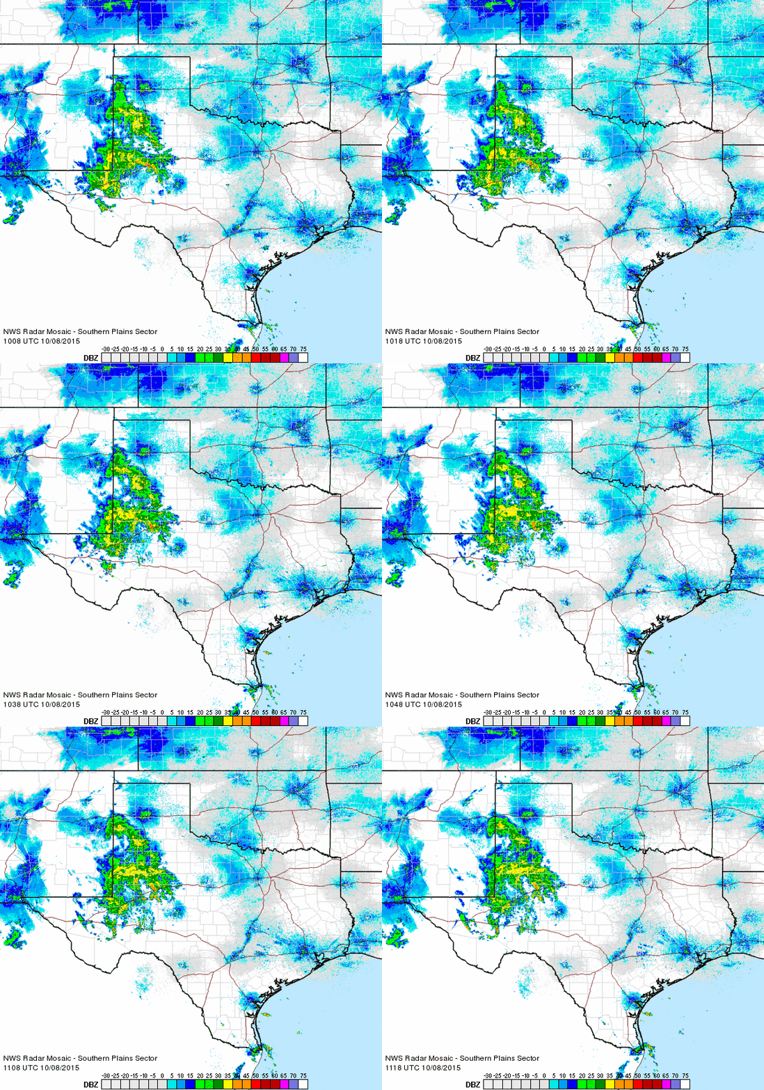
| Regional radar animation valid from 5:08 am to 6:18 am on Thursday, 8 October 2015. An additional radar animation valid from 2:18 pm to 3:28 pm on 8 October can be FOUND HERE. |
| The thunderstorms weakened during the overnight hours, but continued to drop heavy rain as they moved into the central South Plains (see the above animation). Northwest portions of Parmer County were hardest hit, where over 3 inches likely fell. All of the rain inundated FM 1731 north of Bovina and FM 2013 west of Friona. The widespread rain diminished by late Thursday morning, though more localized heavy rain did visit portions of the southern South Plains Thursday afternoon. A cold front moving through the area the next day (Friday, 9 October) did bring scattered showers too, though rainfall was spotty and light as the upper level storm system moved back west toward the eastern Pacific Ocean. |
 |
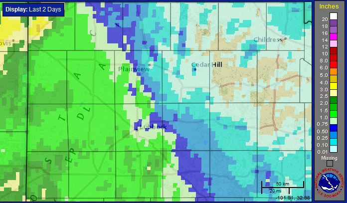
| Two-day radar-estimated and bias-corrected rain totals ending at 2 pm on Friday, 9 October 2015. A regional view of the same map can be VIEWED HERE. In addition, the 2-day COOP totals can be FOUND HERE. |
| Over the course of the event, most locations along and west of a Summerfield to Lubbock to Post line recorded 1 to 2 inches, with localized higher amounts. Lubbock officially recorded nine-tenths of an inch, raising the yearly total to 24.41 inches, or 8.29 inches above average through October 8th. The story was much different to the east of this line, as rainfall amounts quickly dropped off. Drier air and the further proximity to the upper level storm system won out, keeping the southeast Texas Panhandle and much of the Rolling Plains on the drier side. |