Scattered Intense Thunderstorms Followed by Widespread Rains
26-28 April 2015 |
 |
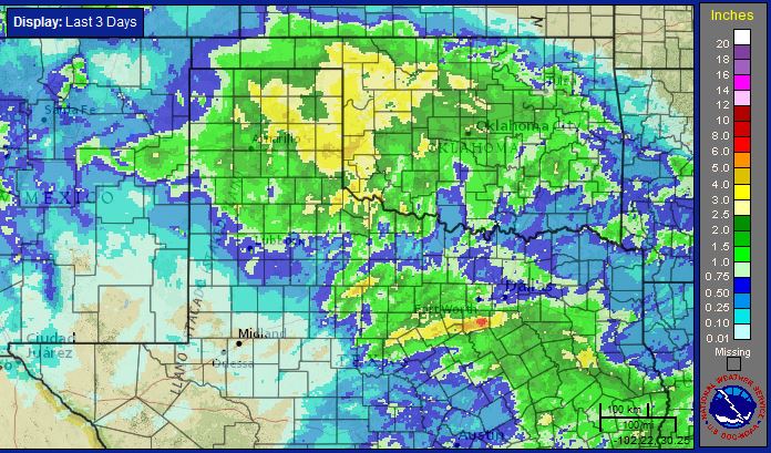
| Radar-estimated, bias-corrected 3-day rainfall ending at 4 pm on Tuesday, April 28, 2015. Click on the map for a close up view of the South Plains and Rolling Plains region. |
| |
| A powerful upper level storm system brought active weather to the southern plains in late April. The storm system first approached from the region from the west Sunday afternoon (April 26, 2015). Lift in advance of the system combined with warm temperatures and quickly increasing moisture and instability to bring several rounds of strong to severe thunderstorms to the Rolling Plains Sunday afternoon and evening. Reports of quarter to nickel size hail were received north of Paducah and near Kirkland, respectively, though larger hail likely fell in some rural areas off the Caprock. In addition, the intense thunderstorms moved slowly and many of them tracked over the same area dumping heavy rains over portions of the southeast Texas Panhandle and northern Rolling Plains. |
| |
| |
| The strong and severe thunderstorms gradually diminished Sunday evening, but more widespread rain redeveloped during the late evening and overnight hours as additional lift from the approaching upper level low interacted with a southwestward moving cold front. The below series of visible satellite images nicely show the progress off the upper level storm system from west to east, with scattered thunderstorms expanding into a broad area of clouds and rain that wrapped into the Texas Panhandle early Monday before eventually pivoting back southward over the South Plains region later in the day. |
| |
|
|
| Sequence of visible satellite images captured at: 2:45 pm on April 26th (left); 10:45 am on April 27th (center); and 6:15 pm on April 27th (right). |
| |
| The following radar animations also show how the broad area of light to moderate rain progressed from Monday morning to Monday evening. Before all was said and done many locations from the central into the eastern Texas Panhandle received 2 to 3+ inches of rainfall. Childress officially recorded 2.67 inches over the 3-day event. This heavy rain did lead to minor flooding in spots, but overall was very beneficial. Rainfall totals were lighter further to the south, tapering off to only trace amounts in much of the Permian Basin (see the top and bottom maps on this page for details). Lubbock officially recorded 0.59 inches. The rain gradually diminished early Tuesday morning as the upper low exited the region to the east. |
| |
|
|
| Regional radar animations valid from: 9:48 to 10:58 am April 27th (left); and 7:28 to 8:38 pm on April 27th (right). |
| |
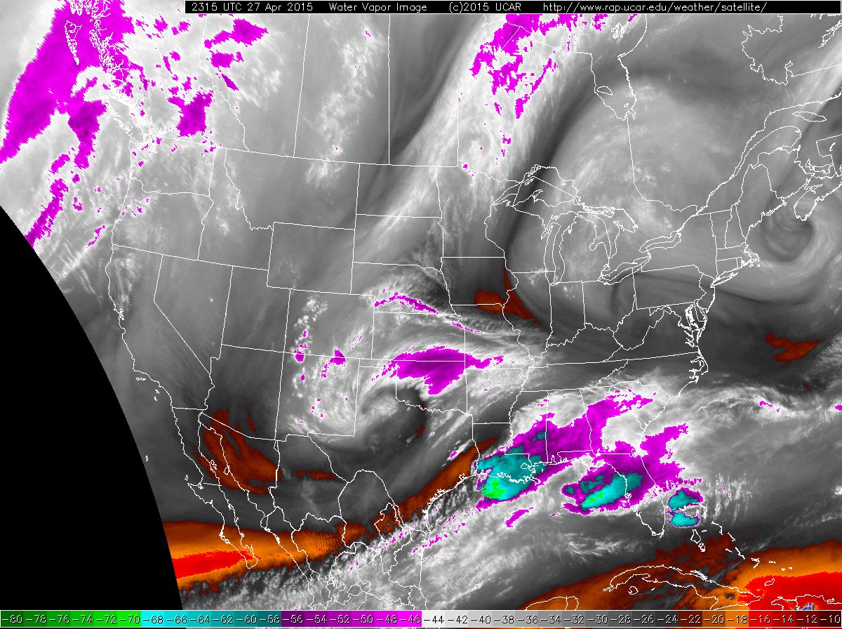
| The below water vapor imagery shows the well wound up storm system squarely atop West Texas Monday evening. The storm system did not only generate widespread precipitation, it also brought much colder air into the region. After highs in the 70s and 80s on Sunday, temperatures tumbled through much of the day on Monday. The high for Lubbock on the 27th only reached 54 degrees, setting a record minimum high for the date. The previous record was 56 degrees, set way back in 1916. The temperatures even fell into the 30s across the western Texas Panhandle and this allowed a few flakes of snow to mix in for a short time. In addition, gusty northerly winds made it feel like it was in the 20s and 30s over much of the Texas Panhandle and South Plains by Monday evening. |
| |
 |
| Water vapor satellite image captured at 6:15 pm on April 27th. |
| |
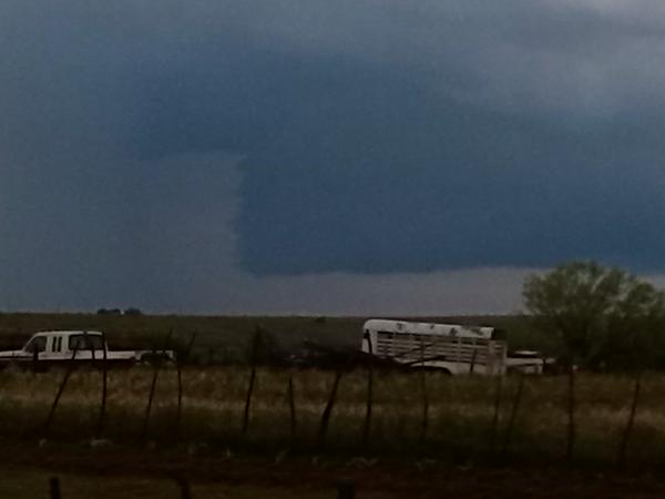
| Before the cold air settled into the region, a couple of the strong storms on Sunday even became organized enough to produce wall clouds, like the one below captured near Paducah early Sunday evening. |
| |
 |
| Picture of a wall cloud near Paducah on the evening of April 26, 2015. The image is courtesy of Randy Detwiler. |
| |
| The map below shows the observed rainfall over the late April event, along with the variation in temperatures from the 26th to the 27th. Also available are the wind chill readings observed late Monday evening. All of the data are courtesy of the West Texas Mesonet. |