 |
 |
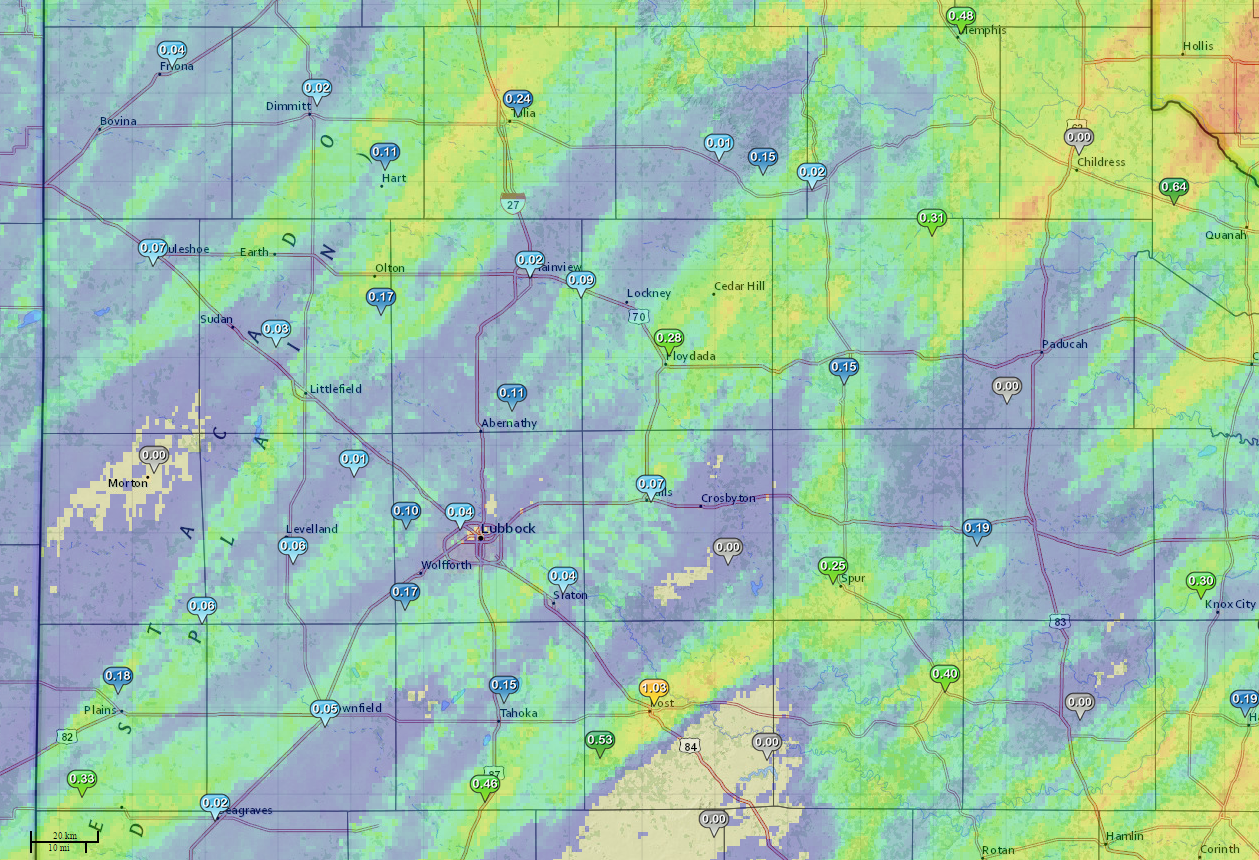
| A map of rainfall totals across the South Plains. from April 15th through early morniing on April 17th, 2015. The background is radar estimated rainfall, overlaid with gage reports. The gage data is courtesy of the West Texas Mesonet (www.mesonet.ttu.edu). Click on the image to view a larger version. |
| |
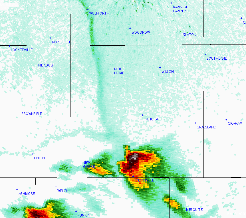
| Thursday, April 16th brought some thunderstorm activity to the South Plains area. A large-upper level low pressure system was spinning over the 4-corners area, and this brought favorable strong winds and cold air aloft to West Texas. Although surface moisture was not especially abundant, expecially on the Caprock, dewpoints in the 40s and lower 50s supported some isolated thunderstorm development during the afternoon, followed by a line of storms overnight. As the image above shows, rainfall was generally light and fell in narrow swaths. Post recorded just over one inch of rain from storms early Friday morning. Thursday afternoon, one of the thunderstorms developed in southern kent County, then moved almost due north across Dickens and Motley Counties, bringing large hail up to golfball size to the communities of Spur, Roaring Springs and Matador. Late in the day, another north-moving storm moved across Lynn County, and produced large hail at O'Donnell and Tahoka. A radar image of this storm is shown below as it had passed O'Donnell and was moving toward Tahoka. |
| |
 |
| Radar image from the National Weather Service Dopppler radar in Lubbock at 8:00 pm CDT on April 17th, 2015. Click on the image to view a larger version. |
| |
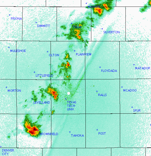
| After dark, the dryline retreated into the western South Plains. A thin, broken line of storms developed along the dryline and then marched east through the early morning hours on Friday. The radar image below at midnight shows a strong storm which was producing pea-sized hail near Brownfield. This storm eventually moved across south Lubbock, and hail ranging from pea-sized up to quarter-sized were reported on the south side of town. |
| |
 |
| Radar image from the National Weather Service Dopppler radar in Lubbock at 12:00 am CDT on April 17th, 2015. |
| |
| Here are some photographs of the weather across the area: |
| |
|
|
| |
|
|
| A sampling of photos from social media sites. The lightning photo in the upper left was taken by Eddie Wimberly near Wolfforth. In hail in the upper-right photo fell near Spur. The hail in the lower-left fell in Tahoka, and the photo was taken by Brenda Cantu. The hail in the lower-right photo fell near Ralls and the photo was taken by Joshua Rojas. These four images were posted on the KCBD Faebook page (https://www.facebook.com/KCBDNewsChannel11). Click on the images to view a larger version. |
| |
| |
| |