Winter makes a prolonged visit to the South Plains region
30 December 2014 - 3 January 2015 |
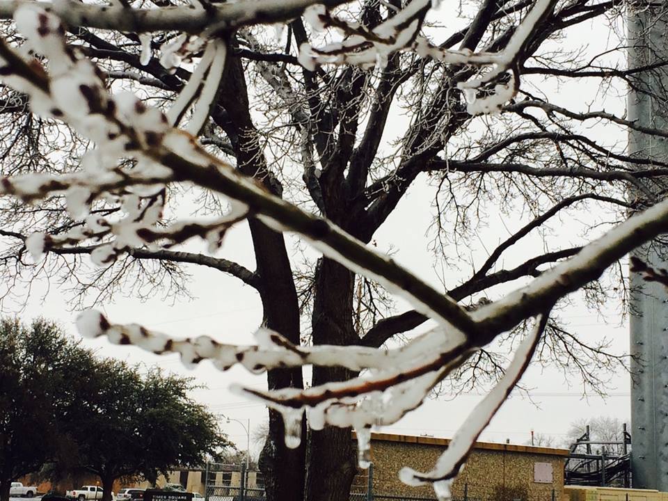 |
| Significant ice accumulation on a tree branch in Lubbock on Friday afternoon (2 Dec. 2015). |
| |
|
The close of 2014 and beginning of 2015 started on the cold and wintry side. Initially, a strong cold front moved through Monday night (Dec. 29th). Arctic air poured in behind this front, quickly dropping temperatures well below freezing. This cold air combined with weak passing upper level disturbances to bring a bout of freezing drizzle and light freezing rain to much of the region on Tuesday (Dec. 30th). Roadways became very slick making travel difficult and dangerous. A bout of light snow followed Tuesday evening, with many locations picking up a dusting to about an inch of accumulation by the next morning.
|
| |
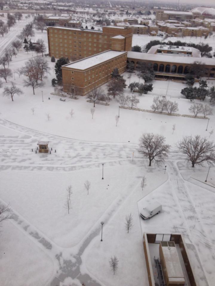 |
| View of the Texas Tech campus on New Year's Eve 2014. The ice and snow made for a nice wintry view, though it did make travel difficult. The picture is courtesy of Tony Reinhart. |
| |
| The wintry precipitation diminished by Wednesday afternoon (Dec. 31st), but temperatures remained well below the freezing mark. Another bout of light freezing drizzle followed at many locations Wednesday night (New Year’s Eve), keeping travel on the tricky side. It remained cloudy and cold New Year’s Day, but was relatively dry. |
| |
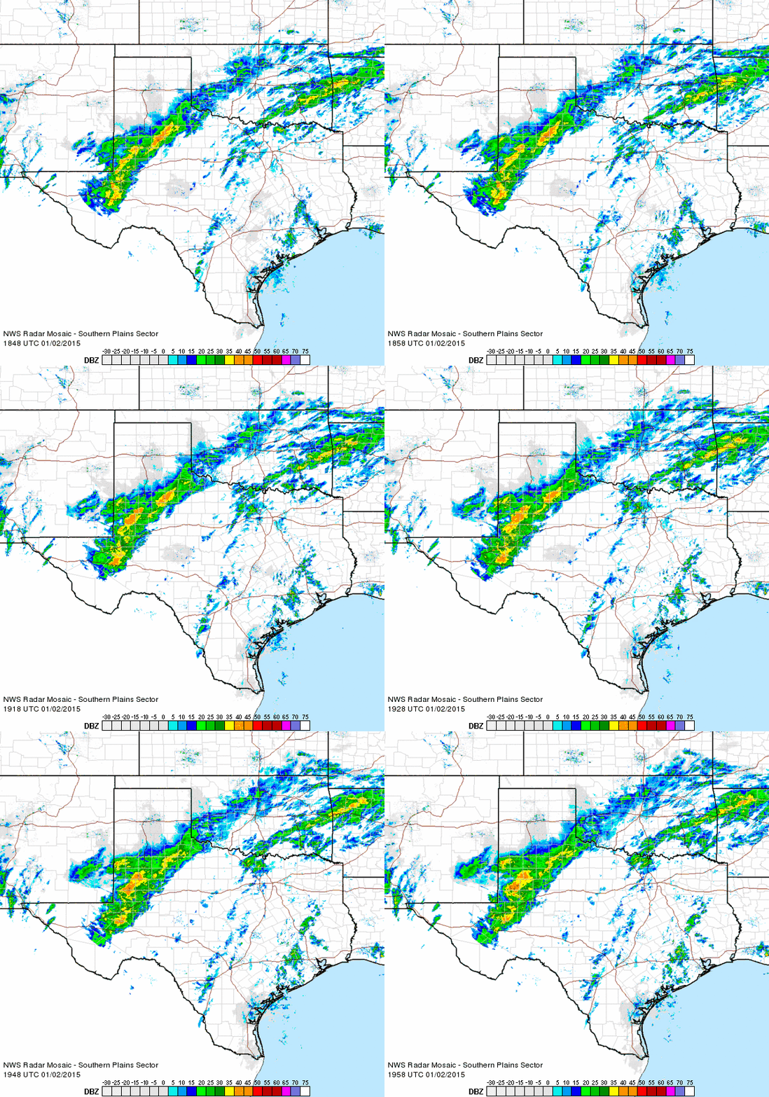 |
| Regional radar loop valid from 12:48 to 1:58 pm on 2 December 2015. |
| |
| The weather took a drastic turn for the worse on the second day of 2015, when a potent upper level storm system began to approach from the west. A large band of light to moderate precipitation, mostly in the form of freezing rain, developed across the southeast South Plains into the Rolling Plains (see the above animation). This band persisted most of the day while gradually shifting to the northwest. Occasionally, the freezing rain would mix with sleet, and even a little snow on the western fringe throughout the day. |
| |
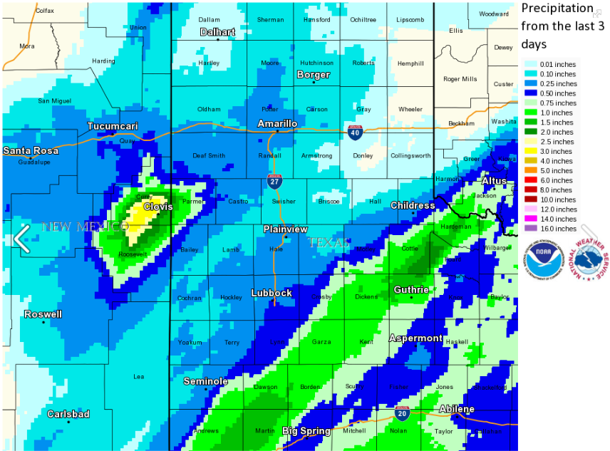 |
| Radar estimated 3-day liquid equivalent precipitation total end on January 3rd, 2015. |
| |
| Liquid totals in excess of an inch were reported at a number of locations in a swath from around Post through Spur, Guthrie and Paducah, as illustrated by the above graphic. Thankfully, temperatures were close enough to the freezing mark through the day that roadways didn’t become as hazardous as they would have been if temperatures has been just a few degrees cooler. Still, all the freezing rain did create some travel difficulties. In addition, significant ice accumulations occurred on exposed objects like vehicles, trees, and power lines. The icing did bring down tree branches and knock out power in many spots where the heavier freezing rain fell. |
| |
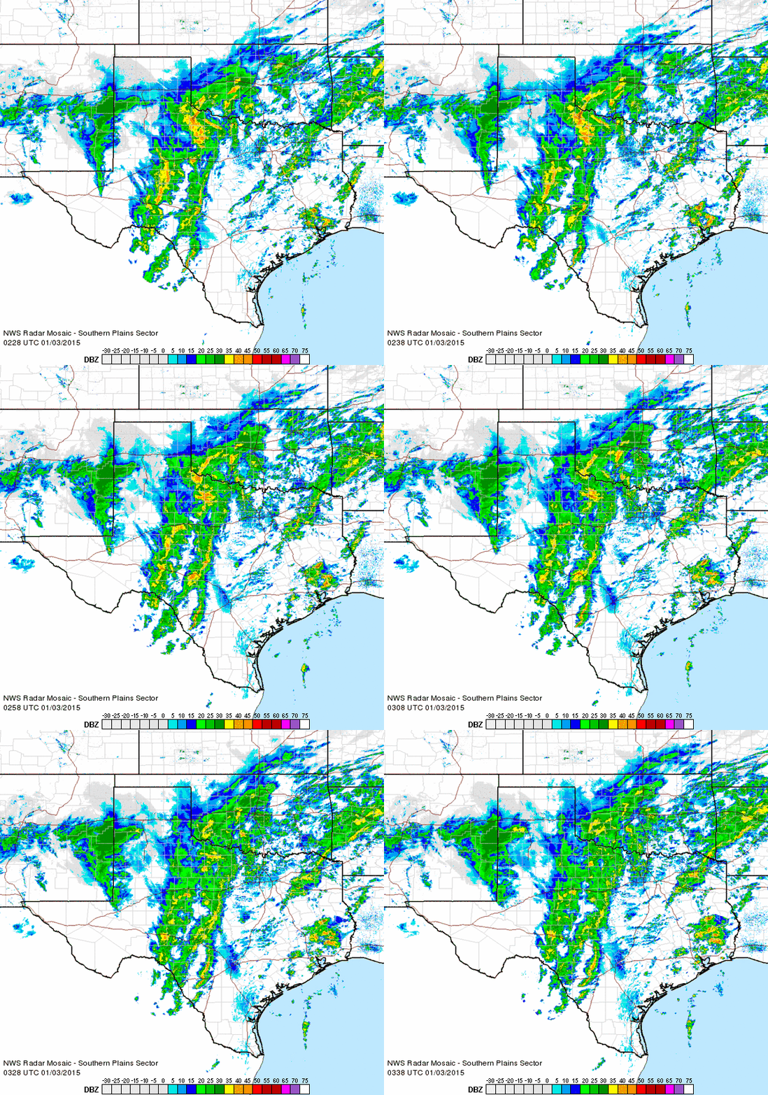 |
| Regional radar loop valid from 8:28 to 9:38 pm on 2 December 2015. |
| |
| The large area of freezing rain gradually shifted off to the east during the evening hours of the 2nd, but an area of snow then developed further west, closer to the center of the upper level storm system approaching from New Mexico (see the above radar animation). The most intense and persistent snow bands set up across the southwest Texas Panhandle and Friona and Rhea received a half of a foot or more of snow before all was said and done. |
| |
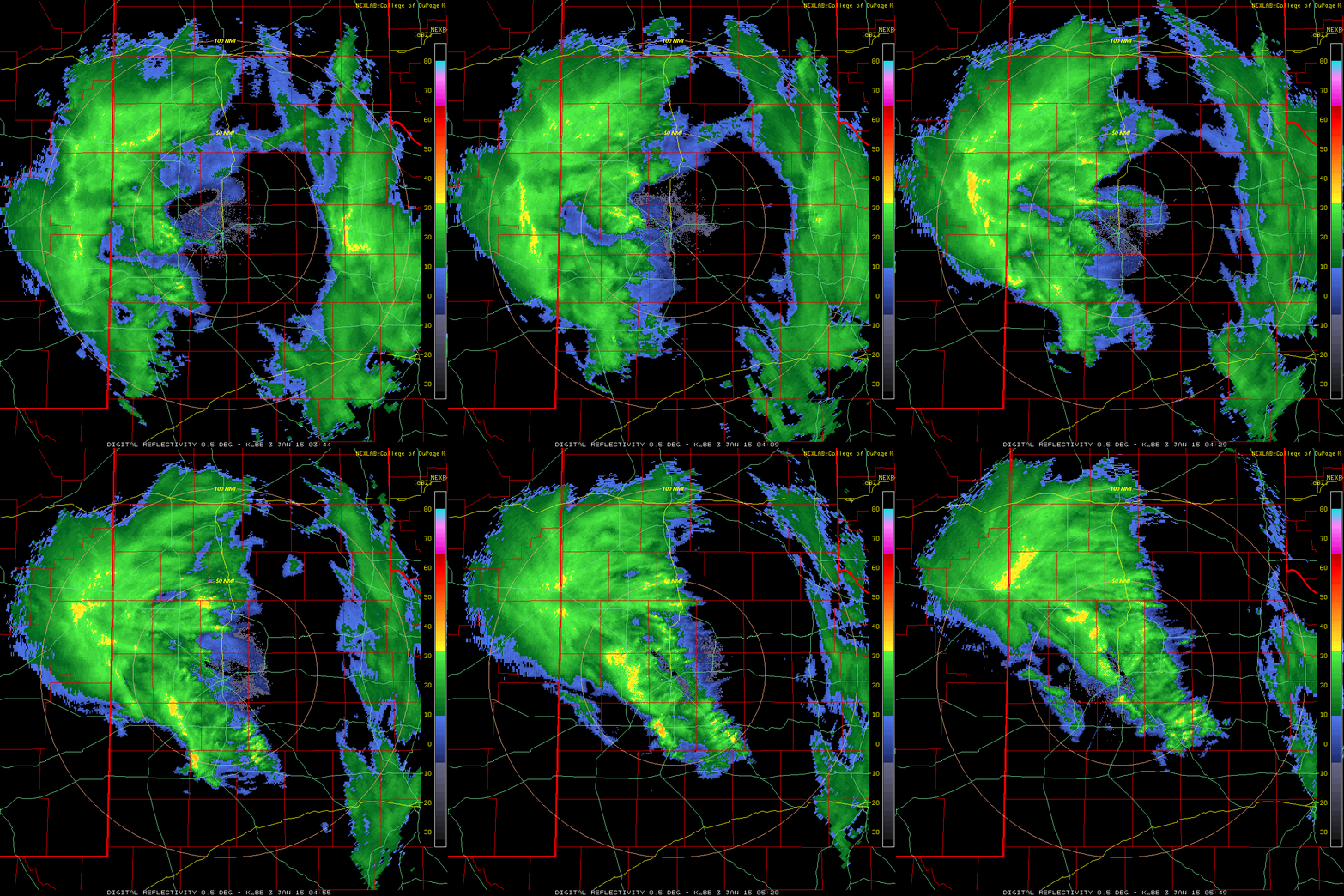 |
| Lubbock radar animation valid from 9:44 to 11:49 pm on January 2, 2015. |
| |
| A band of snow also pivoted quickly eastward over much of the South Plains during the late evening hours (see the above radar animation). This snow band produced heavy snowfall rates, but it didn’t last long, which limited snow totals, with most spots on the South Plains recording around an inch of snow. Spots off the Caprock largely missed out on the snow altogether, with only trace amounts reported. |
| |
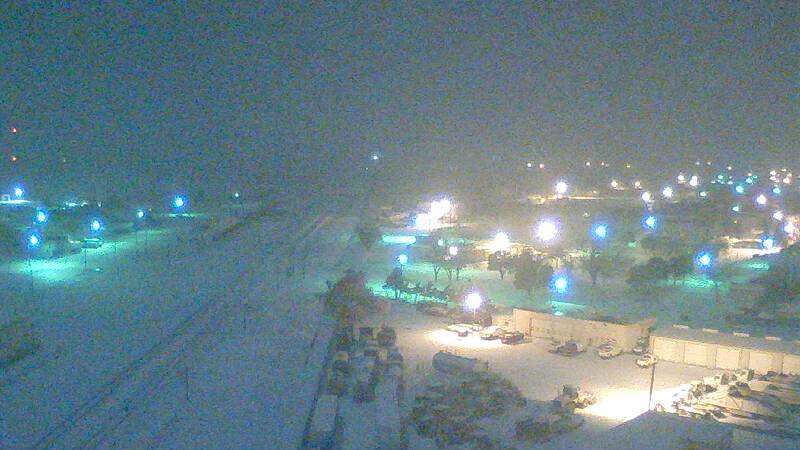 |
| Snow falling in Shallowater late Friday night (Jan. 2, 2015). The image is courtesy of KAMC. |
| |
| Dry air pivoting around the south side of the upper level storm system was the culprit for bringing a quick end to the snow Friday night (2 Jan.), which resulted in less snow falling over the South Plains than was forecast. The below satellite image shows the water content of the middle and upper levels of the atmosphere late Friday evening. The dark colors represent very dry air, which was rapidly advancing northeastward and brought the quick end to the snow for much of the South Plains. |
| |
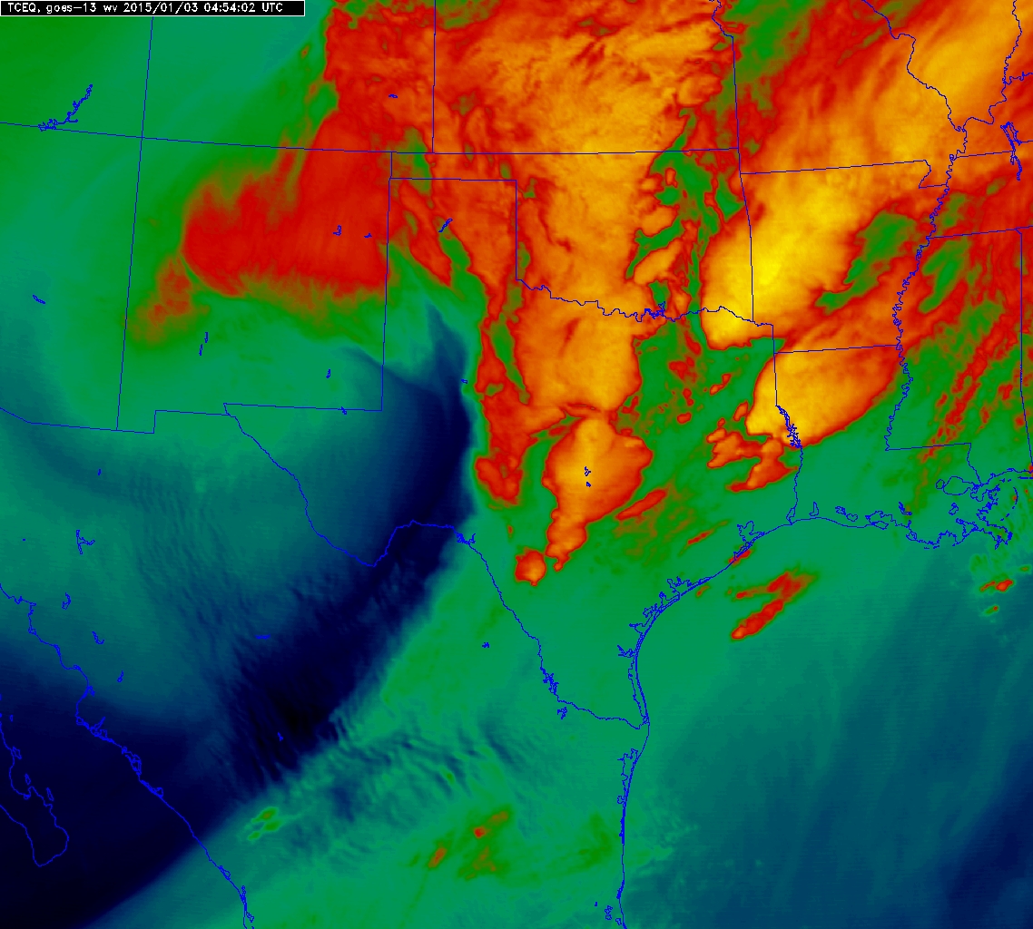 |
| Water vapor satellite image taken around 11 pm on Friday, January 2, 2015. |
| |
| The relative lull in precipitation, thanks to the dry air aloft, lasted through early Saturday morning (3 Jan.), but increasingly moist air then pivoted all the way around the system and southward into the region shortly after sunrise (not shown). This wrap-around moisture did produce a little additional snowfall that moved from west to east across the southern Texas Panhandle and northern South Plains between 8 am and 1 pm, before the area of snow diminished. The final round of snow brought an additional dusting to about an inch of snow before all was said and done. |
| |
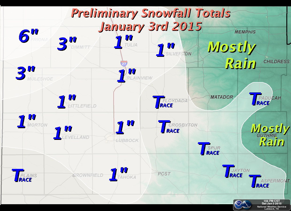 |
| Preliminary snow total map created on January 3rd, 2015. |
| |
| To cap it off, temperatures finally rose above the freezing mark Saturday afternoon after being below freezing since December 30th at most spots. The relatively mild conditions helped improve road conditions, though one had to be alert for thawing ice falling off of objects too! When skies completely cleared by Sunday (4 Jan.), satellite was able to capture the beautiful picture showing the extent of the snow. |
| |
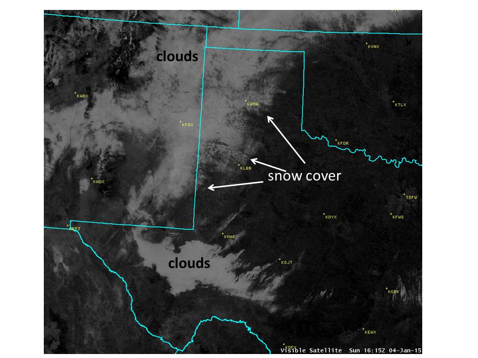 |
| Visible satellite image captured at 10:15 am on January 4, 2015. |