 |
 |
 |
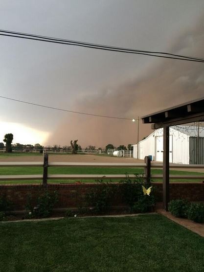
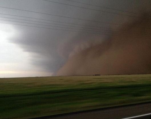
| Pictures of the advancing squall line and leading wall of dust in Parmer County (left) and near Nazareth (right) on the evening of Friday, 13 June 2014. The left picture is courtesy of Jon Douglas and the right is via Mack Morris. |
| |
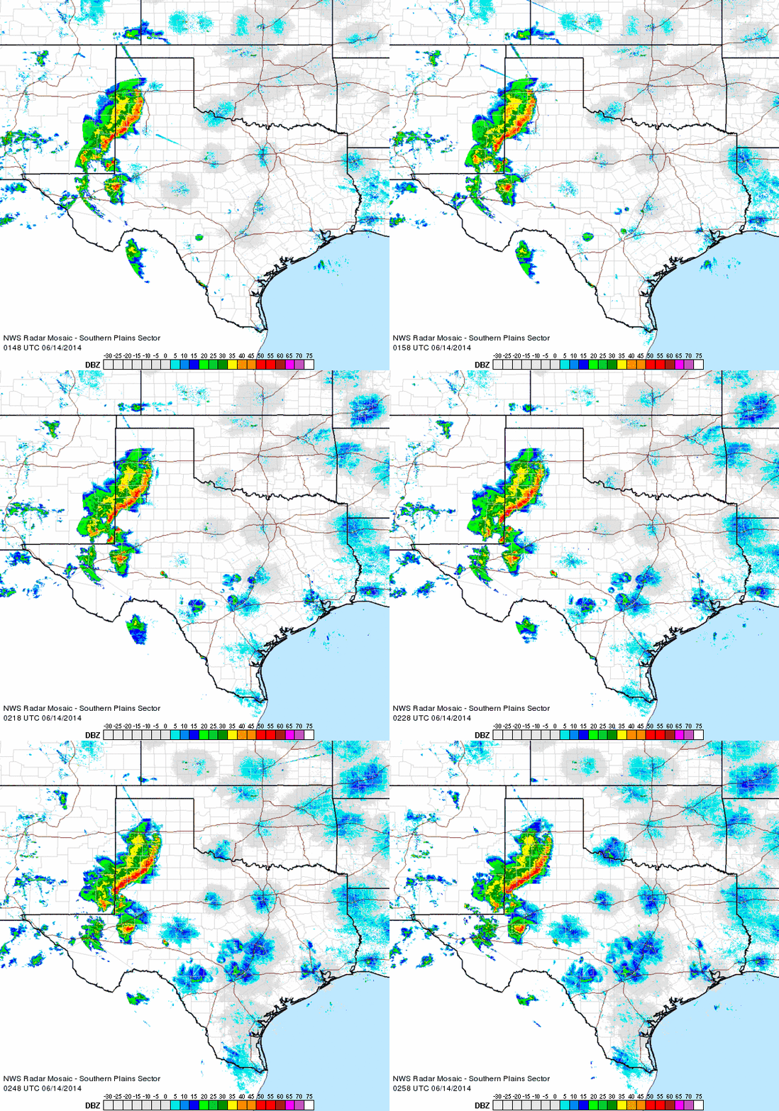
| A full moon on Friday the 13th brought a rarity (at least in the recent past) to West Texas in the form of a squall line. A weak upper level disturbance coupled with abundant moisture and a strengthening low-level jet to bring a widespread line of thunderstorms to the South Plains region. The storms initially developed over the higher terrain of eastern New Mexico, before congealing into a line and accelerating eastward across the state line. |
| |
 |
| Regional radar animation valid from 8:48 to 9:58 pm on 13 June 2014. Additional radar animations can be found at the following links: 6:58 to 8:08 pm and 10:38 to 11:48 pm. |
| |
| The squall line brought strong outflow winds which also lofted blowing dust along its leading edge. Most locations experienced wind gusts peaking at 40 to 50 mph, though a few spots saw stronger wind speeds. The highest winds gust recorded was 62 mph, observed by the West Texas Mesonet (WTM) site three miles northeast of Aspermont shortly after midnight. The Friona WTM site also recorded a gust to 58 mph shortly after the line emerged from New Mexico after 8 pm. However, sub-severe winds (less than 58 mph), pockets of small hail, frequent lightning, and widespread rains were the primary impacts as this squall line moved through. |
| |
 |
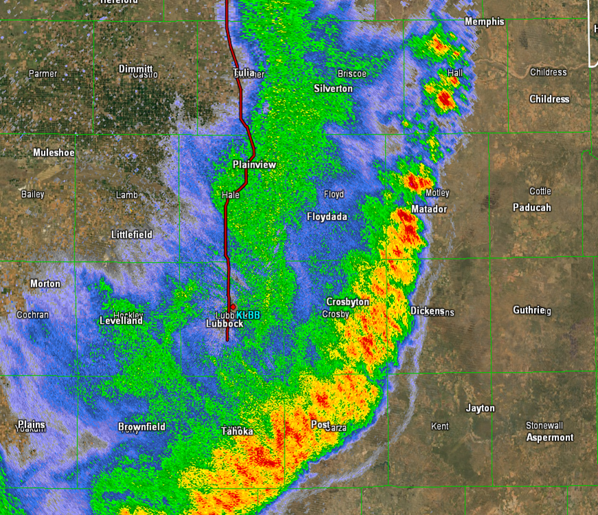
| Close up radar image captured from the Lubbock radar around 11 pm on 13 June 2014. |
| |
| The above radar image shows what the squall line looked like shortly after moving through the Lubbock area. The northern end of the line became more discrete and weakened, while the southern portions of the line maintained its intensity well into the early morning hours. Aside from the far southeast Texas Panhandle, which largely missed out, most of the remainder of the South Plains region received another round of welcome rain. The biggest winners were over portions of the central and southern South Plains where rain totals from 1" to 1.25" were common. The highest recorded rainfall was 1.60" at the WTM site six miles southwest of Wolfforth. The below map shows the distribution of the rainfall from this welcome Friday the 13th event. |
| |

