| Severe Thunderstorms Strike Near Childress 20 April 2014 |
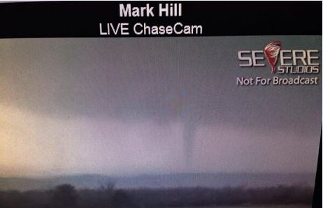 |
| Picture of a brief rope tornado that formed in far eastern Childress County Sunday evening, 20 April 2014. This picture if courtesy of Mark Hill via Kyle Roberts. |
| A slow moving upper level storm system combined with increasing moisture to bring scattered thunderstorms to the South Plains region over the weekend, April 19th and 20th. The storms on Saturday were rather tame, though a few stronger storms did drop small hail and produce gusty outflow winds over southwest Lubbock. More vigorous activity developed on Sunday, with the most intense and long-lasting activity affecting Childress County. One particularly intense storm even generated a brief tornado (seen above) about 8 miles north of Kirkland, in far eastern Childress County. Thankfully, the tornado was over open land and did not cause any known damage during its short duration. |
 |
| Picture of hail and hail damage that occurred in and around Childress the evening of April 20th. The pictures are courtesy of Beth Wallace. |
| Several rounds of slow-moving severe thunderstorms did repeatedly affect Childress County, including the city of Childress, from late Sunday afternoon well into the evening hours. The most widespread impacts from these thunderstorms were large hail and very heavy rainfall. Several reports of golf ball to baseball sized hail were received in and around the Childress area. Unfortunately, as illustrated above and below, the large hail did cause damage. |
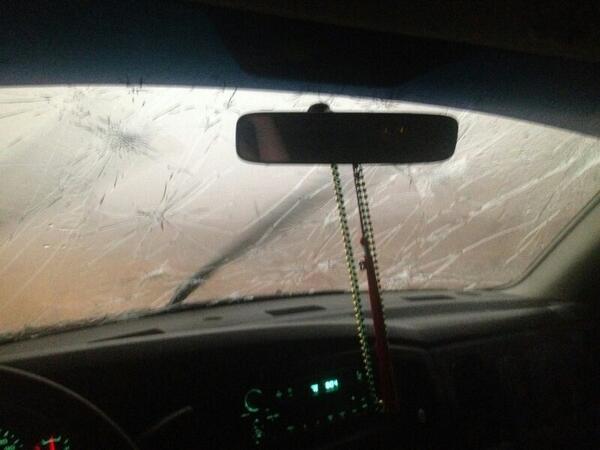 |
| Windshield damage from large hail in Childress on April 20th. The picture is courtesy of Ashlie Zinolli. |
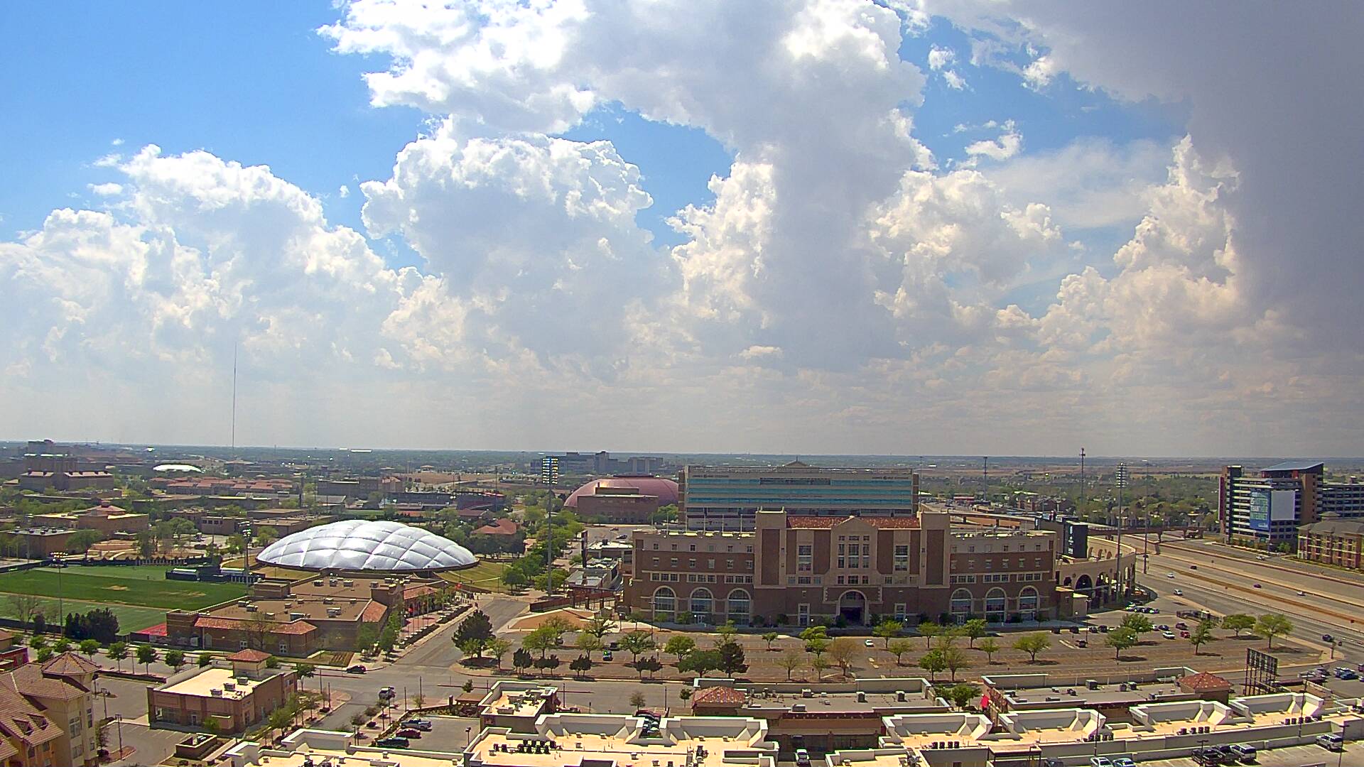 |
| Image captured looking over the Texas Tech Football Stadium around 3:50 pm on April 20th. Picture is courtesy of KAMC. |
| Further to the west, including up on the Caprock, isolated to scattered showers and thunderstorms did form on Sunday, but this activity was weaker (sub-severe) and shorter in duration than the thunderstorms that affected the far southeast Texas Panhandle. The above picture shows clouds attempting to develop into showers/storms near Lubbock Sunday afternoon, while the below animation depicts the evolution of the precipitation Sunday evening. |
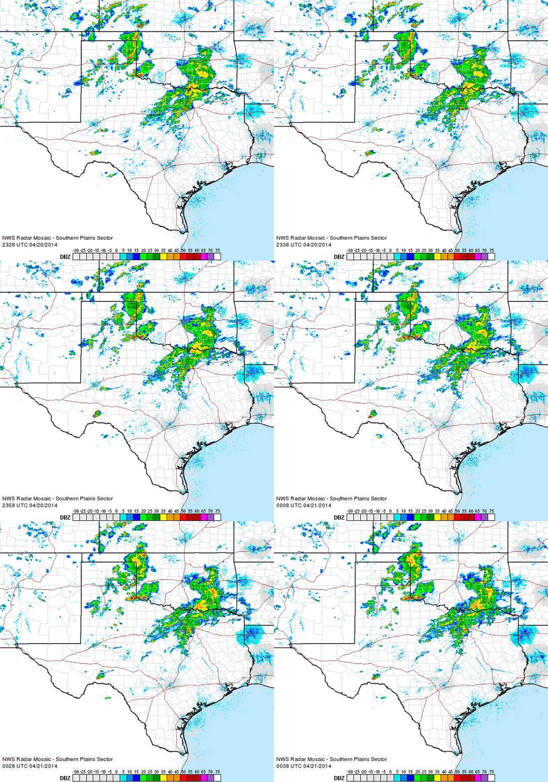 |
| Regional radar loop valid from 6:28 to 7:38 pm on 20 April 2014. |
| The damaging hail in the Childress area was obviously not welcome, but the weekend thunderstorms did bring beneficial rainfall to the region. Many locations saw at least a little rainfall, with localized heavier amount. One swath of 1/2 to 1+ inches fell from Brownfield to the west side of Lubbock on Saturday. Sunday brought heavier rain to portions of the southeast Texas Panhandle into the Rolling Plains. Several rounds of strong to severe storms trained (repeatedly tracked over the same locations) over parts of Childress County, and in addition to dropping pockets of large hail, they also produced torrential rainfall. Rainfall totals in and around Childress ranged from 1-3+ inches, a welcome sight given the prolonged and historic drought. |
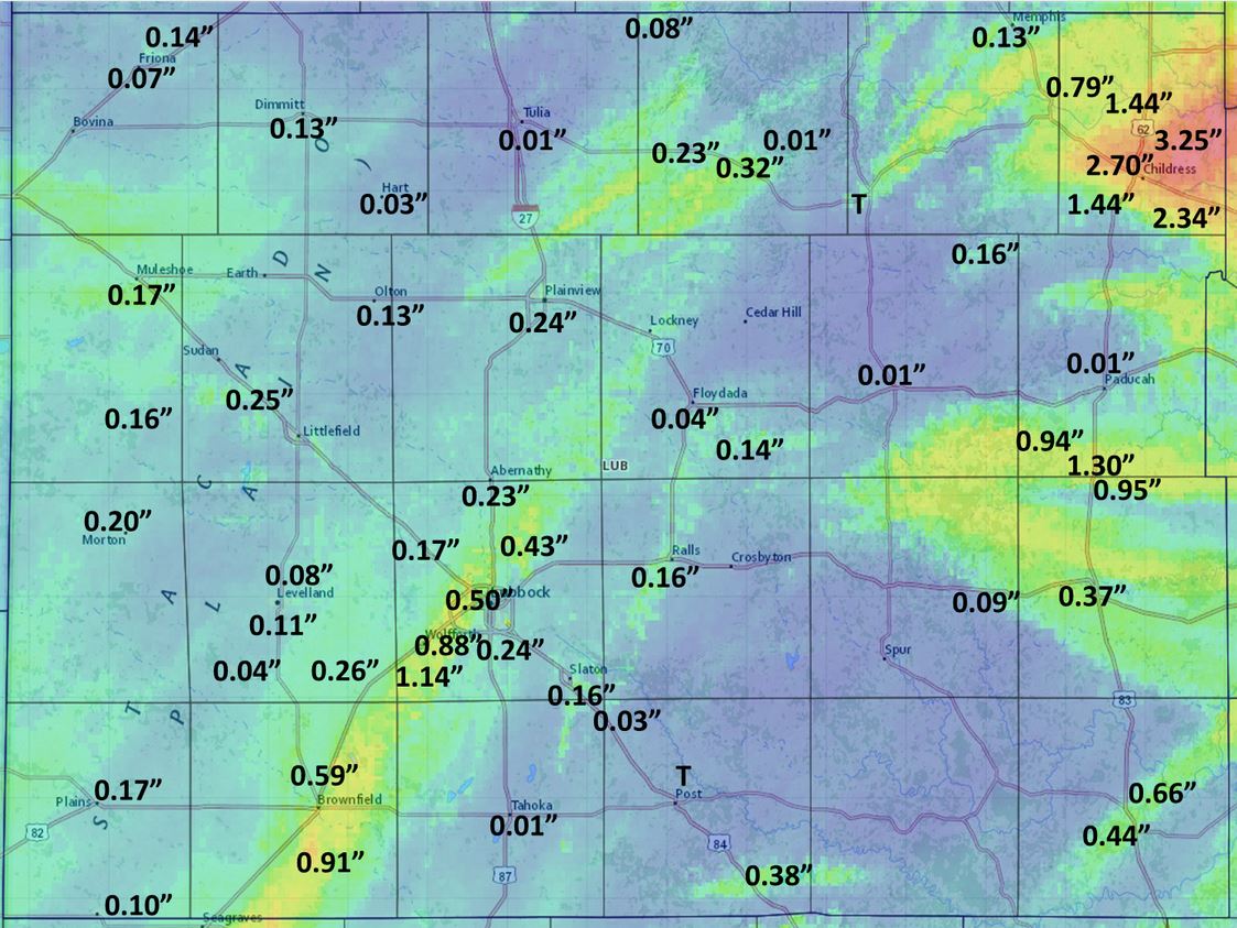 |
| Three day rainfall total ending Monday morning, 21 April 2014. The background image is radar estimated rainfall while the plotted amounts are from rain gauges, as measured by COOP observers, the West Texas Mesonet, and the NWS. |
|
A plot of the preliminary storm reports for the severe weather event and the three-day total precipitation can be found below. Additionally, radar estimated maximum hail size and calculated rotation tracks are available below. A listing of the preliminary local storm reports for the April 20th can be FOUND HERE. |
|
|
|||
|
Toggle Preliminary Storm Reports for April 20, 2014
|
Toggle Total Three-Day Rainfall (inches) ending on April 21, 2014
|
Toggle Maximum Estimated Hail Size Estimated from Radar for April 20, 2014
|
Toggle Rotation Track as Sampled by Radar for April 20, 2014
|