|
Flooding rains, damaging winds, large hail and a tornado |
 |
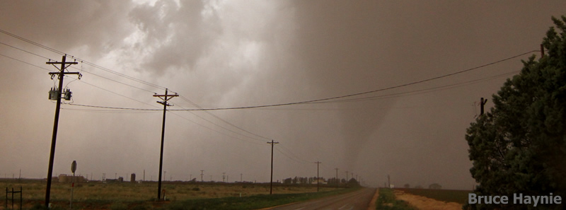
| The tornado near the town of Sundown. Photograph is courtesy of Bruce Haynie. |
| Wednesday, June 19th was an active weather day for the region. During the morning hours a complex of thunderstorms propagated slowly southward from the eastern Panhandle into the Rolling Plains. Several of the storms were strong to severe, and one storm produced straight-line wind damage in the Quitaque area, including lifting the cap/top off of the old town water tower. |
|
Flooded road in Caprock Canyons State Park. Picture is courtesy of Donald Beard. |
| However, the more widespread impact was very heavy rainfall that produced flash flooding over a large chunk of the southeast Panhandle into the northern Rolling Plains. Caprock Canyons State Park recorded upwards of 4 inches of rainfall, which fell at torrential rates as high as 12 inches per hour for a brief period. The extreme rainfall rates led to large amounts of runoff and the widespread flooding. The road in the state park was flooded in two spots when the South Prong of the Little Red River swelled from all the water. In addition, numerous other roadways were flooded across Briscoe, Hall, southwest Childress and northern Cottle Counties. The flooding gradually subsided during the afternoon hours as the rain shifted to the southeast. |
|
|
|
Radar animation valid from 8:58 to 10:08 am on 19 June 2013. To view additional radar animation click on the desired times: 11:18 am to 12:28 pm ; 12:48 pm to 1:58 pm
|
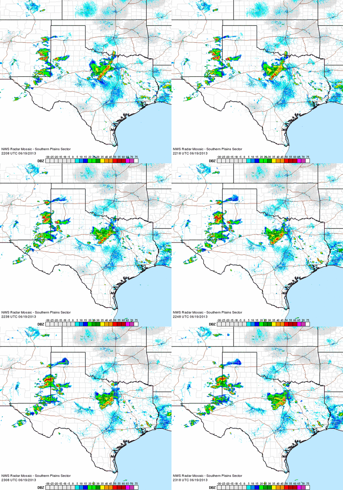
| The early day complex of thunderstorms pushed an outflow boundary westward across the Caprock, with gusty and dusty easterly winds in its wake. This boundary then served as a focus for late afternoon thunderstorm development. One isolated supercell storm developed over southwest Hockley County and intensified, producing a tornado about 4 miles northwest of Sundown along with baseball size hail. This storm eventually weakened, but additional activity moved out of eastern New Mexico. These storms were briefly severe and dropped quarter size hail near Muleshoe, but weakened thereafter and transitioned to locally heavy rainfall and proficient lightning producers. |
 |
| Radar animation valid from 5:08 to 6:18 pm on 19 June 2013. To view additional radar animation click on the desired times: 6:18 pm to 7:28 pm ; 7:38 pm to 8:48 pm |
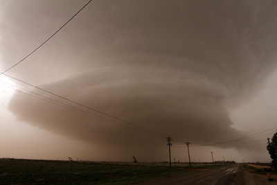
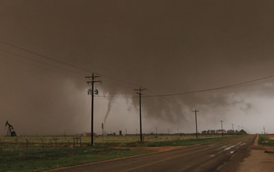
| The next two images show the evolution of the tornado near the town of Sundown. First, a rotating updraft developed that took on a "multi-layered cake" appearance (first image below). Then a wall cloud developed with occasional funnel clouds and several funnels and vortices kicking up dust (second image below). Finally, a single tornado developed and remained on the ground for about 5 to 10 minutes as it moved about two miles to the northeast and then north before dissipating (as seen in the photo at the top of this webpage). |
 |
| The supercell storm. Click on the image for a large version. Photograph is courtesy of Bruce Haynie. |
 |
| A ragged wall cloud and funnel (possibly in contact with the ground) has developed beneath the base of the supercell. Click on the image for a large version. Photograph is courtesy of Bruce Haynie. |
| A damage survey for the Sundown tornado was completed June 20th and the complete results can be VIEWED HERE. The tornado was preliminarily rated as EF2, with estimated peak winds of 115 mph. It had a path length of 2.4 miles and maximum width of 350 yards. A Google Map of the tornado and flooding damage surveys is available below. Alternatively, to access the Damage Survey Interface (with clickable damage points) CLICK HERE. Be sure to select the Lubbock area and adjust the date to include June 20th to see the damage points for this event on the map. Once the damage points load, use the tools at the top of the page to identify and view each point and extract information. |
|
|
|||
|
Map of the tornado damage in southern Hockley County and the flooding damage around Caprock Canyons State Park as surveyed by the NWS. Click on each damage indicator to view images & details.
|
|||
Radar image captured around the time of the tornado.
The preliminary storm reports for this event can be FOUND HERE. The storm reports are also plotted on the map below. In addition, 24 hours rain totals courtesy of the West Texas Mesonet can be viewed below.
|
|
|||
|
Toggle preliminary local storm reports for June 19, 2013
|
Toggle 24 hr rain totals (inches) ending at 7 am on June 20, 2013
|
Toggle Maximum Radar Estimated Hail Size
|
Toggle Radar Derived Rotation Tracks
|
|
The Texas Tech University West Texas Mesonet (TTU-WTM) has also produced a case study for the flooding in Caprock Canyons State Park which can be found HERE. The TTU-WTM also produced a page detailing the Sundown tornado which can be accessed HERE. |