Saturday, while a serious severe weather event was unfolding across Nebraska, Kansas and Oklahoma, the South Plains experienced gusty winds that caused blowing dust. Then in the evening, the dryline retreated west and collided with an incoming Pacific-type cold front. Thunderstorms erupted along this intersection, and formed a squall line which marched east through the early morning hours of Sunday April 15th.
Below are some images and information from this event.
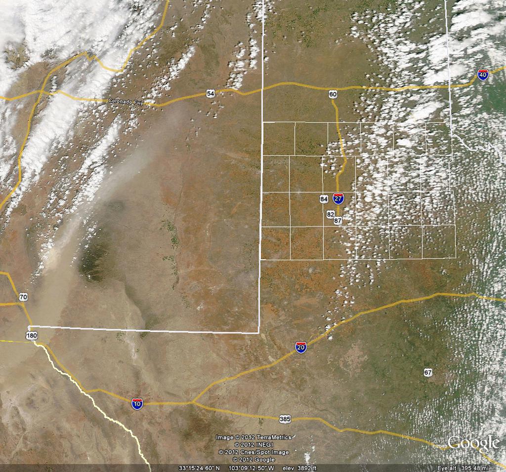 |
| A NASA Satellite image Saturday afternoon showing the thick plume of blowing dust across New Mexico and far west Texas. Click on the image to enlarge it. |
|
|
||
|
Preliminary storm reports from the event. Click on the weather icons to view the full report. Rainfall reports are courtesy of the West Texas Mesonet. Hail size estimates are derived from radar data.
|
||
|
Toggle Storm Reports
|
Toggle Rainfall Reports
|
Toggle Hail Size
|
To download the KML (Google Earth) file of the preliminary storm reports CLICK HERE.
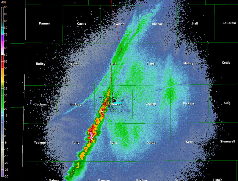 |
| Base (0.5 degrees) reflectivity data from the Lubbock WSR-88D showing the developing storms at 10 pm on Saturday night. Click on the image to view a larger version. |
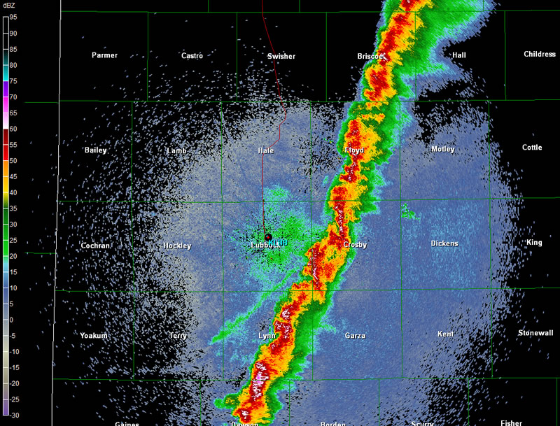 |
| Base (0.5 degrees) reflectivity data from the Lubbock WSR-88D showing the mature squall line at 11 pm on Saturday night. Click on the image to view a larger version. |


 Follow us on X
 Follow us on Facebook
 Follow us on YouTube
 LUB RSS Feed


