|
First Winter Storm of the Season Strikes |
|||||
|
|
|||||
| Water vapor image captured at 10:15 am on 27 October 2011. The upper level storm system that brought the rain and areas of snow to the region in denoted. Click on the picture for for a larger view. | |||||
 |
|||||
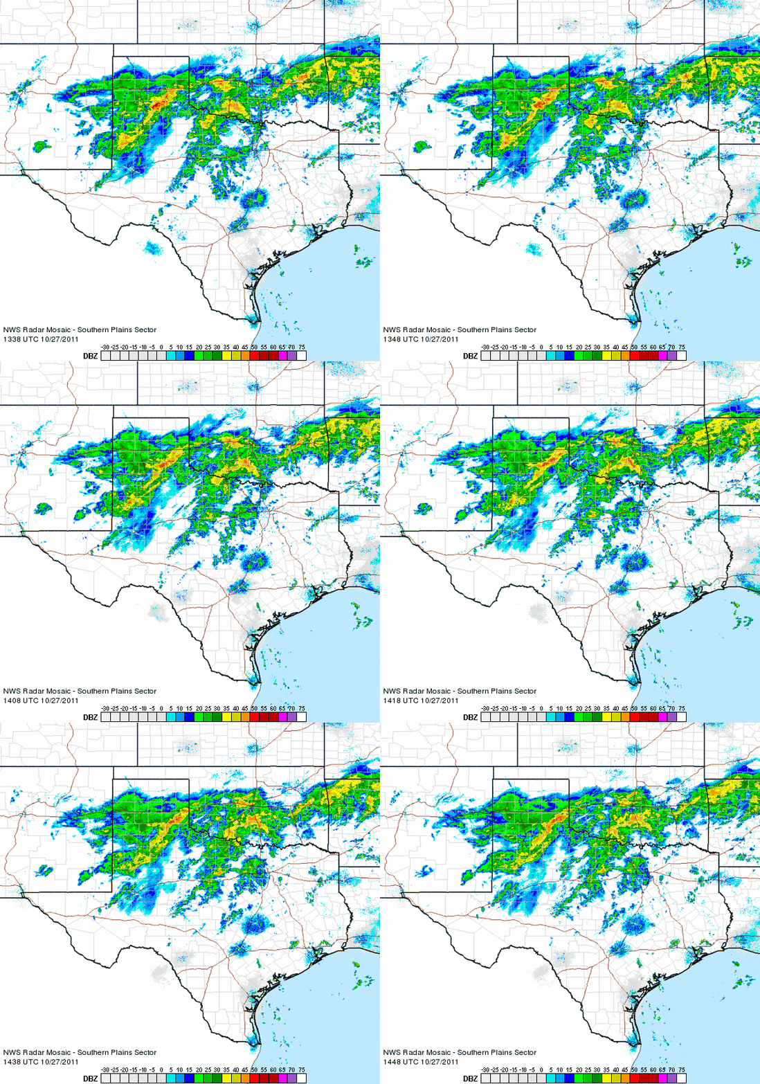
| Radar animation valid from 8:38 am to 9:48 am on 27 October 2011. To view additional radar animations click on the following ending times of the loops: 12:08 pm ; 1:18 pm ; 3:08 pm | |||||
 |
 |
||||
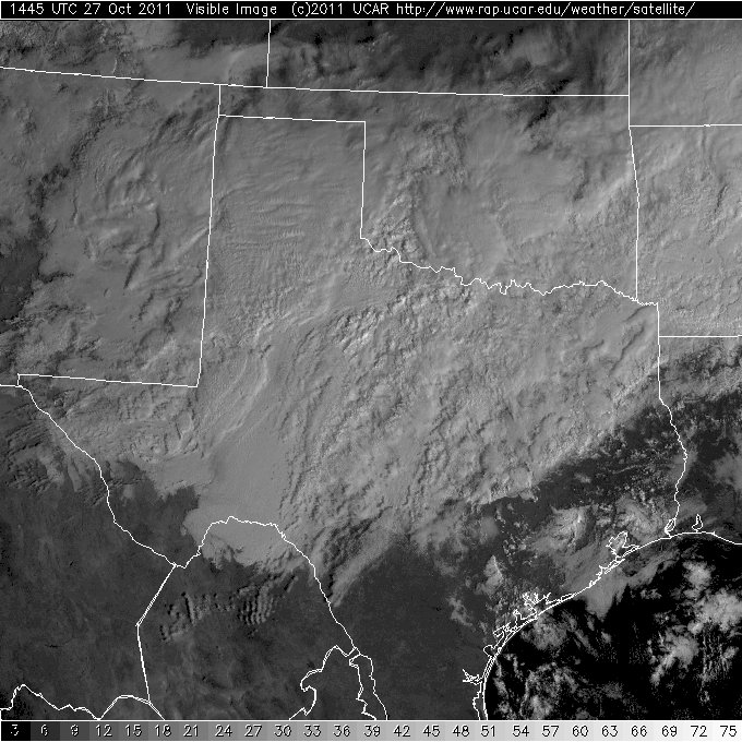
| Visible (left) and infrared (right) satellite imagery captured at 9:45 am on 27 October 2011. Click on the pictures for for a larger view. | |||||
|
|||||
|
|
|||||
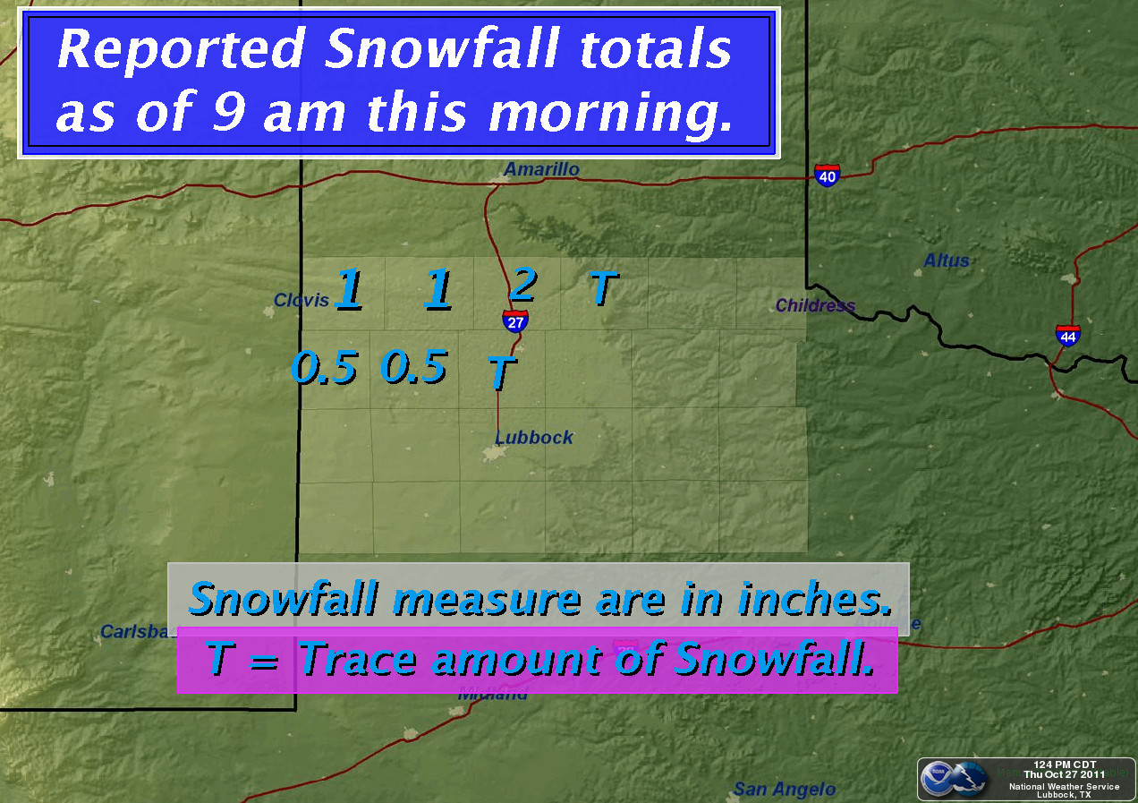
| Snowfall totals, as reported to the National Weather Service through 9 am 27 October 2011. Click on the graphic for a larger view. | |||||
|
Click HERE to view the snow and rain reports for the area. Additionally, the West Texas Mesonet summary for this event can be found HERE. |
|||||
 |
|||||
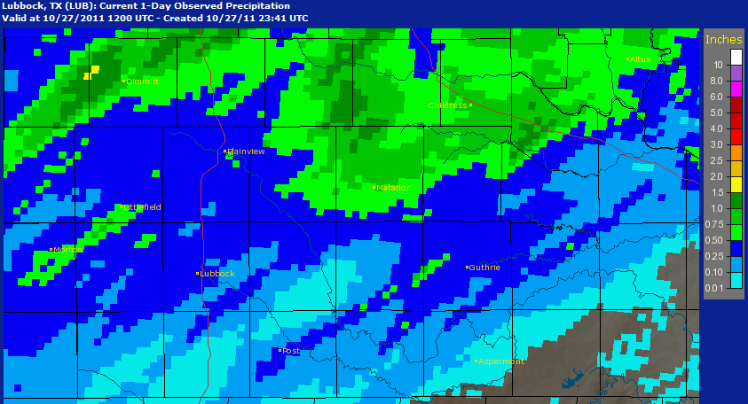
| The NWS precipitation analysis from the event for our forecast area (click on the graphic to enlarge it). | |||||


 Follow us on X
 Follow us on Facebook
 Follow us on YouTube
 LUB RSS Feed