|
Strong winds sweep across the South Plains, 30 December 2010
|
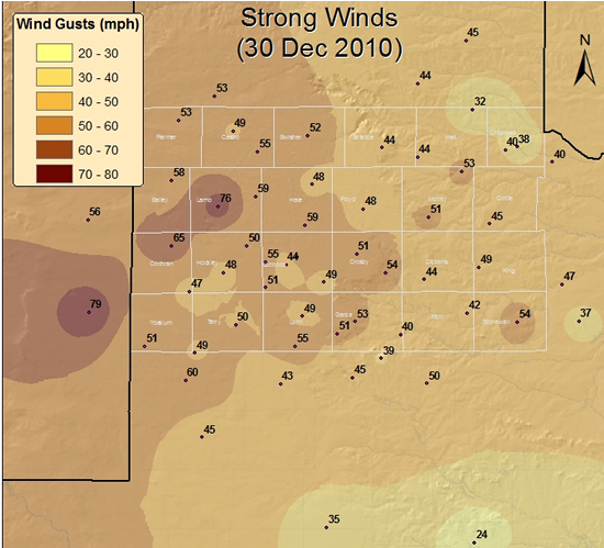 |
| Map displaying the maximum wind gusts (mph) recorded across the South Plains region on Thursday, 30 December 2010. The observations are courtesy of the West Texas Mesonet and the National Weather Service. Click on the above map for a larger view. |
|
A powerful winter storm affected much of the center of the nation during the end of December 2010. While this storm system brought plenty of heavy snow to the Rockies and into the central and northern plains, the main impact across the South Plains region was several days of strong winds. The winds initially began to ramp up on Wednesday, December 29, peaked on Thursday, the 30th, and finally began to drop off late on Friday, December 31st. The above map shows the peak winds on Thursday, the 30th. A majority of the strongest gusts occurred during the afternoon and evening hours, though several sites did experience their peak winds during the early morning hours. |
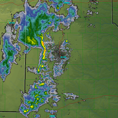 |
| Lubbock NWS radar image taken at 7:30 pm on 30 December 2010. The West Texas Mesonet site near Amherst recorded a wind gust to 76 mph just 5 minutes after this image was taken. Click on the image for a larger view. |
|
The most extreme winds occurred during the evening hours when high based showers and thunderstorms enhanced the winds in several locations. A peak wind gust of 79 mph was measured at the Tatum West Texas Mesonet station, with a peak wind of 76 mph at Amherst and 65 mph at Morton, all associated with the shower activity. |
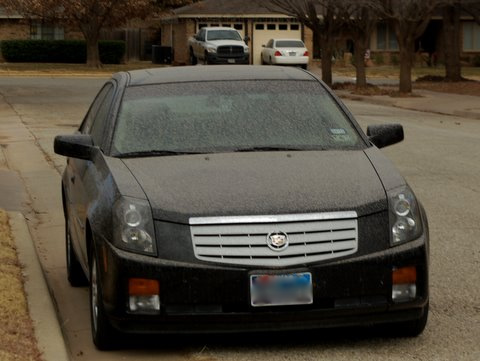 |
| A vehicle with a light coating of mud - a typical scene in Lubbock after the wind, dust and light rain moved through Thursday night. |
| Unfortunately, a couple of the same factors that helped enhance the winds, the dry low-levels and the strong winds aloft, also kept rainfall amounts very light. In fact, most sites across the region only recorded several hundredths of an inch of rain or less. The rain actually turned into more of a nuisance in some cases, because, when combined with the wind and blowing dust, it coated many things with mud. |
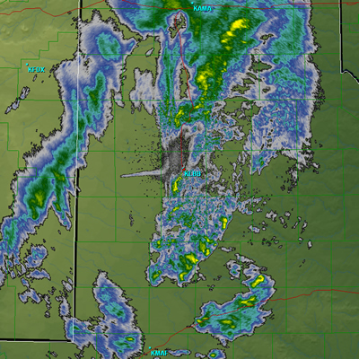 |
| Lubbock NWS radar image taken at 8:40 pm on 30 December 2010. The east-to-west radar returns located west of the radar (KLBB) are generated by a fire that started about 7 miles west of Levelland in western Hockley County. Click on the image for a larger view. |
| The strong winds also sparked another problem, both figuratively and literally. The winds downed four power poles approximately 7 miles west of Levelland. The fallen lines then ignited a grassfire which was fanned by strong westerly winds. The smoke from the fire was very evident in Lubbock, and the fire scorched nearly 2,000 acres before it was contained. |
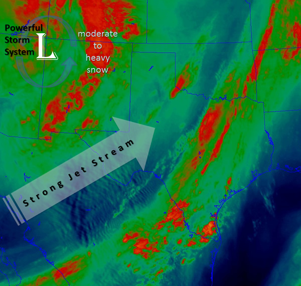 |
| Water Vapor satellite image taken around 2 pm on Thursday, 30 December 2010. The image indicates a strong upper level jet cutting across the region, with strong lift (moisture enhancement in orange) stretching from central New Mexico into Colorado. |
|
The above image shows the large storm system that brought the strong winds and light precipitation to West Texas on the 30th. To view the preliminary local storm reports from this event CLICK HERE. A storm events page was also created by the Texas Tech West Texas Mesonet and it can be VIEWED HERE. |