Wet September Weekend for the Rolling Plains
11-13 September 2009
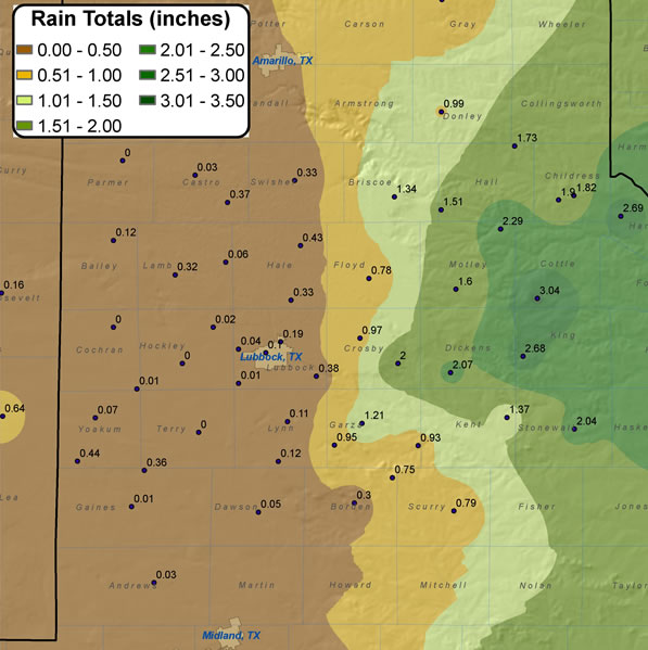 |
| Map of rainfall totals from 11-13 September 2009. Rain totals are courtesy of the West Texas Mesonet and the National Weather Service. Click on the image for a larger view. |
A slow moving upper level storm system combined with abundant amounts of moisture to bring portions of the region significant rainfall. Plentiful moisture was in place for some time, with isolated to widely scattered showers and thunderstorms (producing localized but heavy rain) occurring in the week leading up to the wet weekend.
However, by the weekend a developing upper level storm system organized and used the abundant moisture to bring signifcant amounts of rainfall to much of Texas, including portions of West Texas. The above map shows that many locations off the Caprock received 1.5 to in excess of 3 inches between the 11th and 13th, with amounts dropping off drastically further west up on the Caprock. The big rainfall winner was the West Texas Mesonet site located 10 miles southwest of Paducah where 3.04 inches of rainfall were recorded. Childress saw nearly two inches, which dropped their rainfall deficit for the year to under an inch. On the other hand, the Lubbock airport received only around two tenths of an inch, with the yearly rainfall deficit remaining around 4 inches.
 |
|
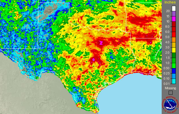
Image of 7-day radar estimated rainfall totals for Texas ending Wednesday morning (16 September 2009). |
In addition to the rain across West Texas, the very large storm system brought a lot of rain to most locations east and southeast or here, including places where they really needed it. Although this rain was not a drought buster, it was a welcome site to much of southern Texas where they are mired in an exceptional drought.


 Follow us on X
 Follow us on Facebook
 Follow us on YouTube
 LUB RSS Feed


