|
Widespread Rains for the South Plains |
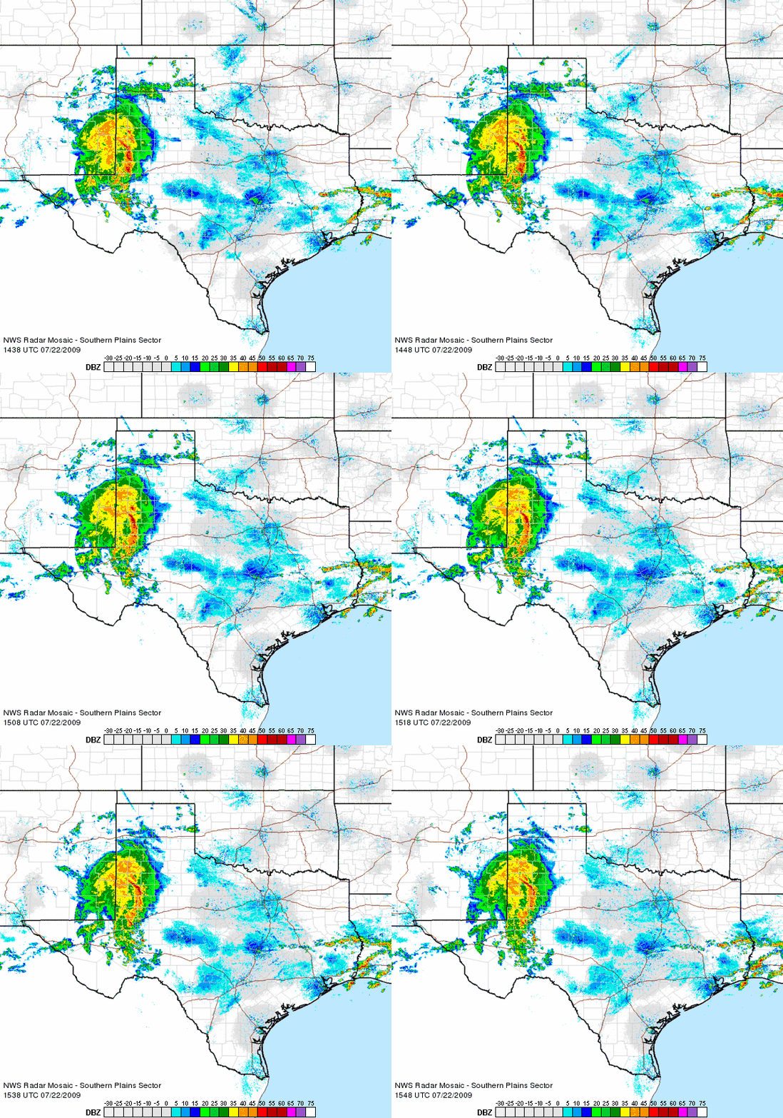 |
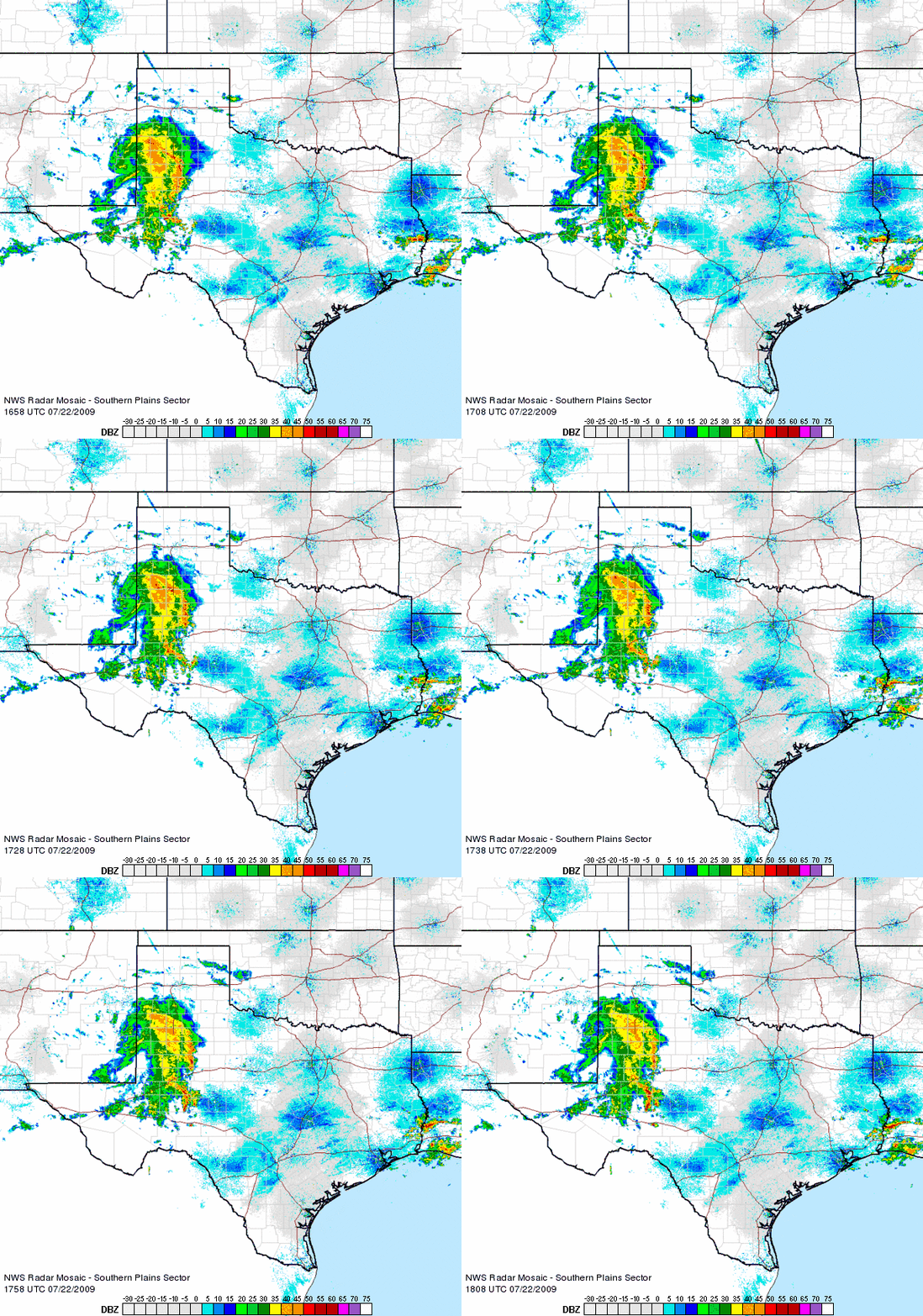
| Radar animation from 9:38 am to 10:48 am on Wednesday morning (22 July 2009). To view another radar animation from 10:58 am to 1:08 pm CLICK HERE. |
A large complex of showers and thunderstorms moved slowly eastward across the South Plains Wednesday morning (22 July) before slowly weakening and diminishing during the late morning and afternoon hours. The complex brought a wide swath of beneficial rainfall to much of the South Plains, though the rainfall did drop off markedly across the northeast South Plains and into the Rolling Plains. The above radar animation shows the mature complex of storms as it tracked slowly eastward across the South Plains Wednesday morning.
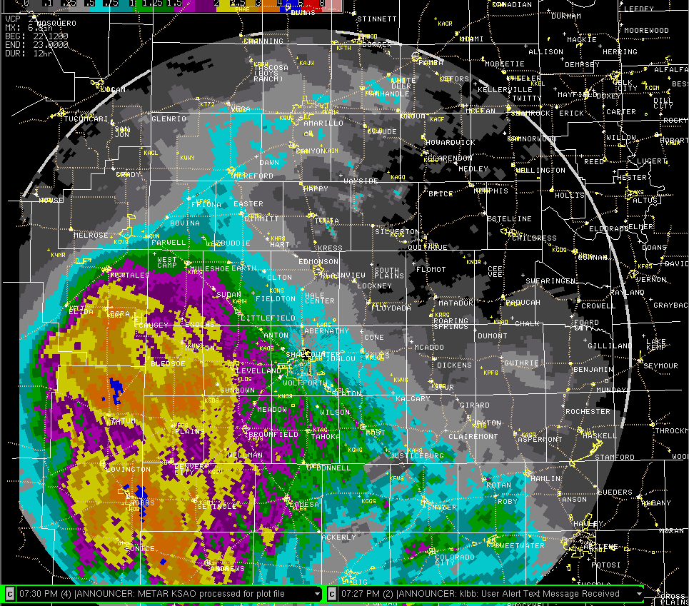 |
| Radar derived storm total precipitation from 7 am to 7 pm on Wednesday, 22 July 2009. Click on the image for a larger view. |
Many locations across the southwest South Plains picked up 1 to 2+ inches of rain. The big winner in Texas was the West Texas Mesonet (WTM) site located 3 miles north of Plains which recorded 2.19 inches. Both the Tatum and Dora WTM sites in eastern New Mexico received over 2.20 inches. However, the amounts steadily dropped off farther north and east. Still, the Lubbock Airport measured 0.65 inches, though the meaningful rainfall quickly dropped off northeast of there with the COOP observer in Floydada only reporting a trace. The sharp gradient in precipitation can be seen clearly in the above radar derived storm total precipitation map for Wednesday.
To read a Public Information Statement about the rain event CLICK HERE.


 Follow us on X
 Follow us on Facebook
 Follow us on YouTube
 LUB RSS Feed