Lubbock, TX
Weather Forecast Office
Littlefield Tornado Damage Survey Findings
(From 21 April 2007 Thunderstorm)
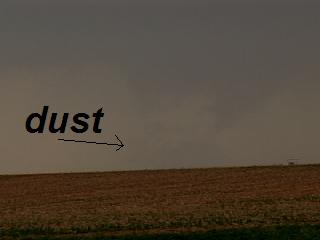
Tornado #1: Littlefield tornado
Rated EF-0 little to no damage observed.
Path length: 2 miles.
Max width: 200 yards.
Tornado began at 6:20 p.m. and ended at 6:24 p.m. with zero fatalities/zero injuries.
The tornado originated in southwest Lamb county about 5 miles west of Littlefield and moved northeast. The tornado remained in open country and dissipated before the storm crossed U.S. Highway 84. There was no reports of damage.

US Dept of Commerce
National Oceanic and Atmospheric Administration
National Weather Service
Lubbock, TX
2579 S. Loop 289
Suite 100
Lubbock, TX 79423-1400
806-745-3916
Comments? Questions? Please Contact Us.


 Follow us on X
 Follow us on Facebook
 Follow us on YouTube
 LUB RSS Feed


