Lubbock, TX
Weather Forecast Office
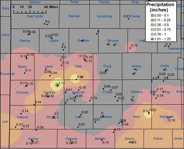
Rain Falls on Portions of the South Plains and Rolling Plains

Above is a map of the rainfall (in inches) that fell across the region from March 28 through early March 29, 2006. The image was created from data gathered by West Texas Mesonet Stations and NWS Cooperative observation stations
US Dept of Commerce
National Oceanic and Atmospheric Administration
National Weather Service
Lubbock, TX
2579 S. Loop 289
Suite 100
Lubbock, TX 79423-1400
806-745-4260
Comments? Questions? Please Contact Us.

