STRONG WIND AND WILDFIRES CAUSE HAVOC FROM EASTERN NEW MEXICO INTO THE TEXAS PANHANDLE
 |
|
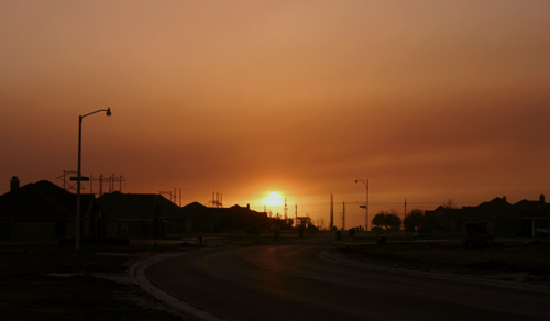
Looking west from Lubbock, the smoke from the New Mexico fire creates an red-orange sunset (photo by Todd Lindley)
|
|
For the second time this year, very strong winds swept across the region, causing massive wildfires and plumes of dirt and smoke. The winds were produced by a large and powerful storm system moving out of the Rocky Mountains. This same storm system caused heavy snow in the southern Rockies and spawned deadly tornadoes in the Mississippi Valley and Midwest. High winds spread from west to east across the South Plains Sunday morning and by midday the wind at Lubbock Airport was sustained around 35 mph with gusts to near 55 mph. The wind caused areas of blowing dust to develop, and visibilities dropped to near zero at times near open fields. Soon, smoke began to mix with the dirt as several large wildfires developed. Unfortunately, due to the recent drought across the region, the dry brush has become a tinderbox for wildfire development. The largest fires were located in southeast New Mexico; near Hobbs, and in the eastern Panhandle; near McClean. In the South Plains, fires developed near Abernathy, Levelland, Plainview and south of Morton. Across the Rolling Plains, a large fire developed near Childress and another north of Paducah. These fires could be seen by satellite burning through the night. The following images show how the fires, smoke and dust appeared via satellite. |
 |
|
|
Visible satellite image taken around 4:30 pm CST shows several distinct smoke plumes from the larger wildfires along with blowing dust across the South plains and Rolling Plains.
|
|
 |
|
|
The Infrared image taken around the same time clearly shows several "hot spots", where the intense heat from the wildfires shows up in black on the image
|
|
|
Radar is also used to detect the smoke plumes from fires. The following image is a mosaic of several National Weather Service radars around the region. |
|
 |
|
|
Radar image from 3:42 pm CST. The radar echoes from the dense smoke plumes can be seen spreading downwind
|
|
|
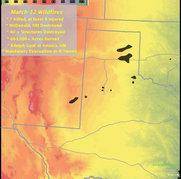
Our final picture summarizes the extent of the wildfires and some of the damage that we've compiled. 4 persons dies in a multiple-vehicle accident on I-40 east of Amarillo, caused by poor visibility due to smoke from the Groom wildfire. In the Lubbock area, widespread minor damage was reported, such as roof damage, downed trees and limbs, and fence and shed damage. |
|
 |
|
|
The black areas show the approximate burn areas from the wildfires
|
|
|
To view a listing of the preliminary storm reports associated with this event please CLICK HERE.
|
|