The storm on Saturday, March 26, 2005, brought snowfall to much of the northwest quarter of the South Plains and southwest Texas Panhandle. However, in most locations, the combination of warm ground temperatures, above freezing air temperatures, and the relatively short duration of the heavy snow resulted in little if any accumulations. There were a few locations, however, where the combination of very heavy snow and slight cooler temperatures allowed the snow to accumulate.
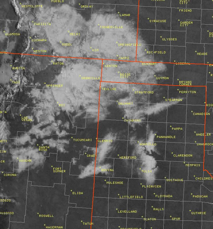
Above is a visible satellite image taken at 9:10 am on March 27, 2005. (Click on the Image for a view of the entire shield of snow that stretched from southeast Colorado through the northern South Plains)
Looking at the visible satellite image (above) taken early Easter morning, one can easily pick out the locations where snow did accumulate (the white regions). Two notable regions of snow accumulation are present across the Lubbock County Warning Area. The first area spreads across much of Parmer County, with the second area located across Eastern Swisher, Western Briscoe, and Northwest Floyd Counties. Additionally, there is a narrow swath where snow accumulated in Southeast Floyd County.
Below are the snowfall reports we received for each distinct area of snow accumulation:
Parmer County:
2 inches at Frionia
3-4 inches at Rhea
5 inches at Bovina
Eastern Swisher, Western Briscoe, and Northwest Floyd Counties:
0.5-1 inch at Tulia
7 inches at Vigo Park
5 inches 5 miles east of Vigo Park
Southeast Floyd County:
1.5 inches 9 miles southeast of Floydada


 Follow us on X
 Follow us on Facebook
 Follow us on YouTube
 LUB RSS Feed


