
Tropical Depression Two is expected to gradually strengthen and could bring tropical storm conditions to the Florida Panhandle beginning late Monday. Areas of flash flooding will be possible through Thursday along the eastern and central Gulf Coast. Severe thunderstorms will develop and move along a cold front crossing the Upper Midwest Monday, and through the Ohio Valley/Mid-Atlantic on Tuesday. Read More >
Last Map Update: Tue, Jul 21, 2026 at 8:12:11 am PDT
|
Text Product Selector (Selected product opens in current window)
|
|


 KBHX Radar
 Satellite
 Weather Map
 Forecast Weather Tables
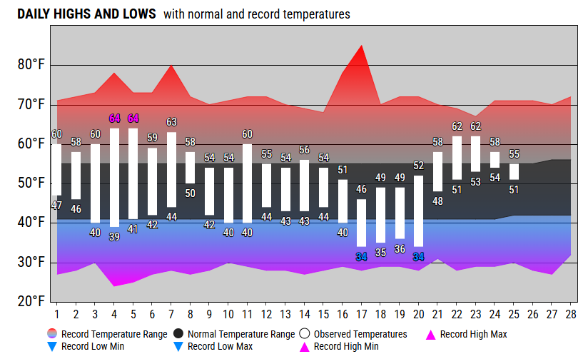 Monthly Past Weather Graphs
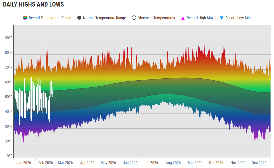 Yearly Past Weather
 Become A Rain/Snow/Hail Observer
 TsunamiReady
 Water Temperatures for NW California
 NW CA Mtn Pass Forecasts
 NW CA Daily Graphicast
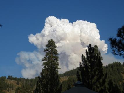 Area Smoke Forecast
 Drought Monitor
 Air Quality
 Winter Weather
 Probabilistic QPF Experiment
 Submit a Storm Report