
Dangerous to record breaking heat will build across the center of the nation and slowly build eastward this week. Wildfire conditions remain critical for the Southwest and portions of the Great Basin through Monday. For the northern Plains and upper Midwest, severe thunderstorms with the potential for large to very large hail and severe winds are the primary hazards. Read More >
 |
 |
 |
 |
 |
 |
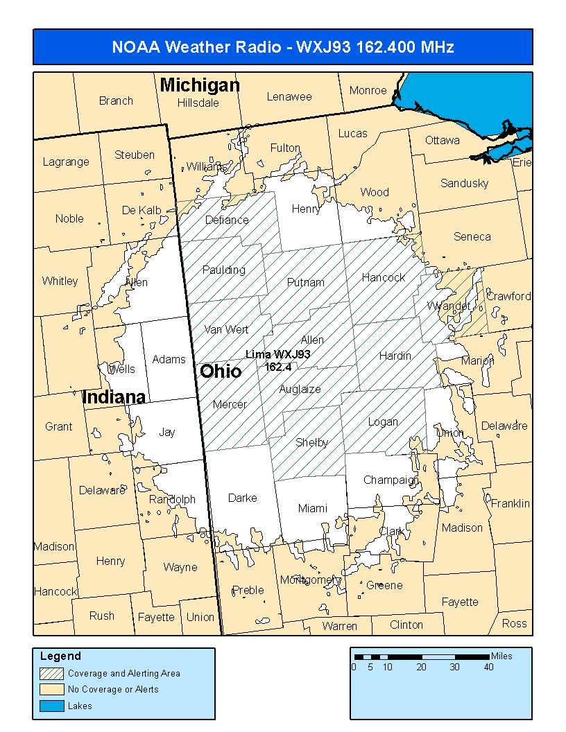
| Cridersville, OH (Lima) WXJ-93 |
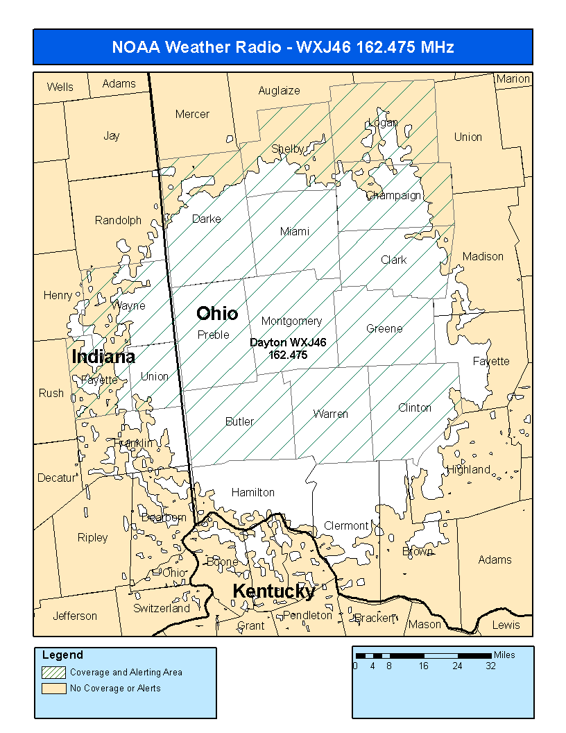
Miamisburg, OH (Dayton) WXJ-46 |
Columbus, OH KIG-86 |
 |
 |
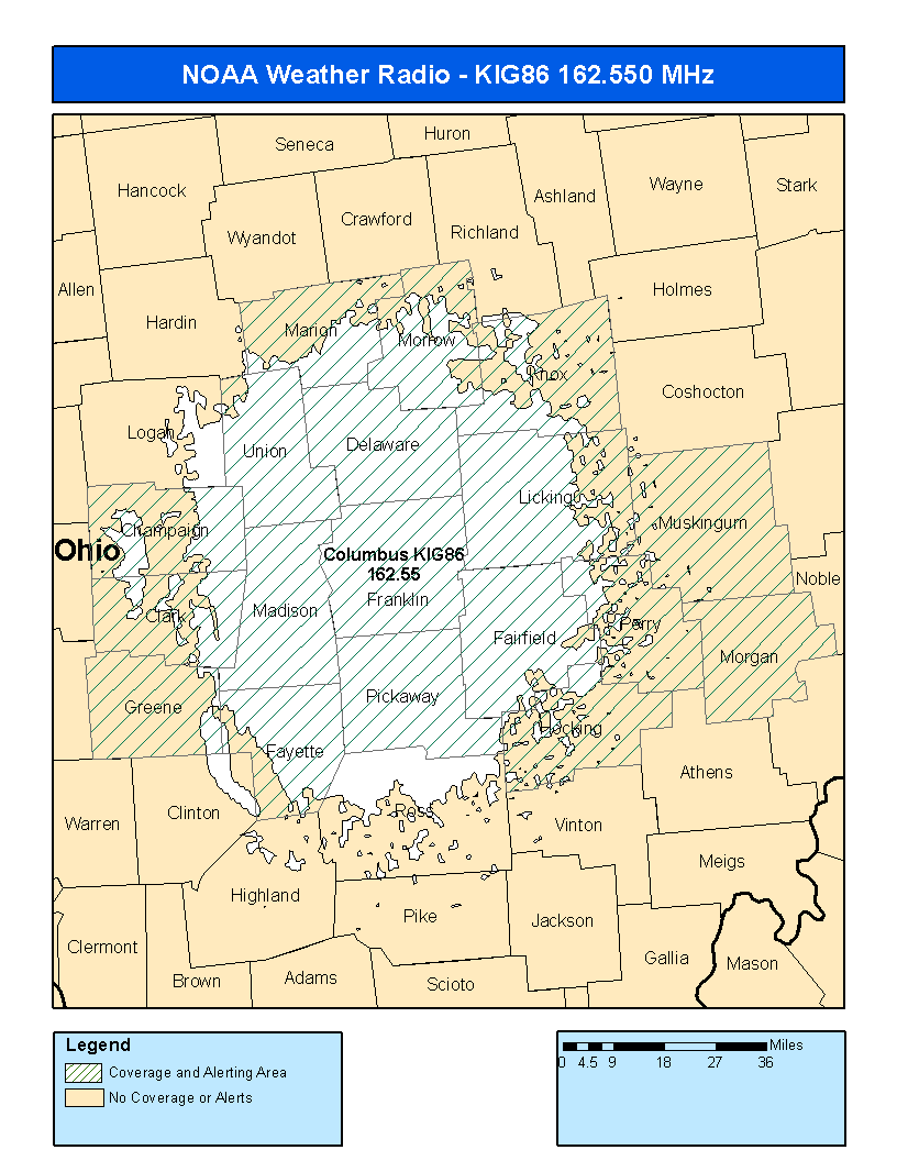 |
| Frequency: 162.400 MHz | Frequency: 162.475 MHz | Frequency: 162.550 MHz |
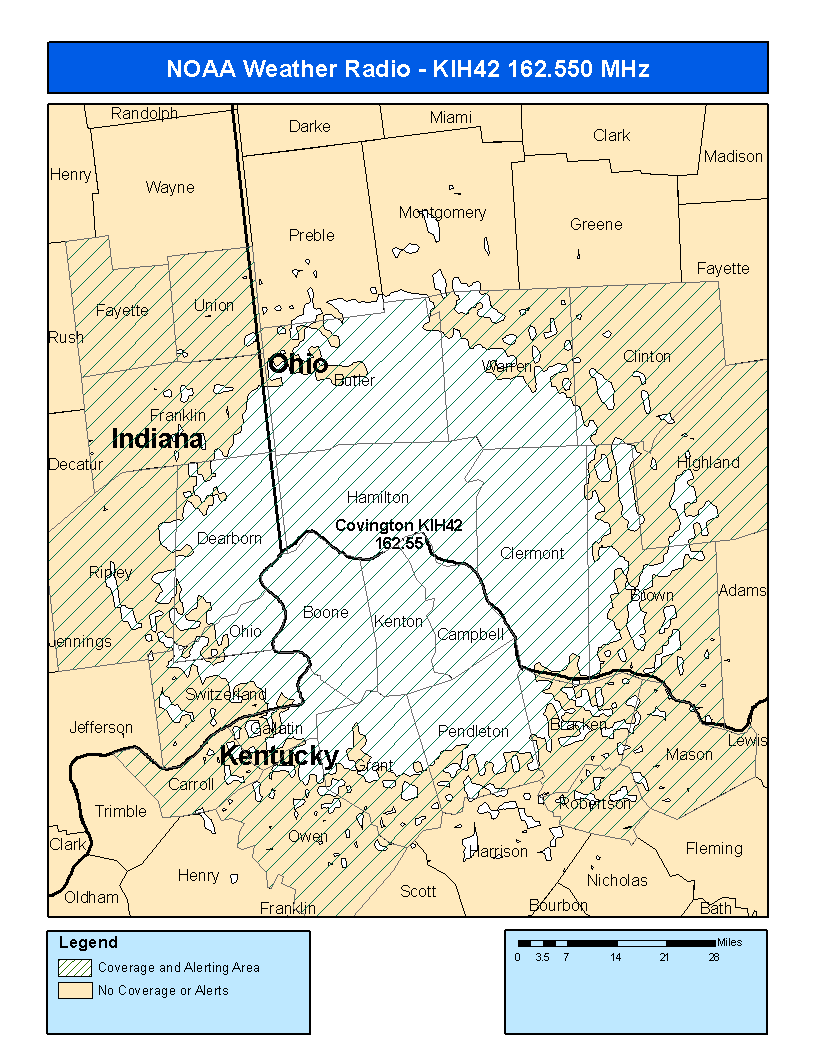
| Covington, KY (Cincinnati) KIH-42 |
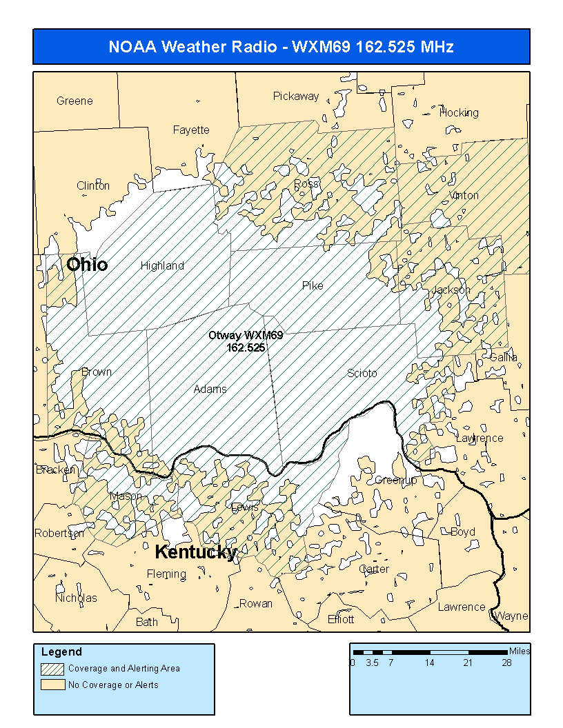
Otway, OH WXM-69 |
Maysville, KY KZZ-49 |
 |
 |
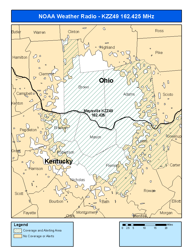 |
| Frequency: 162.550 MHz | Frequency: 162.525 MHz | Frequency: 162.425 MHz |
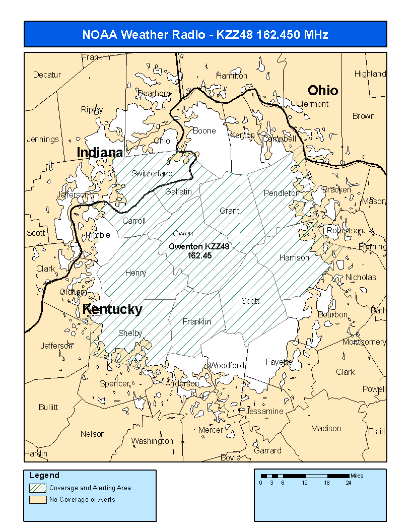
| Owenton, KY KZZ-48 |
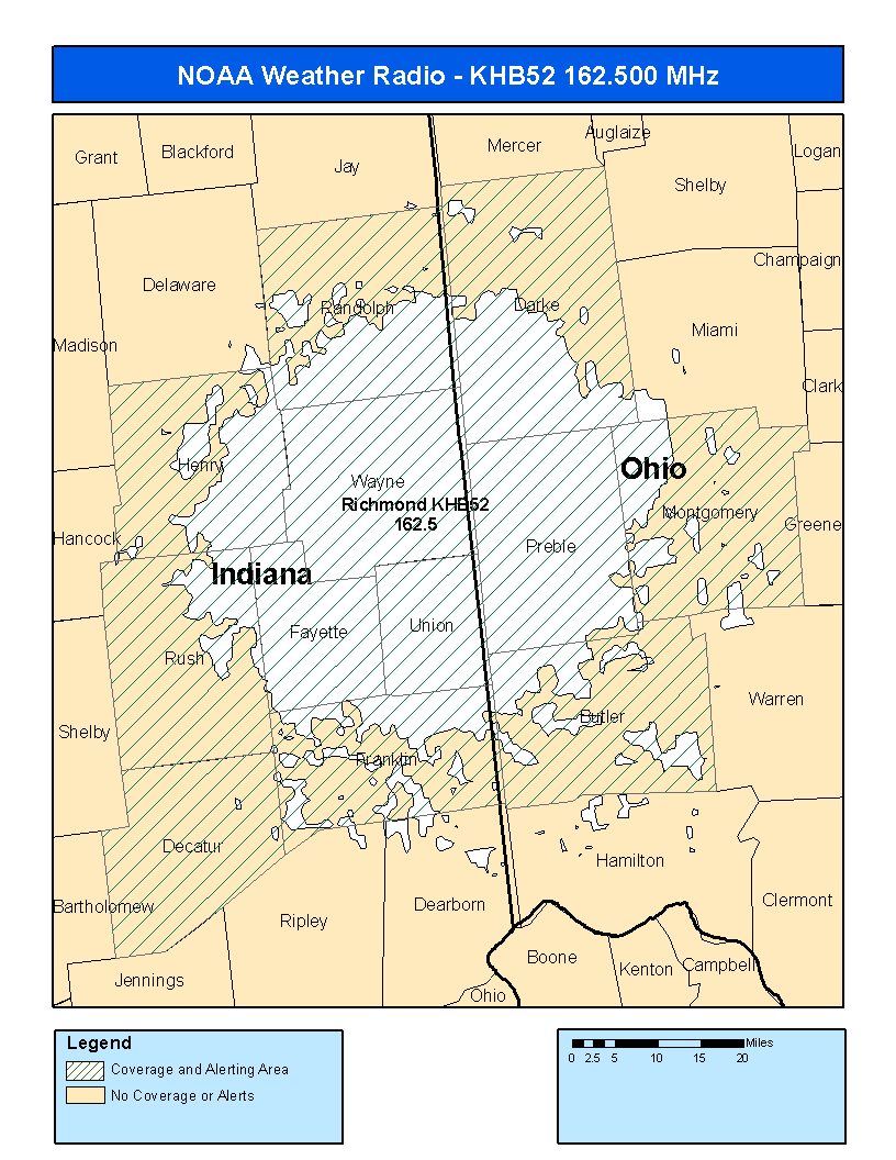
Richmond, IN KHB-52 |
Chillicothe, OH KJY-68 |
 |
 |
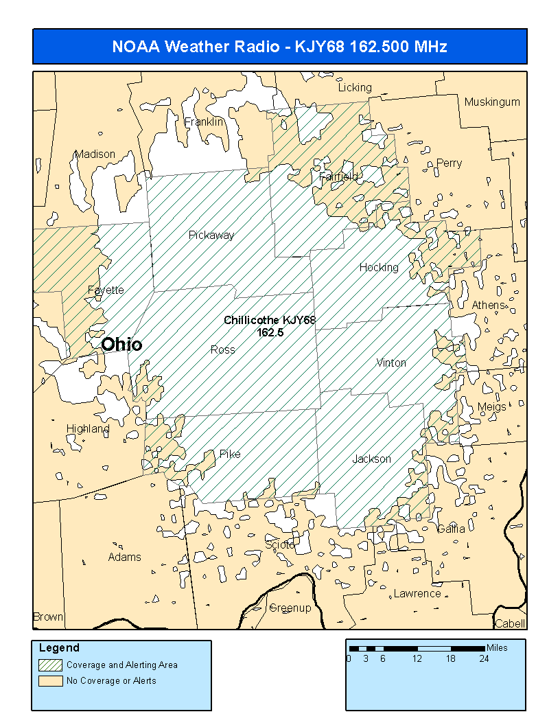 |
| Frequency: 162.450 MHz | Frequency: 162.500 MHz | Frequency: 162.500 MHz |
Traveling outside the local area? Click here for nationwide transmitter information and broadcast coverage maps.
Current NWR transmitter outages/degraded service
Coverage Map Notes:
The coverage statistics and maps shown above are calculated using a computer model and station data assuming ideal conditions. Coverage may be 5 to 10 percent below the computer predicted coverage for the following reasons:

