Overview of June 19, 2016, Severe Thunderstorms and Tornadoes
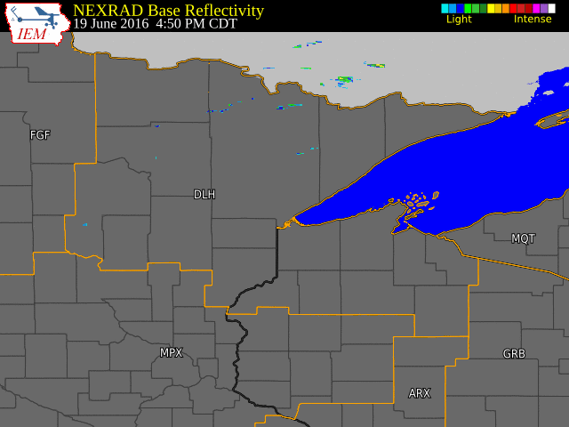
Tornadic thunderstorms developed over the Northland on Sunday evening, June 19, 2016. These storms formed in a very unstable airmass ahead of a cold front that moved through the area during the evening. Storms developed around 5 pm, and moved rapidly east, affecting much of northeast Minnesota and parts of northwest Wisconsin. Reports of tornadoes, large hail and damaging winds were found across parts of the area.
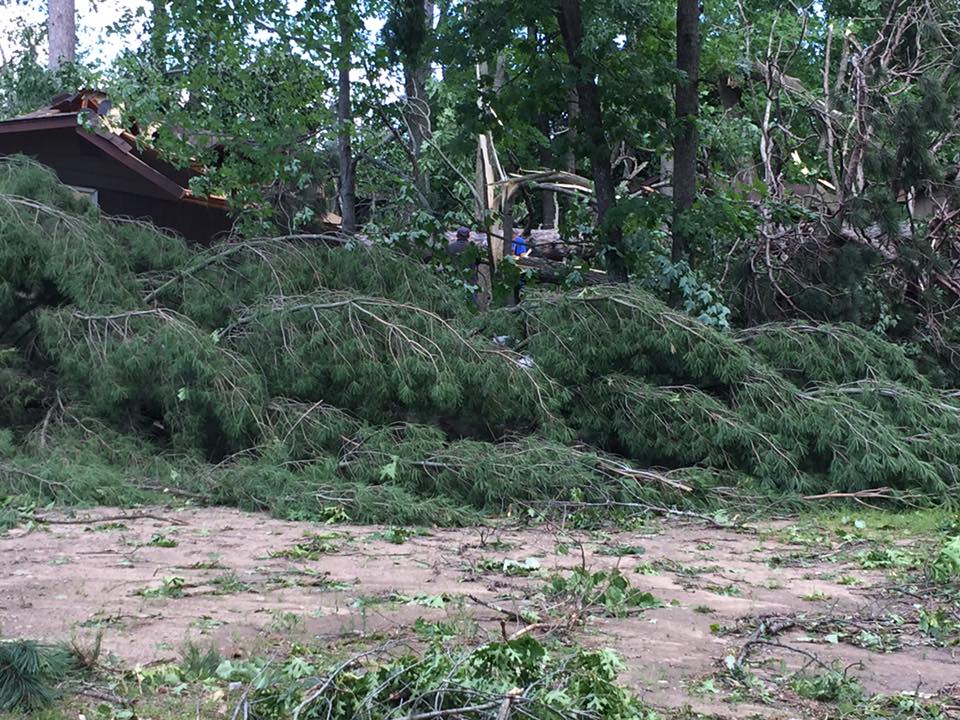
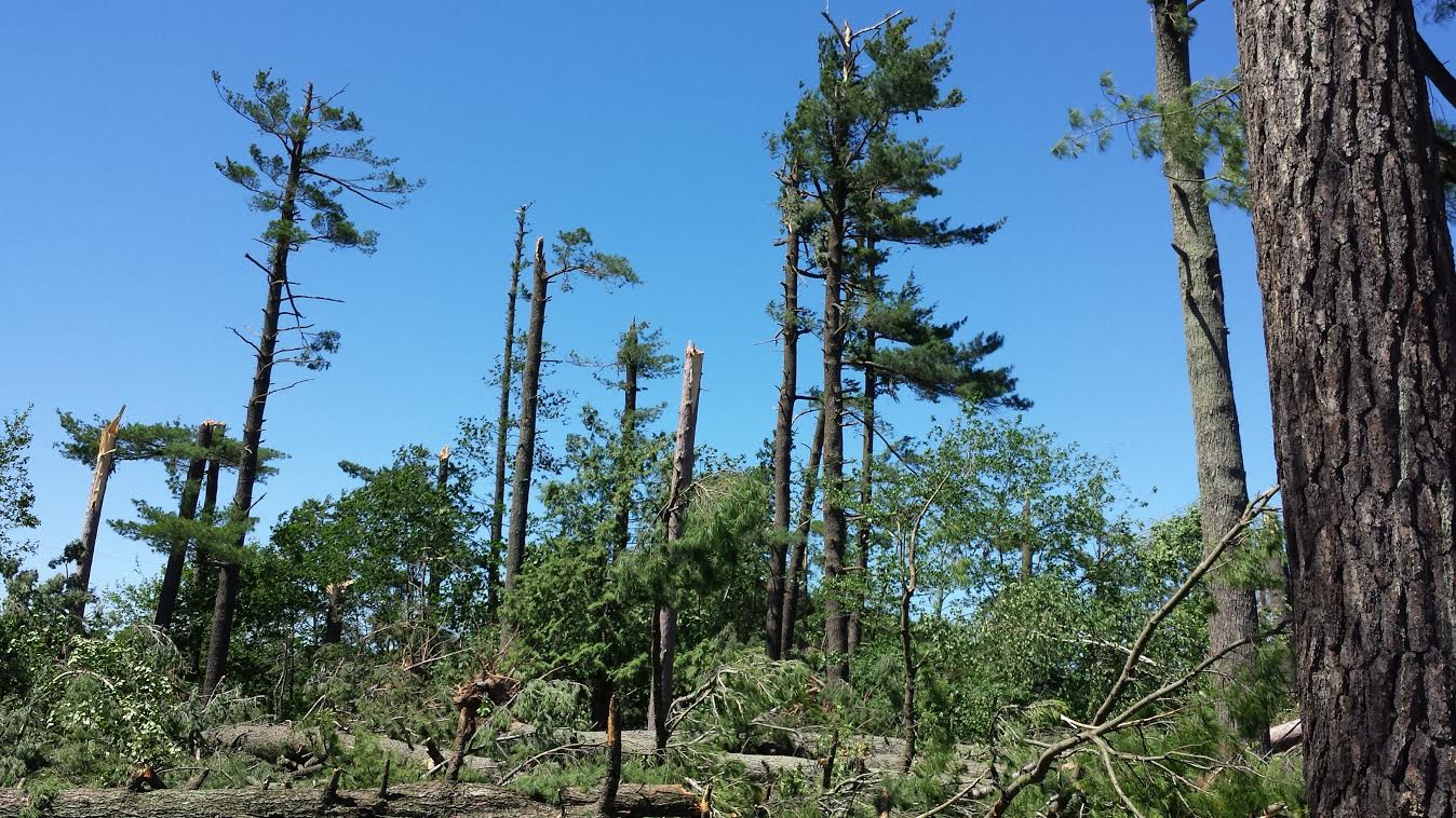
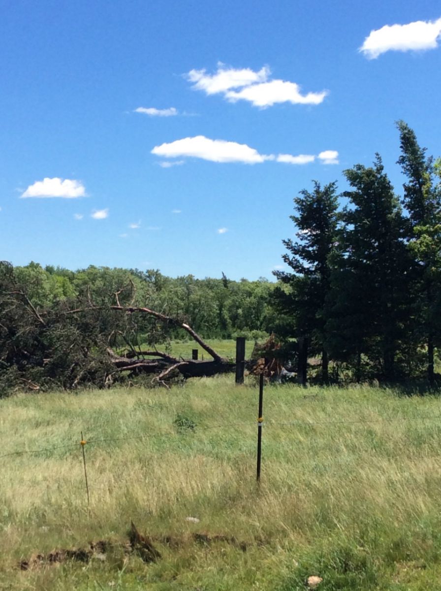
Damage surveys conducted by National Weather Service meteorologists confirmed 4 tornadoes over northeast Minnesota that evening. The strength of the tornadoes ranged from EF-0 to EF-2.
Tornadoes:
|
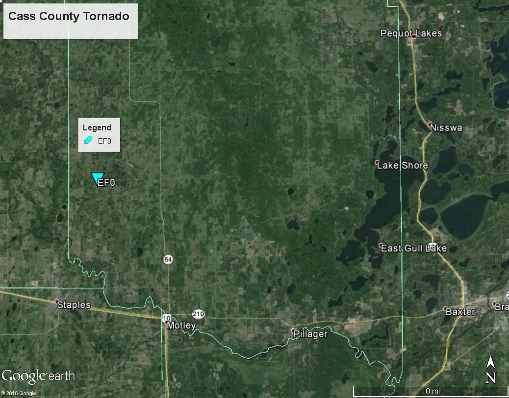
Tornado - #1
|
||||||||||||||||
|
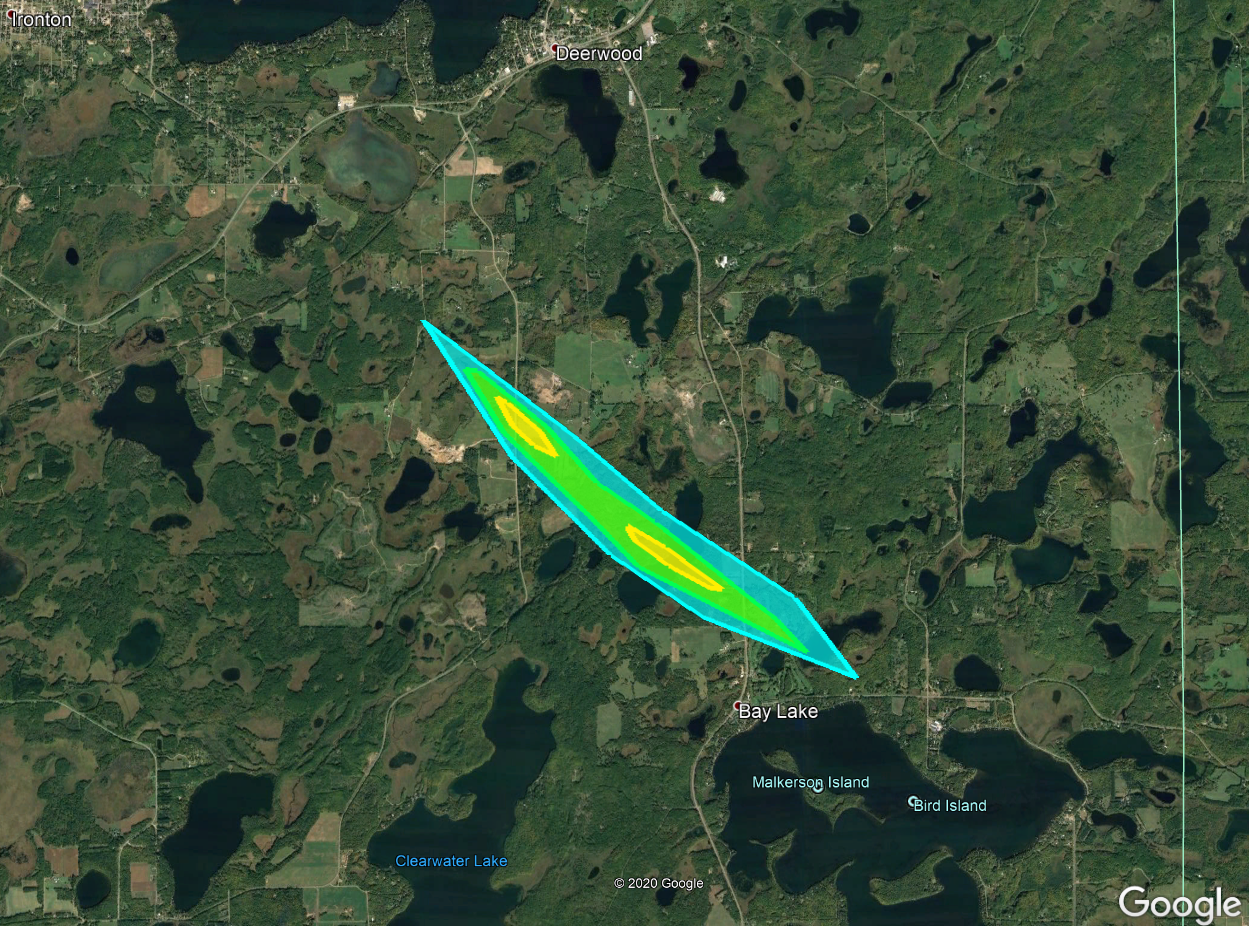
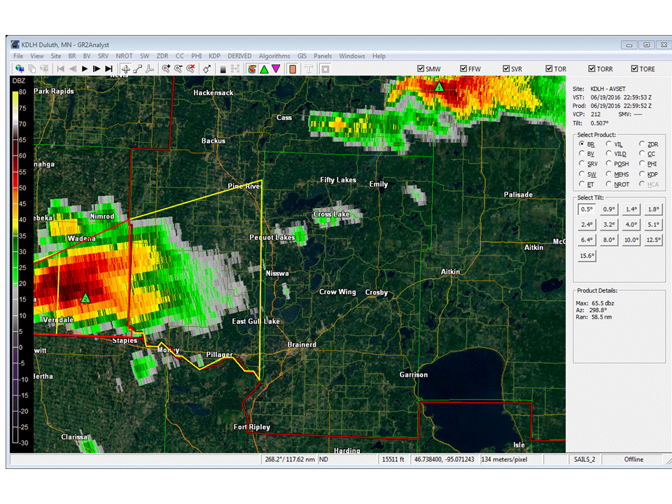
Tornado - #2 - Placid Lake
|
||||||||||||||||
|
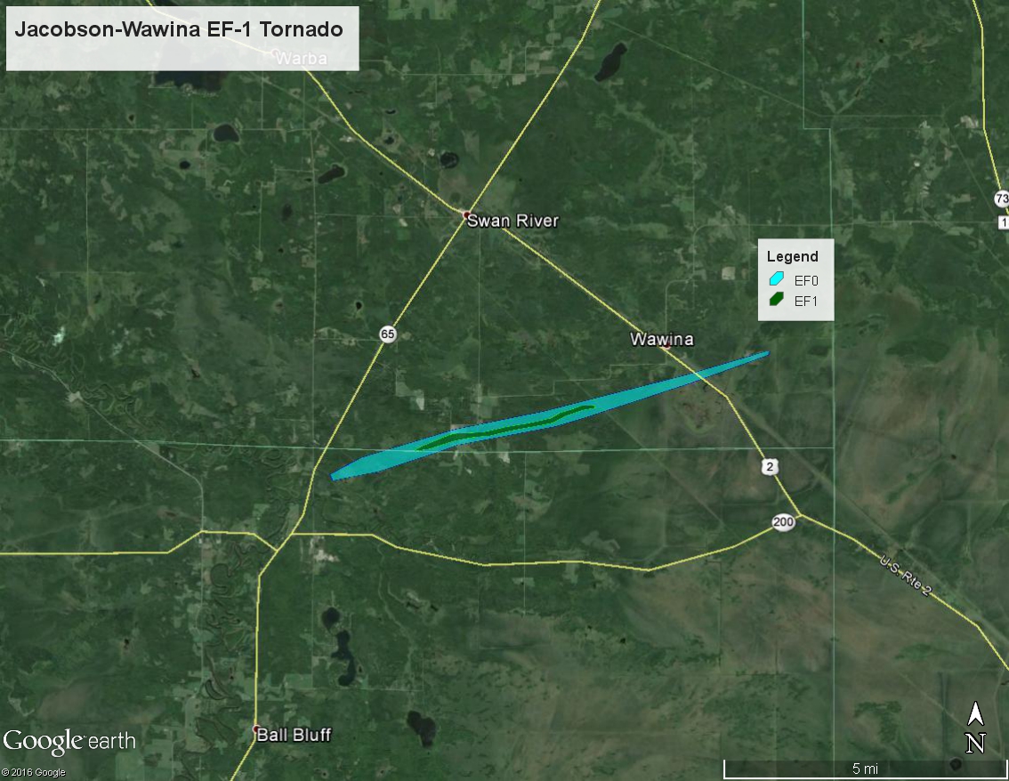
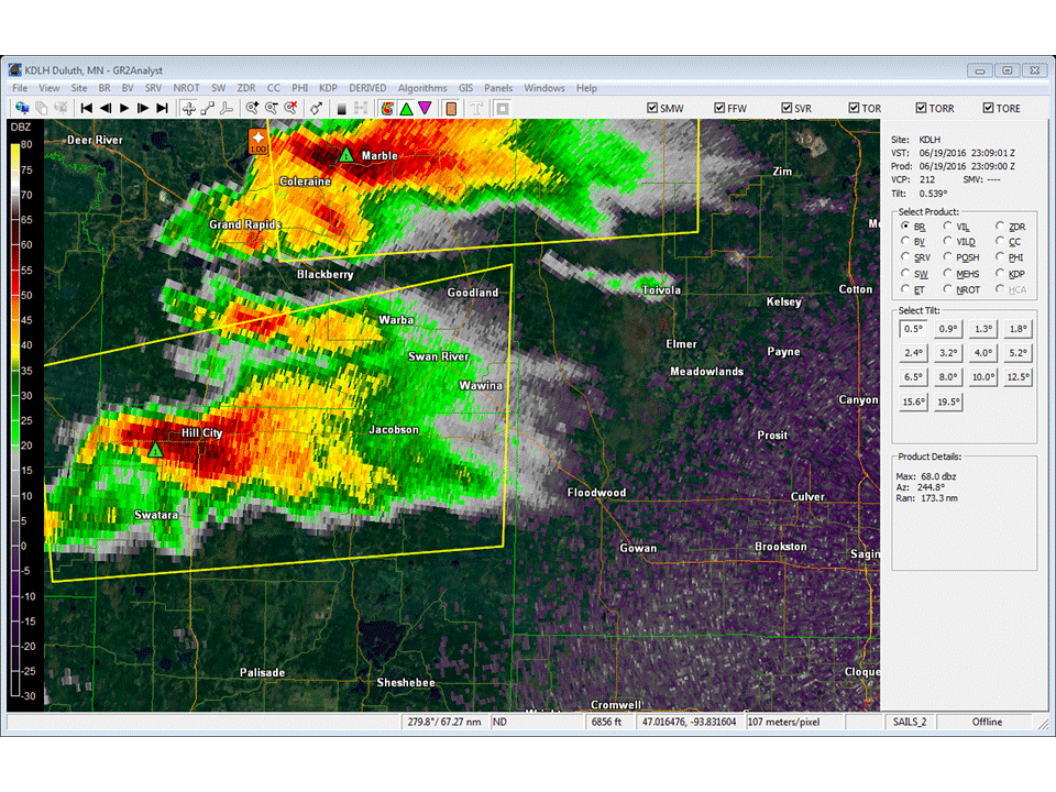
Tornado - #3 - Jacobson-Wawina
|
||||||||||||||||
|
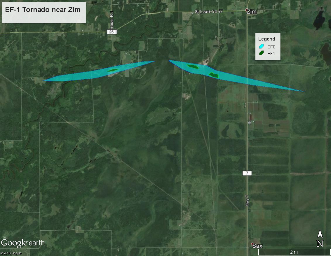
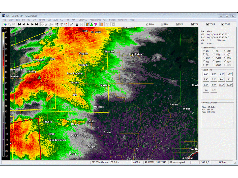
Tornado - #4 - near Zim
|
||||||||||||||||
The Enhanced Fujita (EF) Scale classifies tornadoes into the following categories:
| EF0 Weak 65-85 mph |
EF1 Moderate 86-110 mph |
EF2 Significant 111-135 mph |
EF3 Severe 136-165 mph |
EF4 Extreme 166-200 mph |
EF5 Catastrophic 200+ mph |
 |
|||||
Wind & Hail
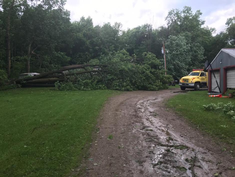
Wind Damage
 |
 |
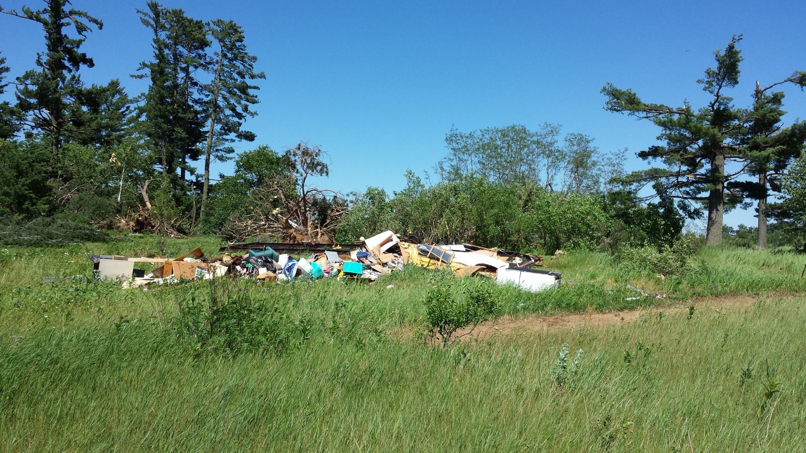 |
| Storm damage to trees to a camp near Deerwood, MN | Tree damage near Rutgers along Highway 6 | A manufactured home 2.5 miles south of Deerwood, MN was destroyed. |
 |
 |
 |
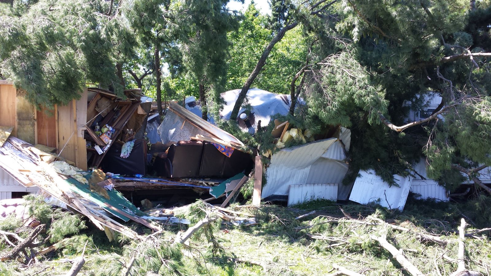 |
| Tree damage 3.5-4 miles south of Swan River | Damage to car in Sago township, southwest of Swan River, MN Photo by Cindy Hansmann | Tree damage in Sago township, southwest of Swan River, MN. Photo by Cindy Hansmann | This mobile home near Deerwood was smashed by a fallen tree. |
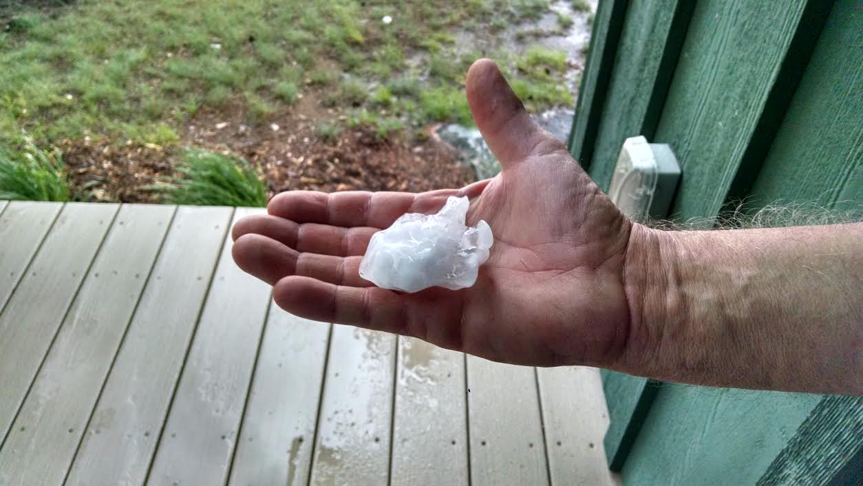
Hail
 |
 |
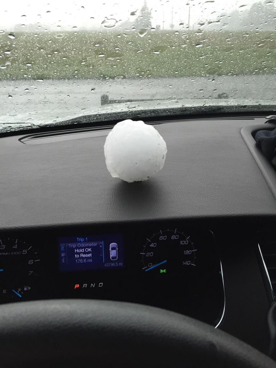 |
| 1 inch hail in Pengilly, mixed with half inch hail. Nickel used for size comparison. Hail fell around 6:20 PM | Large hail- approximately 2.5 to 3 inches in diameter. | Hail that fell near Nisswa |
Radar
Northern Minnesota, northwest Wisconsin radar loop of entire event:
Radar loops focused on the 3 areas of concern for tornadic development.
 |
 |
 |
|
Radar loop 5:59PM to 7:43PM as storms move across the Brainerd lakes region, and likely produced Tornado #1. |
Radar loop 6:09 PM to 7:25 PM as storms move from the southern Itasca/northern Aitkin county border region east to southern St. Louis county. During this time frame Tornado #2 was produced. | Radar loop 6:45 PM to 7:01 PM as storms moved across southern St. Louis county. This storm also prodced a tornado. |
Storm Reports
PRELIMINARY LOCAL STORM REPORT...SUMMARY
NATIONAL WEATHER SERVICE DULUTH MN
124 AM CDT MON JUN 20 2016

..TIME...   ...EVENT...      ...CITY LOCATION...     ...LAT.LON...
..DATE...   ....MAG....      ..COUNTY LOCATION..ST.. ...SOURCE....
            ..REMARKS..

0600 PM     HAIL             7 NE COHASSET           47.34N 93.51W
06/19/2016  M1.00 INCH       ITASCA             MN   AMATEUR RADIO

0622 PM     FUNNEL CLOUD     5 E LEADER              46.50N 94.55W
06/19/2016                   CASS               MN   TRAINED SPOTTER

0622 PM     HAIL             PENGILLY                47.33N 93.20W
06/19/2016  M1.00 INCH       ITASCA             MN   AMATEUR RADIO

0630 PM     HAIL             5 E LEADER              46.52N 94.54W
06/19/2016  M1.75 INCH       CASS               MN   AMATEUR RADIO

0630 PM     TORNADO          8 NNE STAPLES           46.47N 94.74W
06/19/2016                   CASS               MN   LAW ENFORCEMENT

0634 PM     HAIL             1 N PINE RIVER          46.74N 94.40W
06/19/2016  M1.00 INCH       CASS               MN   TRAINED SPOTTER

            NICKEL TO QUARTER SIZED HAIL.

0640 PM     HAIL             2 W BREEZY POINT        46.60N 94.26W
06/19/2016  M2.50 INCH       CROW WING          MN   PUBLIC

0640 PM     HAIL             3 N NISSWA              46.54N 94.30W
06/19/2016  M2.75 INCH       CROW WING          MN   TRAINED SPOTTER

0642 PM     HAIL             LAKE SHORE              46.50N 94.36W
06/19/2016  M2.75 INCH       CASS               MN   TRAINED SPOTTER

0647 PM     HAIL             4 S BREEZY POINT        46.54N 94.22W
06/19/2016  M2.75 INCH       CROW WING          MN   TRAINED SPOTTER

0647 PM     TORNADO          2 NNE JACOBSON          47.03N 93.25W
06/19/2016                   ITASCA             MN   TRAINED SPOTTER

            TIME ESTIMATED BY RADAR. DEBRIS IS SEEN BEING LOFTED IN
            THE AIR FROM PHOTO.

0647 PM     HAIL             NISSWA                  46.50N 94.30W
06/19/2016  M3.00 INCH       CROW WING          MN   AMATEUR RADIO

0648 PM     HAIL             5 E NISSWA              46.50N 94.19W
06/19/2016  M2.75 INCH       CROW WING          MN   TRAINED SPOTTER

0650 PM     HAIL             4 NE NISSWA             46.54N 94.24W
06/19/2016  M4.00 INCH       CROW WING          MN   TRAINED SPOTTER

            OBSERVER ESTIMATED 70MPH WINDS.

0650 PM     HAIL             7 S CROSSLAKE           46.58N 94.09W
06/19/2016  M1.75 INCH       CROW WING          MN   TRAINED SPOTTER

0651 PM     TORNADO          4 NE JACOBSON           47.03N 93.20W
06/19/2016                   ITASCA             MN   LAW ENFORCEMENT

            FOUR OUTBUILDINGS DESTROYED WITH LOSS OF MACHINERY. MAJOR
            DAMAGE TO RESIDENCE AND ATTACHED GARAGE.

0652 PM     HAIL             LAKE HUBERT             46.50N 94.26W
06/19/2016  M1.75 INCH       CROW WING          MN   TRAINED SPOTTER

0654 PM     FUNNEL CLOUD     3 S NISSWA              46.45N 94.30W
06/19/2016                   CROW WING          MN   TRAINED SPOTTER

0707 PM     FUNNEL CLOUD     CROSBY                  46.49N 93.96W
06/19/2016                   CROW WING          MN   TRAINED SPOTTER

0711 PM     TSTM WND DMG     6 SE CUYUNA COUNTRY STA 46.43N 93.92W
06/19/2016                   CROW WING          MN   LAW ENFORCEMENT

            *** 1 INJ *** LARGE TREE FELL ON HOME AND RESIDENTS WERE
            TRAPPED NEEDED TO BE EXTRICATED. MINOR INJURIES.

0715 PM     TSTM WND DMG     5 E WOODROW             46.38N 93.97W
06/19/2016                   CROW WING          MN   TRAINED SPOTTER

            MULTIPLE LARGE TREES DOWN

0715 PM     TSTM WND DMG     3 SSE DEERWOOD          46.43N 93.87W
06/19/2016                   CROW WING          MN   TRAINED SPOTTER

            NUMEROUS TREES DOWN ALONG MN-6 ALONG A 1 TO 2 MILE
            STRETCH. TIME EST FROM RADAR.

0715 PM     TSTM WND DMG     3 SSE DEERWOOD          46.43N 93.88W
06/19/2016                   CROW WING          MN   EMERGENCY MNGR

            REPORTS OF SEVERAL CABINS DAMAGED BY DOWNED TREES AROUND
            THE PLACID LAKE AREA.

0716 PM     HAIL             AITKIN                  46.53N 93.71W
06/19/2016  M1.00 INCH       AITKIN             MN   TRAINED SPOTTER

0723 PM     FUNNEL CLOUD     5 NW WEALTHWOOD         46.42N 93.73W
06/19/2016                   AITKIN             MN   PUBLIC

            PUBLIC REPORT OF FUNNEL CLOUD S OF CR-28 AND E OF MN-210.
            TIME EST FROM RADAR.

0743 PM     TSTM WND DMG     GOODLAND                47.16N 93.14W
06/19/2016                   ITASCA             MN   AMATEUR RADIO

            6 TO 8 INCH DIAMETER TREE DOWN. TIME ESTIMATED BY RADAR.

0753 PM     HAIL             SWAN RIVER              47.09N 93.20W
06/19/2016  M1.00 INCH       ITASCA             MN   AMATEUR RADIO

0754 PM     HAIL             4 N SWAN RIVER          47.14N 93.20W
06/19/2016  M1.00 INCH       ITASCA             MN   AMATEUR RADIO

0813 PM     TSTM WND DMG     WILLOW RIVER            46.32N 92.84W
06/19/2016                   PINE               MN   TRAINED SPOTTER

            3 TO 4 INCH DIAMETER TREES SNAPPED OFF. TIME EST FROM
            RADAR.

0825 PM     NON-TSTM WND DMG 4 NW ESKO               46.75N 92.42W
06/19/2016                   CARLTON            MN   TRAINED SPOTTER

            3 CEDAR TREES BLOWN DOWN, ONE 18 INCH DIAMETER.

0829 PM     NON-TSTM WND DMG SAWYER                  46.67N 92.63W
06/19/2016                   CARLTON            MN   TRAINED SPOTTER

            10 INCH TREE SNAPPED 4.5 FEET ABOVE GROUND.

0838 PM     HAIL             MEADOWLANDS             47.07N 92.73W
06/19/2016  M1.25 INCH       ST. LOUIS          MN   TRAINED SPOTTER

            LARGEST HAIL WAS HALF DOLLAR SIZED WITH SOME QUARTERS.

0904 PM     TSTM WND DMG     SUPERIOR                46.70N 92.06W
06/19/2016                   DOUGLAS            WI   PUBLIC

            LARGE TREE BLOWN DOWN IN EAST END OF SUPERIOR.

0910 PM     HAIL             2 W CARLTON             46.66N 92.47W
06/19/2016  E1.75 INCH       CARLTON            MN   TRAINED SPOTTER

            HALF DOLLAR SIZED HAIL COVERING THE GROUND WITH MANY GOLF
            BALL SIZED HAIL STONES

0915 PM     HAIL             1 S SOLON SPRINGS       46.33N 91.82W
06/19/2016  M0.75 INCH       DOUGLAS            WI   TRAINED SPOTTER

0915 PM     TSTM WND GST     2 S SOLON SPRINGS       46.31N 91.82W
06/19/2016  M68.00 MPH       DOUGLAS            WI   AWOS

            SOLON SPRINGS MUNICIPAL AIRPORT

0919 PM     HAIL             1 NE GORDON             46.26N 91.78W
06/19/2016  E1.00 INCH       DOUGLAS            WI   TRAINED SPOTTER

            GROUND COVERED WITH HAIL. ESTIMATES LARGEST HAIL SIZE OF
            QUARTERS.

0928 PM     HAIL             2 SE CARLTON            46.64N 92.39W
06/19/2016  M1.00 INCH       CARLTON            MN   TRAINED SPOTTER

0935 PM     HAIL             GARY NEW DULUTH         46.68N 92.21W
06/19/2016  M0.75 INCH       ST. LOUIS          MN   TRAINED SPOTTER

            DIME SIZE HAIL.

0959 PM     TSTM WND DMG     WILLOW RIVER            46.32N 92.84W
06/19/2016                   PINE               MN   TRAINED SPOTTER

            30-40 TREES DOWN AROUND TOWN. MOST UPROOTED. SOME BROKEN
            15-20 FT AGL. TIME EST FROM RADAR.

1043 PM     HAIL             NNW HINCKLEY            46.02N 92.94W
06/19/2016  E1.00 INCH       PINE               MN   TRAINED SPOTTER

1045 PM     HAIL             3 E HINCKLEY            46.01N 92.88W
06/19/2016  E1.00 INCH       PINE               MN   TRAINED SPOTTER
Environment
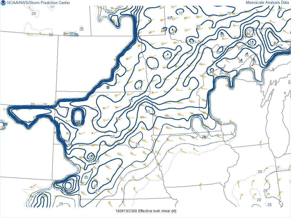
A very warm and unstable airmass had spread to over northern Minnesota Sunday afternoon. A strong cold front moving into that warm airmass generated strong to severe thunderstorms that then moved across portions of northeast Minnesota and into northwest Wisconsin Sunday evening and overnight. The large scale environment was characterized by CAPE values of over 3000 j/kg (Figure 5 below) and 40+ knots of deep layer bulk shear. This produced Supercell composite values of over 12, a good indicator that supercellular thunderstorms were expected to develop. Thunderstorms developed around 6 PM CDT, and spread east, producing widespread wind damage, large hail and a few tornadoes.
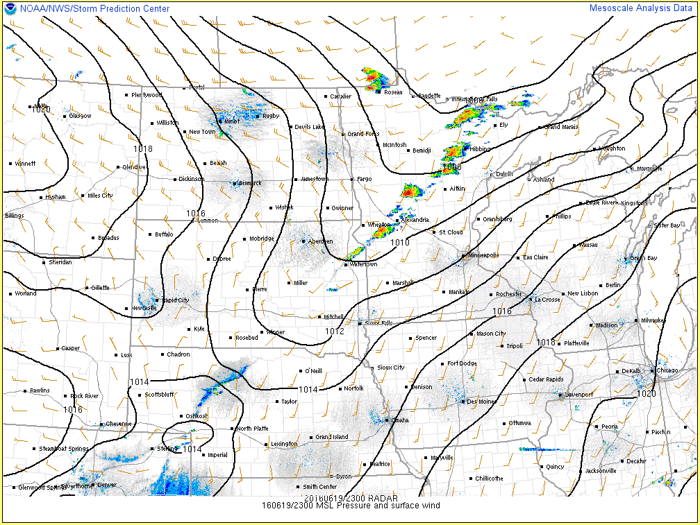 |
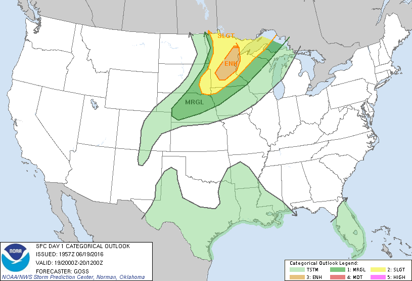 |
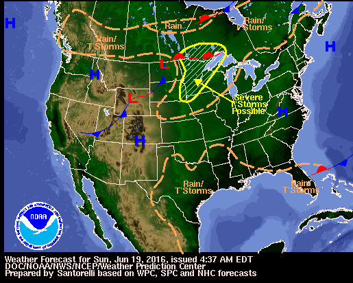 |
| Figure 1: PMSL, winds and radar at 23z, just as the event was beginning. | Figure 2: SPC Day 1 outlook issued at 4 PM CDT. | Figure 3: WPC forecast synoptic scale forecast for Sunday, June 19th. |
Near-storm environment images from SPC.
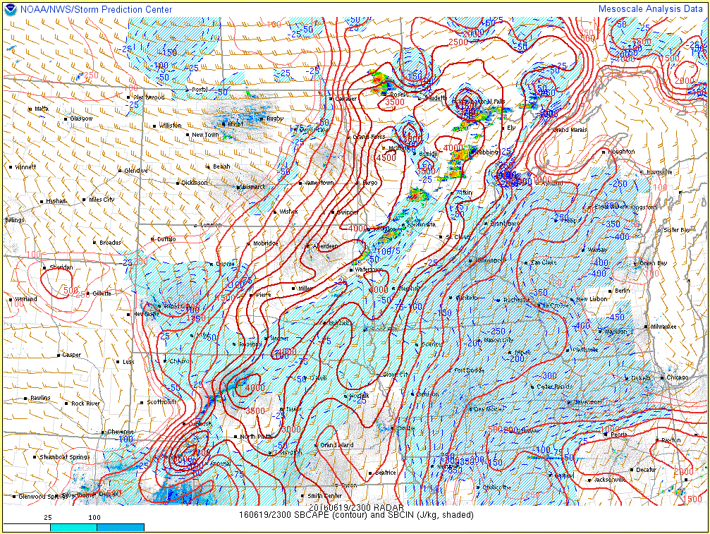 |
 |
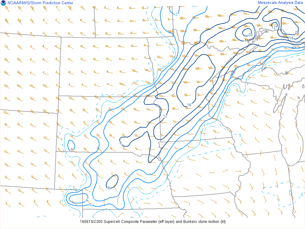 |
| Figure 4: Surface based CAPE analysis at 23z. | Figure 5: Deep layer bulk shear values at 23z. | Figure 6: Supercell composite parameter |
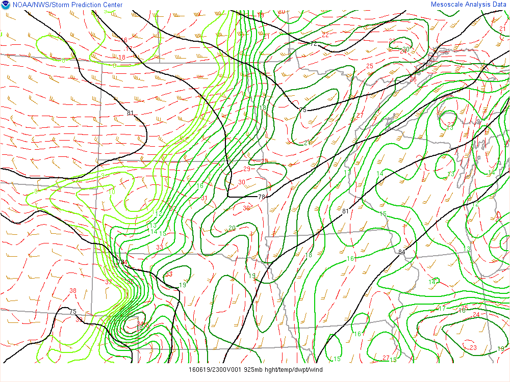
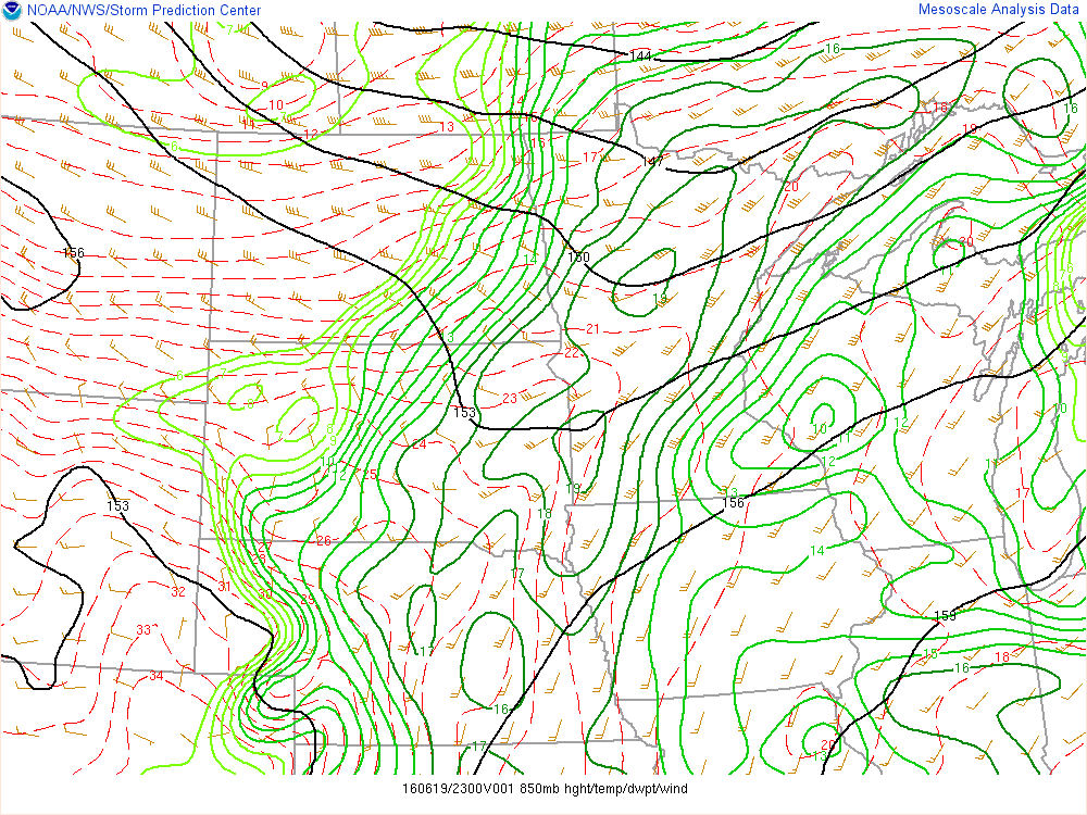
Additional upper air environmental analysis.
 |
 |
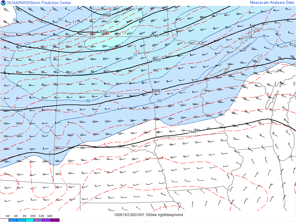 |
| Figure 7: 925 MB analysis | Figure 8: 850 MB analysis | Figure 9: 500 MB analysis |
 |
Media use of NWS Web News Stories is encouraged! Please acknowledge the NWS as the source of any news information accessed from this site. |
|