A winter-like pattern will continue over much of the Lower 48 over the next few days, with snow stretching from the Rockies today into the Middle Mississippi Valley on Monday. Showers and thunderstorms will develop along the Gulf Coast and Southeast on Monday. As the storm moves northward late Monday into Tuesday, winter weather is possible from the Central Appalachians to Interior New England. Read More >
Overview
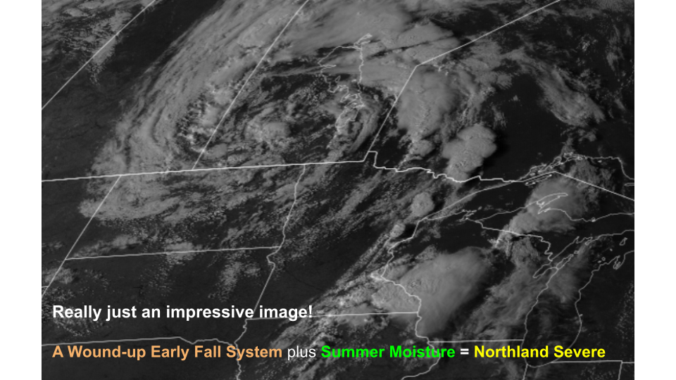
| A cold front moved through north-central Minnesota in the late afternoon hours on Thursday, September 19, 2024. Out ahead of the cold front in northeast Minnesota, discrete severe thunderstorms began to form in far northeast Minnesota along the US Hwy 53 corridor around 4 PM CT. The first Severe Thunderstorm Warning was issued at 4:15 PM for parts of far northeast St. Louis County and northwest Lake County as the severe storm moved northeastward around 30 mph. By 4:55 PM, conditions within a different severe supercell thunderstorm warranted the first Tornado Warning of the evening to be issued for central St. Louis County around the communities of Cotton and Canyon, MN. Between 5 and 5:30 PM that evening, multiple additional Severe Thunderstorm and Tornado Warnings were issued along and east of US Hwy 53 and along the I-35 corridor into east-central Minnesota. The cold front continued to move eastward through the early evening hours on the 19th, with storms beginning to enter Douglas and Burnett Counties in northwest Wisconsin towards 6 PM as funnel clouds were reported by law enforcement and trained weather spotters. Hail up to 1.5 inches in diameter was reported from the strongest thunderstorms, but in very localized reports. As the air mass began to cool and stabilized in the mid-evening hours, the threat for additional tornadoes began to wane and the strongest thunderstorms were limited to the Twin Ports and across northwest Wisconsin. As the cold front entered northwest Wisconsin by late evening, activity subsided to only showers and general thunderstorms with no additional impacts reported overnight. In total, eight Tornado Warnings, nine Severe Thunderstorms Warnings and two Special Marine Warnings were issued for this severe weather event. The Cotton/Canyon Tornado is the only confirmed tornado from this severe weather event at this time. While funnel clouds were reported with several other storms, there is currently no evidence that any of the other storms produced a tornado that reached the ground and produced damage. This assessment is subject to change as additional reports are received and in reviewing satellite imagery over the coming days and weeks. |
A Wound-up Early Fall System + Summer Moisture = Northland Severe! |
Tornadoes:
|
Tornado - Cotton/Canyon, MN
|
||||||||||||||||
The Enhanced Fujita (EF) Scale classifies tornadoes into the following categories:
| EF0 Weak 65-85 mph |
EF1 Moderate 86-110 mph |
EF2 Significant 111-135 mph |
EF3 Severe 136-165 mph |
EF4 Extreme 166-200 mph |
EF5 Catastrophic 200+ mph |
 |
|||||
Photos & Video
Cotton/Canyon Tornado
 |
 |
 |
 |
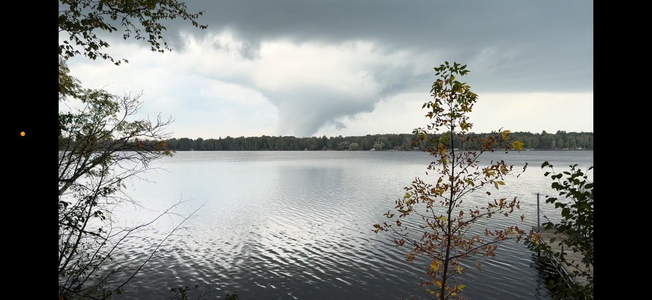
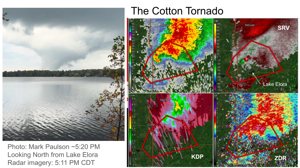
| View of Cotton/Canyon tornado as viewed from the southeast side of Lake Elora looking northwestward. (source) |
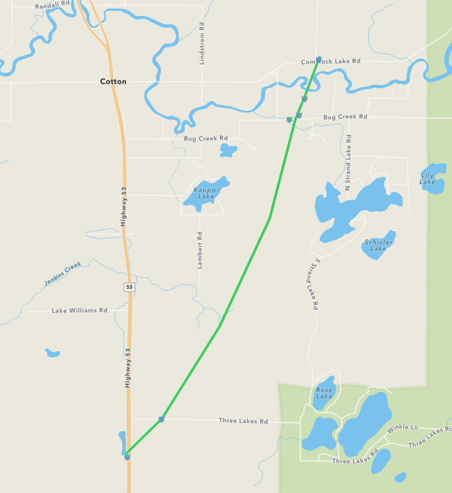
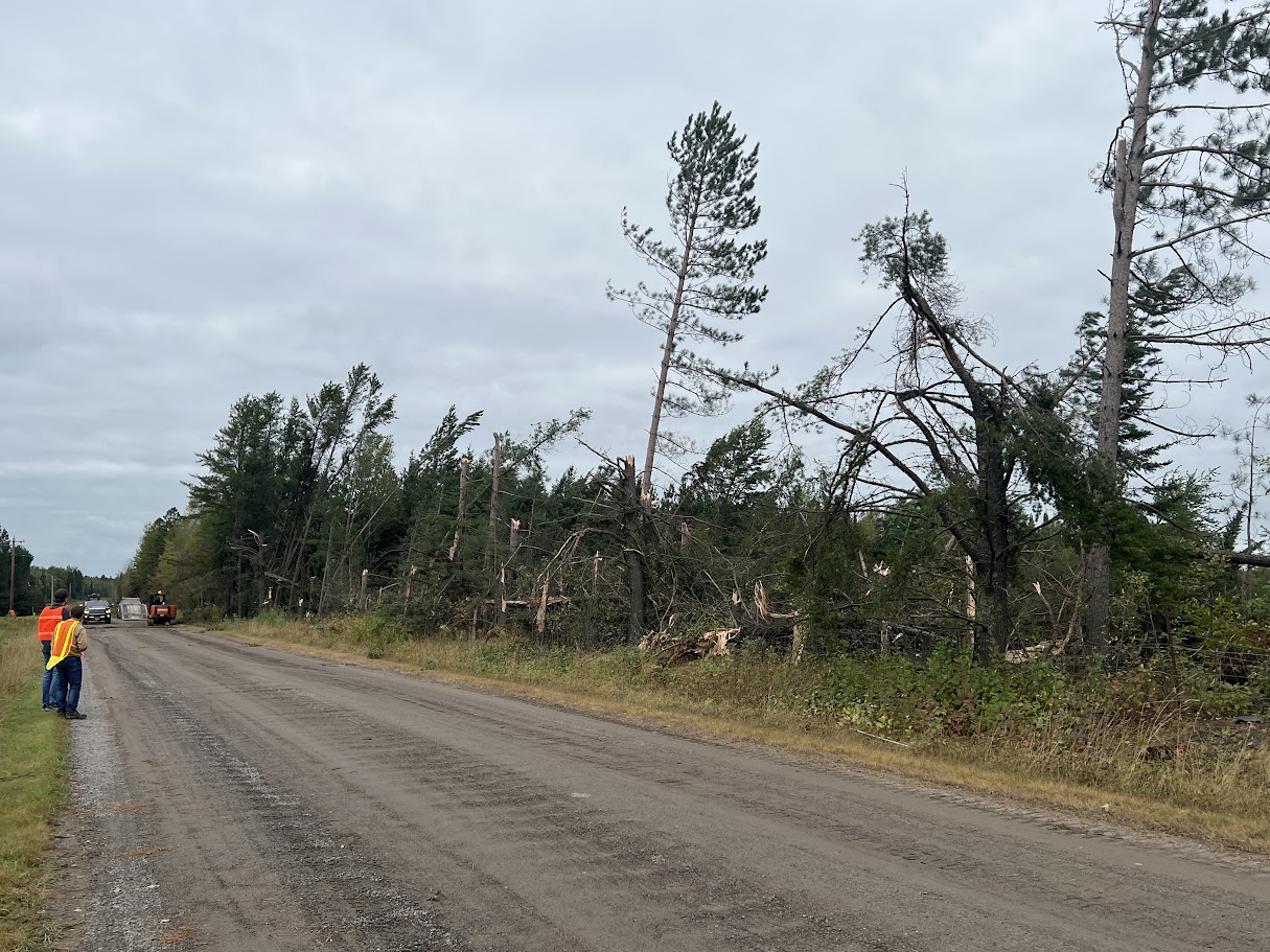
The first damage from the tornado that was viewed on the storm survey was on the western side of U.S. Hwy 53 just south of the Three Lakes Road intersection. (NWS Duluth) |
The second round of tornado damage was viewed on Three Lakes Road about 1/2 mile east of the intersection with U.S. Hwy 53. (NWS Duluth) |
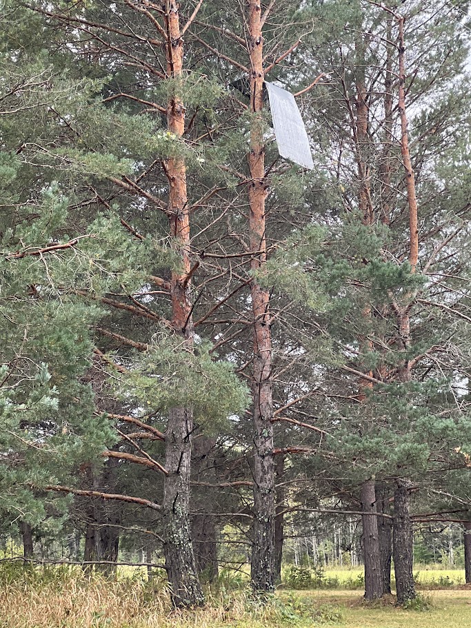
Sheet metal was lofted into pine trees from tornado damage as seen along Bug Creek Road. (NWS Duluth) |
 |
 |
 |
|
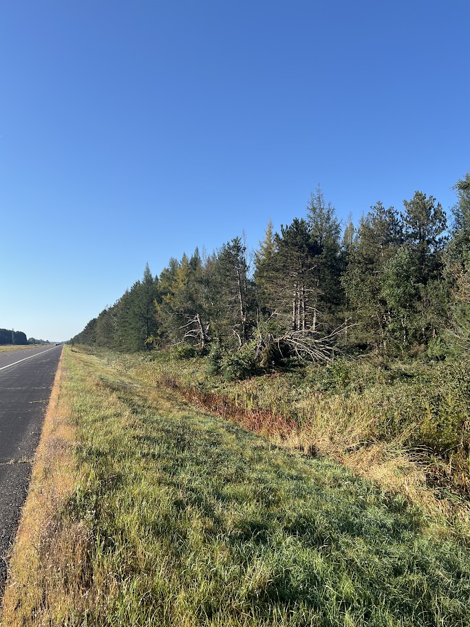
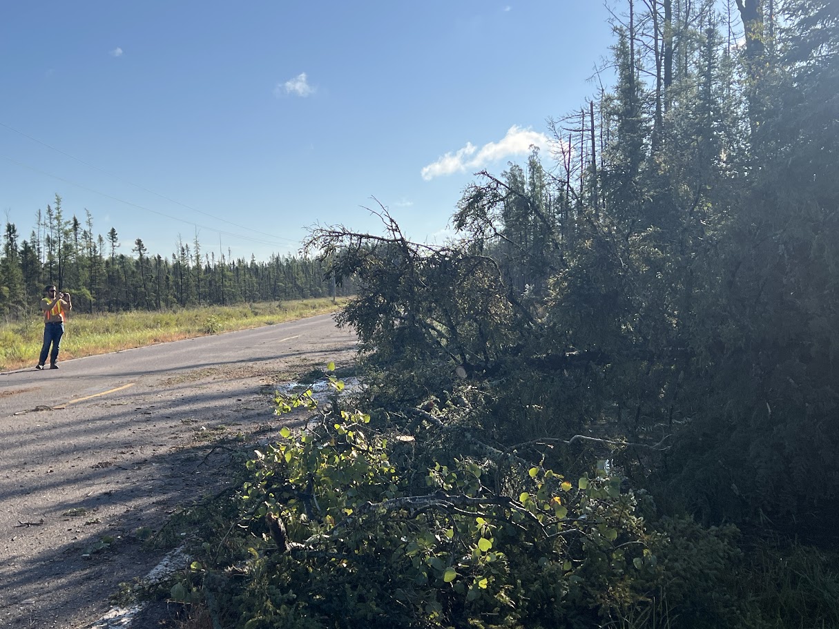
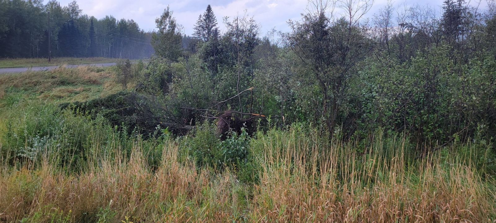
| Over 35 pine trees were snapped at the base from tornado damage along Bug Creek Road. (NWS Duluth) |
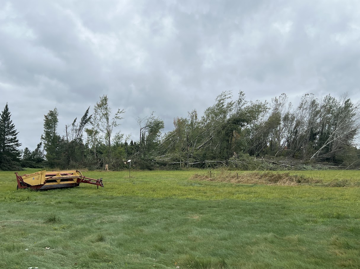
A patch of Aspen trees were uprooted by the tornado as seen on a farm located on the northside of Bug Creek Road. (NWS Duluth) |
The last storm damage that was seen on the NWS Duluth Storm Survey was at the intersection of Comstock and Melrude Roads. (NWS Duluth) |
Funnel Clouds
 |
 |
||
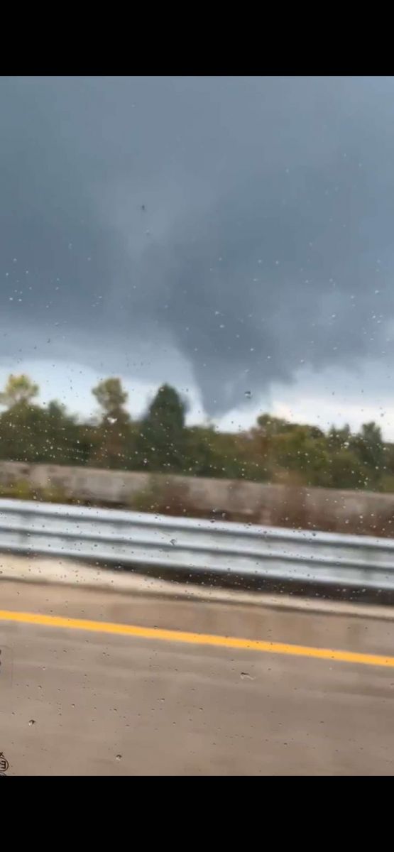
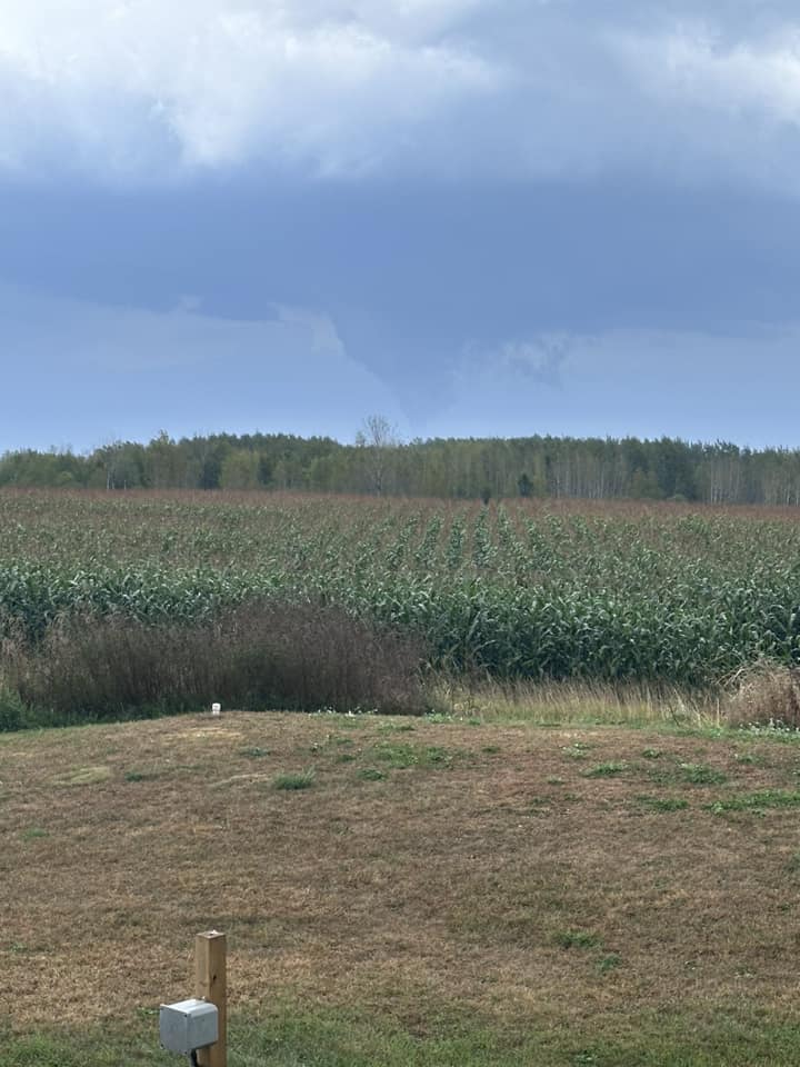
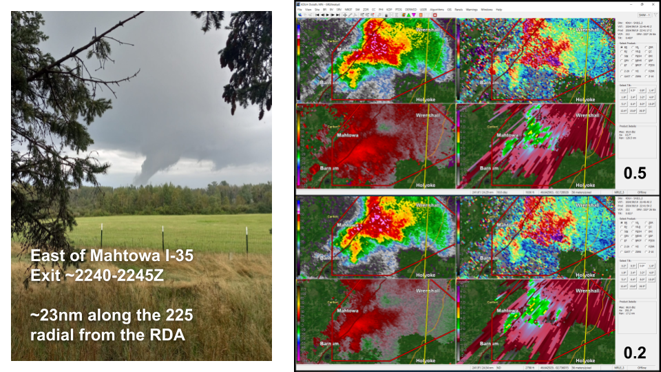
| Funnel cloud as viewed from near Barnum. (source) |
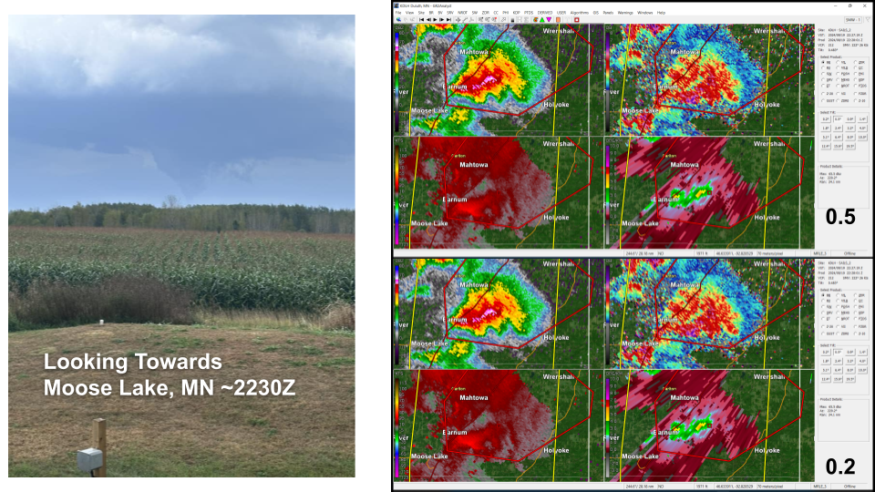
Funnel cloud as viewed from Interstate 35 near Moose Lake. (source) |
Radar
Individual Tornado/Funnel Clouds with Radar Imagery
 |
 |
 |
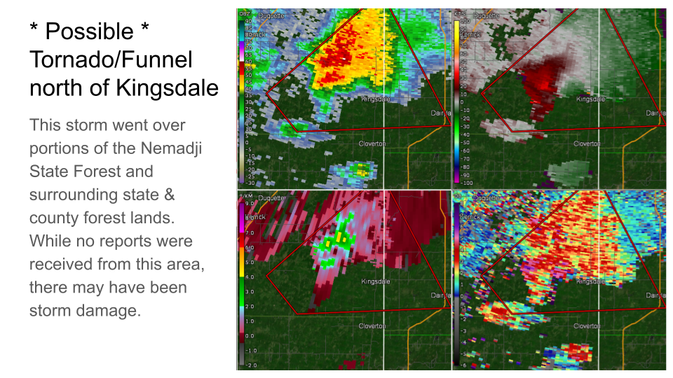 |
| Radar Imagery of Cotton Tornado with photo of tornado from Lake Elora. | Radar Imagery of Mahtowa Funnel Cloud with photo. | Radar Imagery of Moose Lake Funnel with photo. | Radar Imagery of a storm north of Kingsdale in the Nemadji State Forest that may have produced funnels/tornado. |
A loop of the line of thunderstorms through the event
A loop of radar imagery every 15 minutes from 4 pm to 930 pm.
Storm Reports
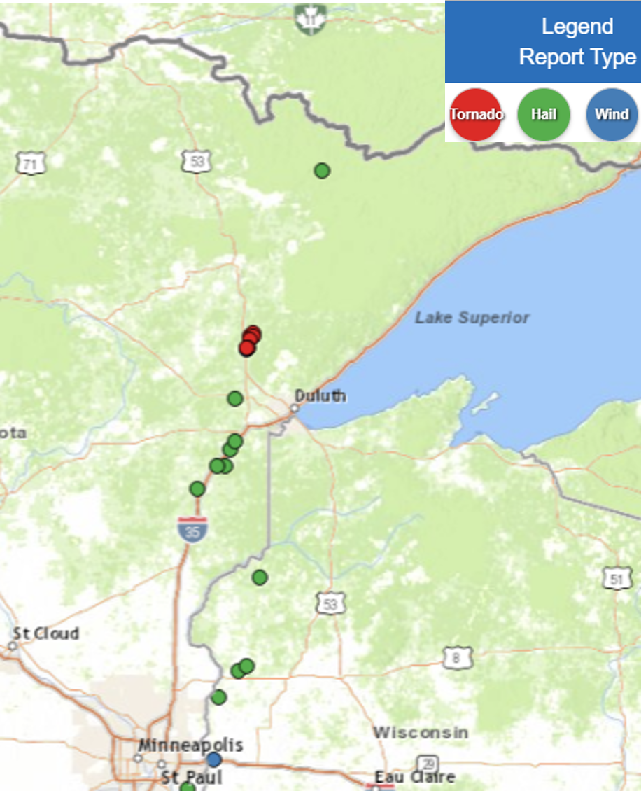
...HAIL REPORTS FROM STRONG AND SEVERE THUNDERSTORMS THAT MOVED ACROSS
NORTHEAST MINNESOTA AND FAR NORTHWEST WISCONSIN LATE AFTERNOON TO LATE
EVENING THURSDAY SEPTEMBER 19 2024...

Location                     Size      Time/Date

...Northeast Minnesota...

...Carlton County...
2 E Mahtowa                  1.50 in   0540 PM 09/19
2 NW Nemadji                 1.25 in   0545 PM 09/19
Barnum                       1.00 in   0539 PM 09/19
5 NE Mahtowa                 1.00 in   0544 PM 09/19

...Pine County...
Sturgeon Lake                1.00 in   0503 PM 09/19

...St. Louis County...
3 SE Brookston               1.00 in   0555 PM 09/19
6 NNW Ely                    0.88 in   0420 PM 09/19

...Northwest Wisconsin...

...Burnett County...
1 SSE Yellowlake             0.88 in   0720 PM 09/19

Observations are collected from a variety of sources with varying
equipment and exposures. We thank all volunteer weather observers
for their dedication. Not all data listed are considered official.
Environment
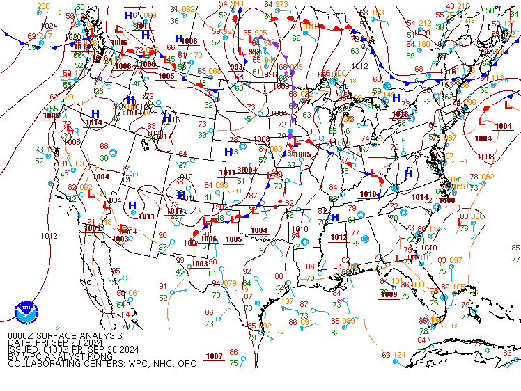
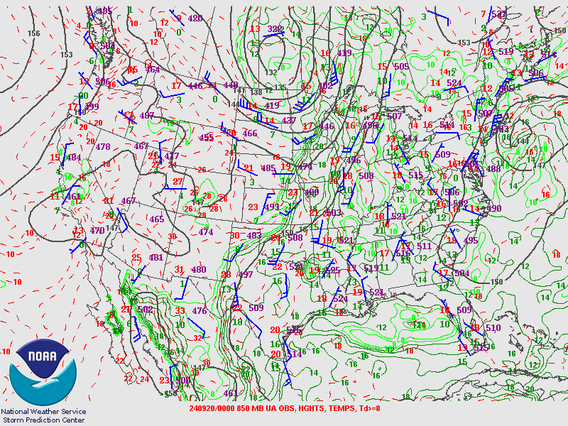
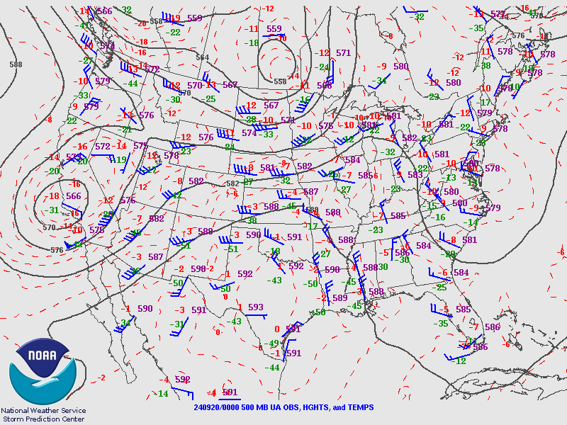
A line of supercells developed across northeast Minnesota into northwest Wisconsin late Thursday afternoon and into the evening ahead an occluded front and north of a warm front which were all connected to a deep low pressure system across southern Canada. The strength of this early fall system coupled with the summer-like instability provided the background for severe weather across the Northland. Significant turning of the winds in the low levels of the atmosphere, low cloud bases and near surface instability provided the key ingredients for supercells to become tornadic.
 |
 |
 |
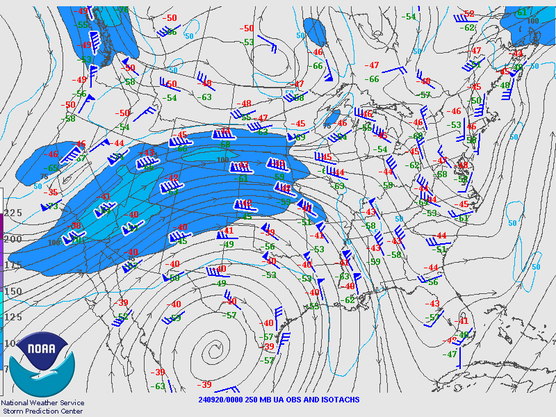 |
| Figure 1: Surface Analysis 00 UTC September 20 | Figure 2: 850mb Analysis 00 UTC September 20 | Figure 3: 500mb Analysis 00 UTC September 20 | Figure 3: 250mb Analysis 00 UTC September 20 |
Near-storm environment summary.
 |
 |
 |
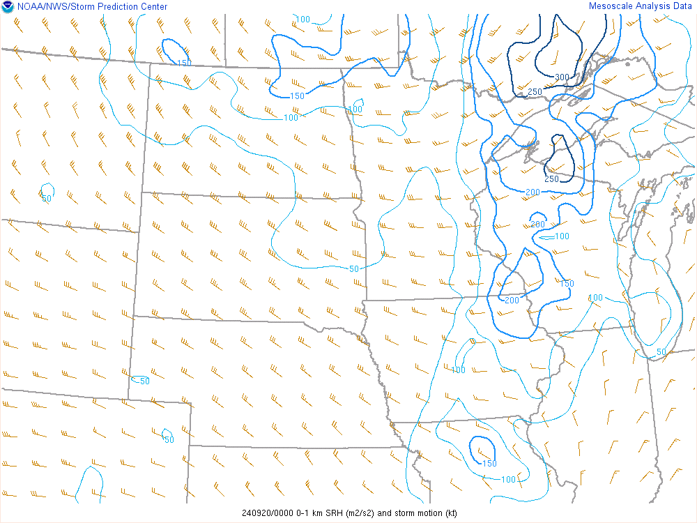 |
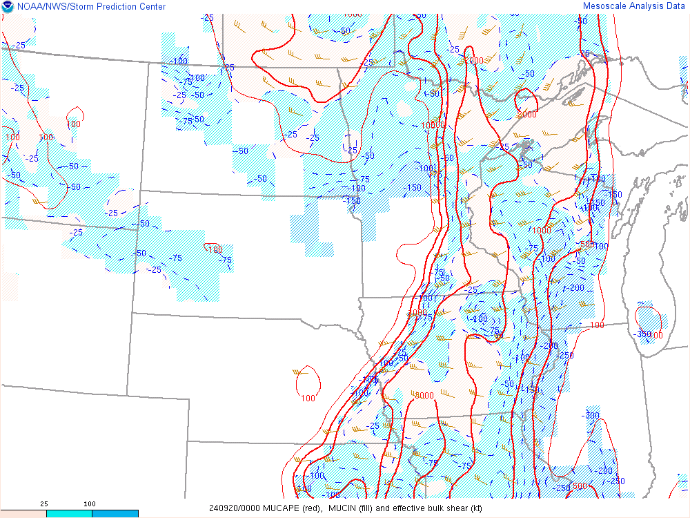
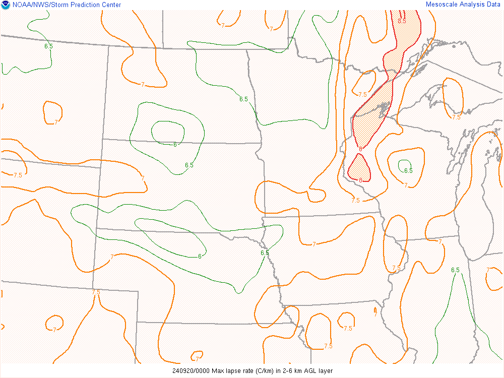
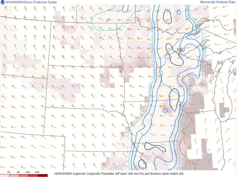
| Figure 4: Most Unstable CAPE and Bulk Shear, 00 UTC September 20 | Figure 5: Mid Level Lapse Rates 2-6km 00 UTC September 20 | Figure 6: Supercell Composite 00 UTC September 20 | Figure 7: Storm Relative Helicity 0-1km 00 UTC September 20 |
Additional environmental data.
 |
 |
|
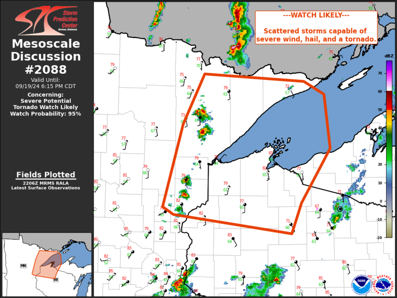
Figure 7: SPC Mesoscale Discussion #2088 508 PM CDT Mesoscale Discussion 2088 NWS Storm Prediction Center Norman OK 0508 PM CDT Thu Sep 19 2024 Areas affected...Minnesota and northern Wisconsin Concerning...Severe potential...Tornado Watch likely Valid 192208Z - 192315Z Probability of Watch Issuance...95 percent SUMMARY...Scattered storms capable of severe wind, hail, and a tornado. DISCUSSION...Thunderstorm development is ongoing along an occluding front and lifting warm front located across Minnesota and Wisconsin into Canada. Storms are located within a narrow corridor of instability and have shown increase in intensity over the last 30 minutes, with a few cells exhibiting rotation. A watch is likely to be needed to cover this threat. ..Thornton/Hart.. 09/19/2024 |
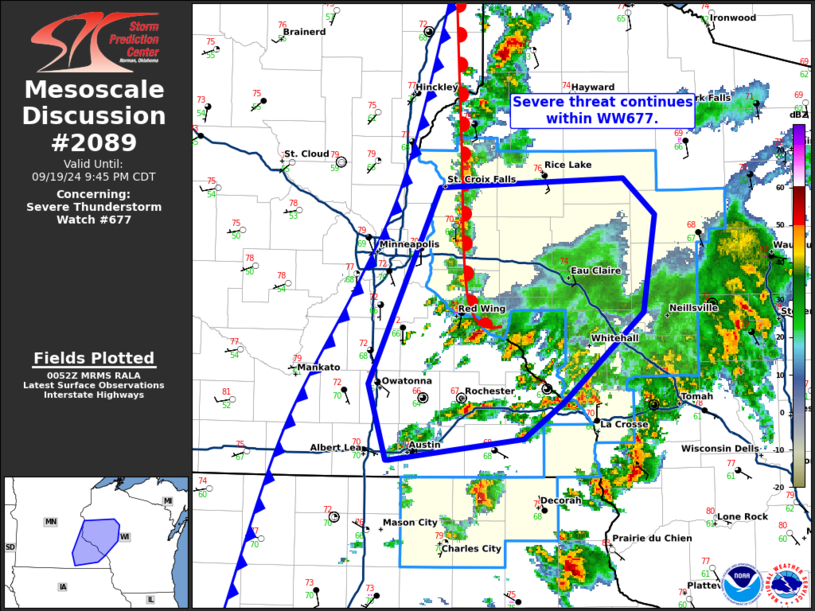
Figure 8: SPC Mesoscale Discussion #2089 754 PM CDT Mesoscale Discussion 2089 NWS Storm Prediction Center Norman OK 0754 PM CDT Thu Sep 19 2024 Areas affected...southeastern Minnesota...western Wisconsin Concerning...Severe Thunderstorm Watch 677... Valid 200054Z - 200245Z CORRECTED FOR MISSPELLING The severe weather threat for Severe Thunderstorm Watch 677 continues. SUMMARY...Severe threat continues within WW677. DISCUSSION...Storms continue along a northward lifting warm front and cold front moving across portions of eastern MN into western WI. Recent storm reports from storms along the warm front have produced instances of hail up to 1.25 in. Recent 00z RAOB from MPX shows a warm layer aloft with MLCAPE around 1900 J/kg and deep layer shear around 30 kts. Hodographs are primarily linear with generally uniformly westerly winds aloft. This will continue to support mixed mode of multi-cell clusters and occasional supercells capable of large hail. The highest threat for large hail will remain along and north of the warm front in the near term. Further severe development will continue along and ahead of the cold front as well, with potential for hail and instances of strong to severe wind. ..Thornton/Hart.. 09/20/2024 |
 |
|
|
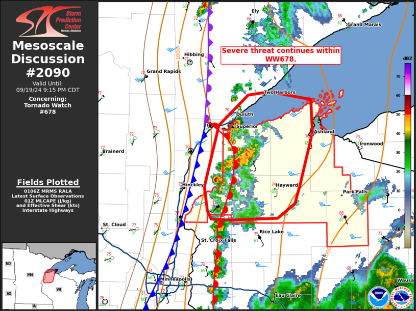
Figure 9: SPC Mesoscale Discussion #2090 808 PM CDT Mesoscale Discussion 2090 NWS Storm Prediction Center Norman OK 0808 PM CDT Thu Sep 19 2024 Areas affected...northern Wisconsin Concerning...Tornado Watch 678... Valid 200108Z - 200215Z The severe weather threat for Tornado Watch 678 continues. SUMMARY...Severe threat continues within WW678. DISCUSSION...Thunderstorms continue within WW678 across northern WI. Storm mode has largely been supercellular, with weakening observed over the last hour. Storms are still within a region of MLCAPE around 1000 J/kg but may be responding to loss of daytime heating and warmer mid-levels. Shear profiles do remain favorable. The VAD profile from DLH continues to show low-level curvature and 0-3 km SRH around 160 m2/s2, favorable for maintaining supercells capable of instances of large hail and perhaps a tornado. However, the declining thermodynamic profile may not support this risk for much longer into the evening. ..Thornton.. 09/20/2024 |
 |
Media use of NWS Web News Stories is encouraged! Please acknowledge the NWS as the source of any news information accessed from this site. |
|