"Watching" for Danger
11:40 a.m.
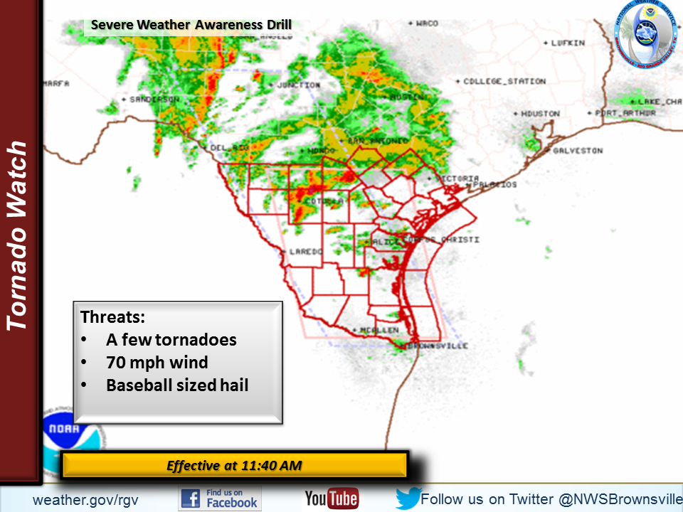
You are on your way to lunch and your favorite song is interrupted by an Emergency Alert System Message. Don't change the station, the message is important! A Tornado Watch has been issued and it includes your county!
While you are waiting for your food you see the watch scrolling on the TV behind the counter and our office's page now has this graphic displayed.

What's Important?
A "Watch" has now been issued, severe weather is becoming more likely! A Watch is usually issued for a fairly large area, and means everything has come together for bad weather to develop, but either the storms have not quite yet arrived or have not yet developed. In a watch you still have a little time. When you look at your wrist "Watch" you are checking the time, so remember "Watch" means "Time." Usually watches are issued 1-5 hours before the arrival of dangerous weather. It means "Watch" for dangerous weather.
A Tornado Watch means that there is a better chance severe storms that develop will produce tornadoes, in addition to large hail and damaging wind. A Severe Thunderstorm Watch means tornadoes are less likely but storms are still likely to produce large hail and damaging winds.
One more note, the hail size has increased from the earlier forecasts. The graphic now says "Baseball Sized Hail." Things are getting a little more serious!
What Do You Do Now?
Now is the time to really begin "Watching" conditions. Severe weather may develop very quickly and those puffy clouds outside the window could turn into dangerous thunderstorms. Turn your TV to a local channel, or frequently check our website or offices Facebook and Twitter feed. If you are in a mobile home, or a place that isn't designed for strong winds NOW is the time to begin moving to a safer location. Think about friends and family members that have special concerns or needs and reach out to help, but don't wait, it won't be long before things are dangerous!

