 |
 |
||||||||||||||||||||||||||||||||||||||||||||||||
| Minor Storm Surge Flooding Accompanies Dolly Laguna-side Flooding More Impressive on South Padre Island on July 23, 2008 |
|||||||||||||||||||||||||||||||||||||||||||||||||
E = Estimated
|
|||||||||||||||||||||||||||||||||||||||||||||||||
|
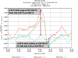
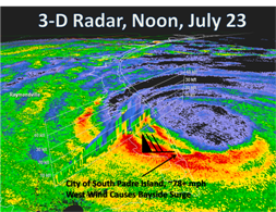
Dolly's rapid intensification just prior to landfall, combined with her slow crawl northward just east of South Padre Island, changed the result of Storm Surge flooding for residents along both sides of the lower Laguna Madre during the morning and afternoon of July 23rd. While the initially expected surge values (generally 3 to 5 feet, above) largely materialized across the area, and contributed to minor to locally moderate inundation, the resultant bayside flooding proved once again that actual landfall location of a hurricane eye can make all the difference in how much, and where, storm surge flooding develops. Cameron: Through 10 AM Cameron: After 10 AM  0.5 degree base reflectivity in three dimensional space as Dolly's Eyewall pounded SPI. |
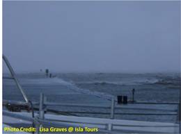
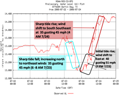
During the most intense period of winds, which were dominant from the west and west southwest, bayside storm surge of up to 4 feet rapidly developed, inundating areas west of Laguna (Gulf) Boulevard, and adding to the ongoing urban type flooding as a result of the torrential rains. Gulf Boulevard was totally under water, and other eyewitnesses claimed that the bayside surge stretched across the resort town during the peak of the winds, a little after 1 PM. Erosion from the prolonged period of hurricane force westerly winds shows clearly in these before and after images (courtesy of NASA).  Tides for Baffin Bay (just north of Kenedy County), showing initial tide drop, than a sharp rise after landfall Port Mansfield to Kenedy County |
||||||||||||||||||||||||||||||||||||||||||||||||