National Weather Service United States Department of Commerce

Severe Weather and Heavy Rainfall from the Midwest to the Ohio Valley; Mid-Summer Heat Continues

Severe thunderstorm and heavy rainfall threats will persist from the Midwest to Lower Great Lakes through Monday, shifting into the Ohio Valley and Central Appalachians Monday evening into Tuesday. Mid-summer heat will continue across much of the CONUS this week, with record highs possible well into the 100s across the south-central High Plains. Read More >


Navigation Menu
Quick Jumps:
Fuel Conditions
Drought Monitor


Precipitation and Fuel Conditions


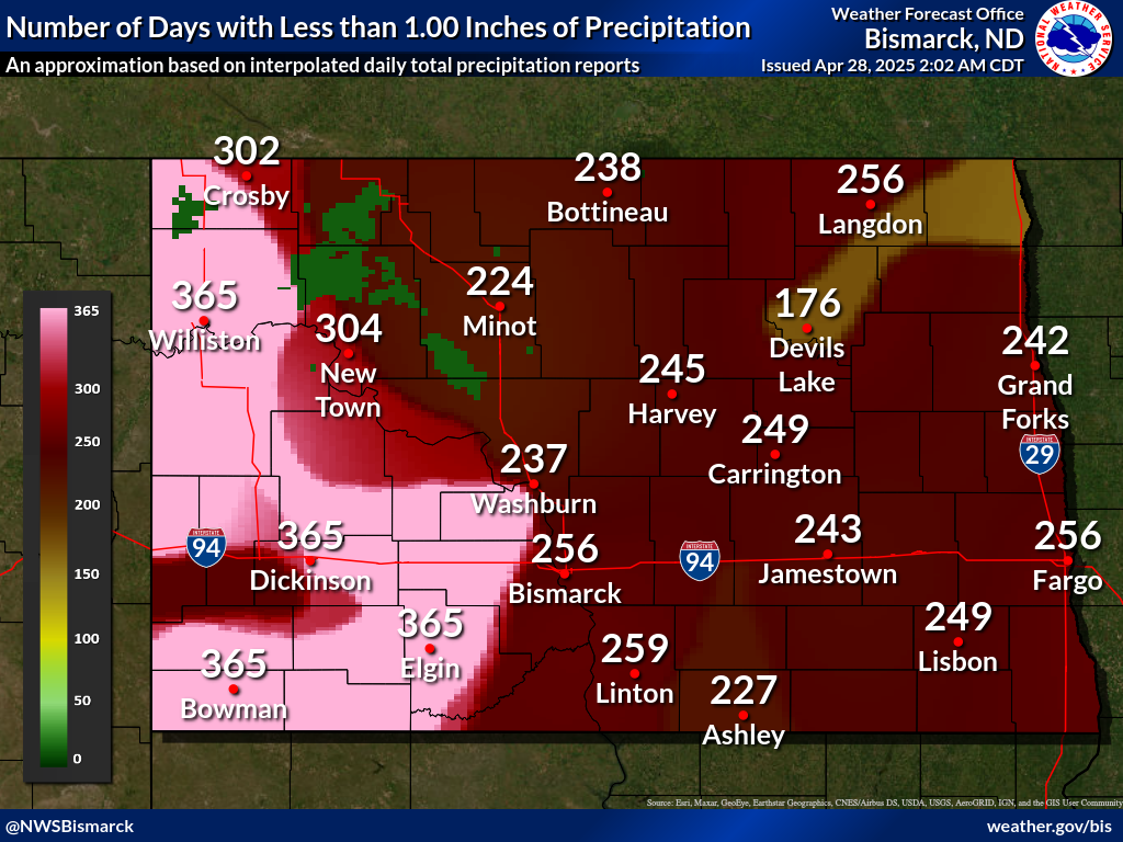
Number of Days with Less than 1.00" of Precipitation
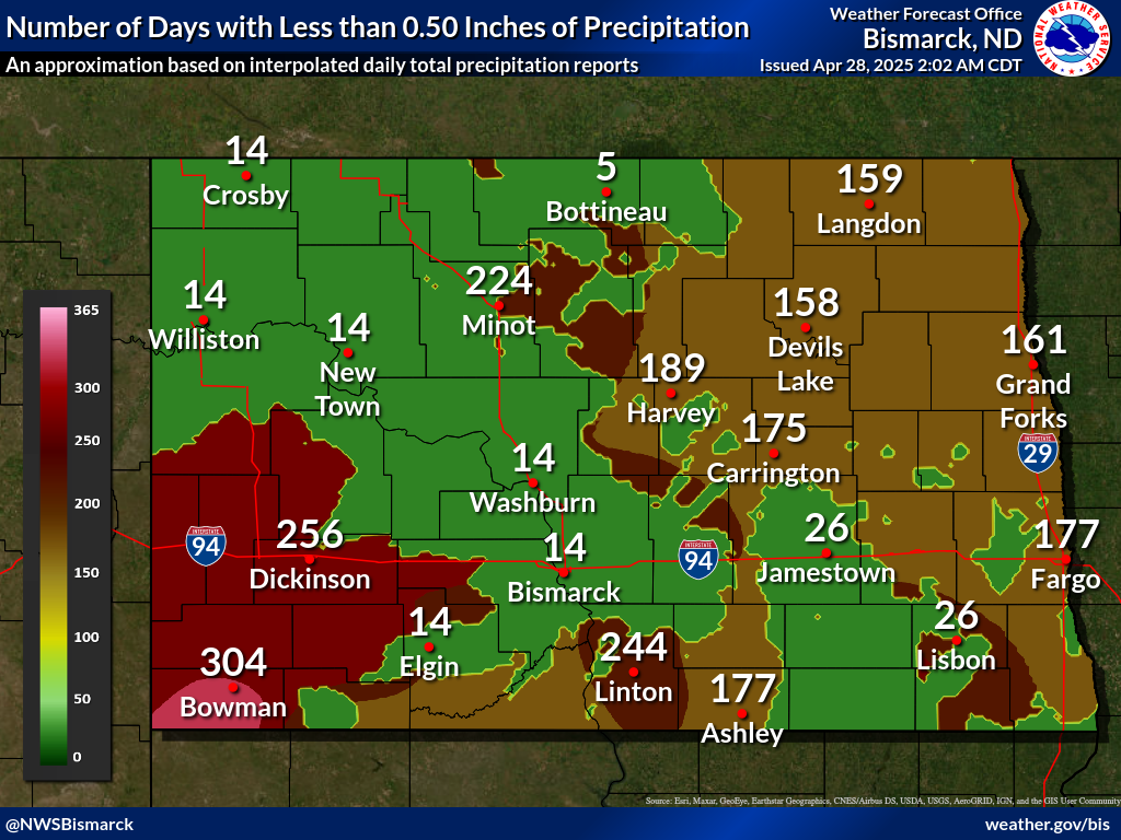
Number of Days with Less than 0.50" of Precipitation


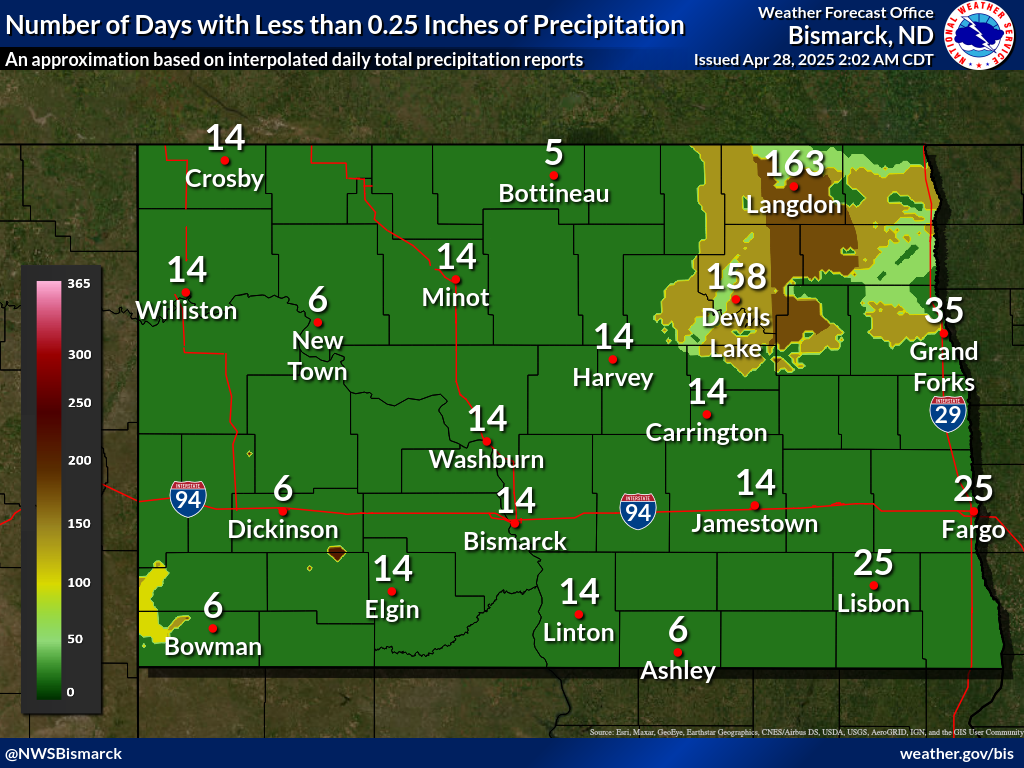
Number of Days with Less than 0.25" of Precipitation
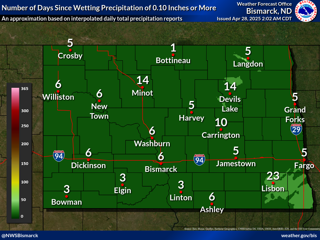
Number of Days with Less than 0.10" of Precipitation


Current Modeled Live Herbaceous Fuel Moisture


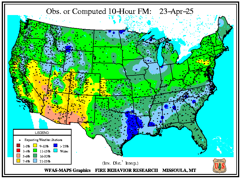
10 Hr. Fuel Moisture
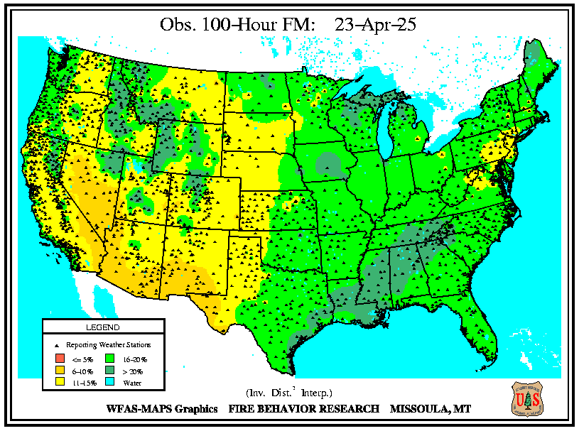
100 Hr. Fuel Moisture
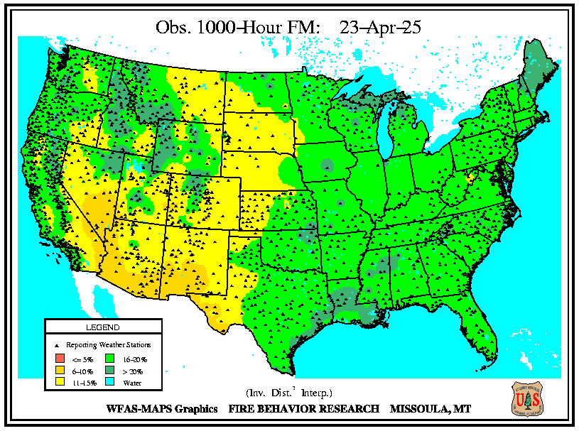
1000 Hr. Fuel Moisture


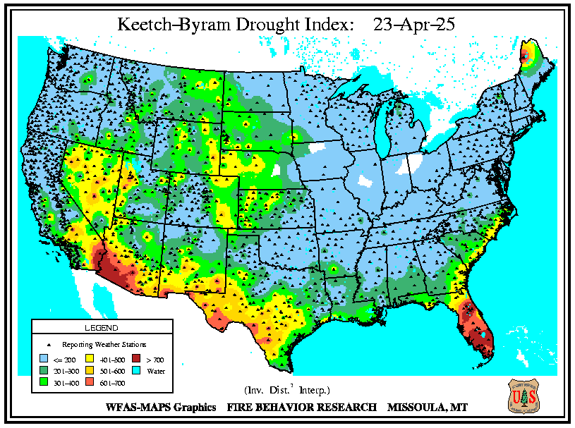
KBDI
Quick Jumps:
Precipitation and Fuel Conditions
Drought Monitor
 
Drought Monitor and Outlooks
ND Drought Monitor
Drought Monitor
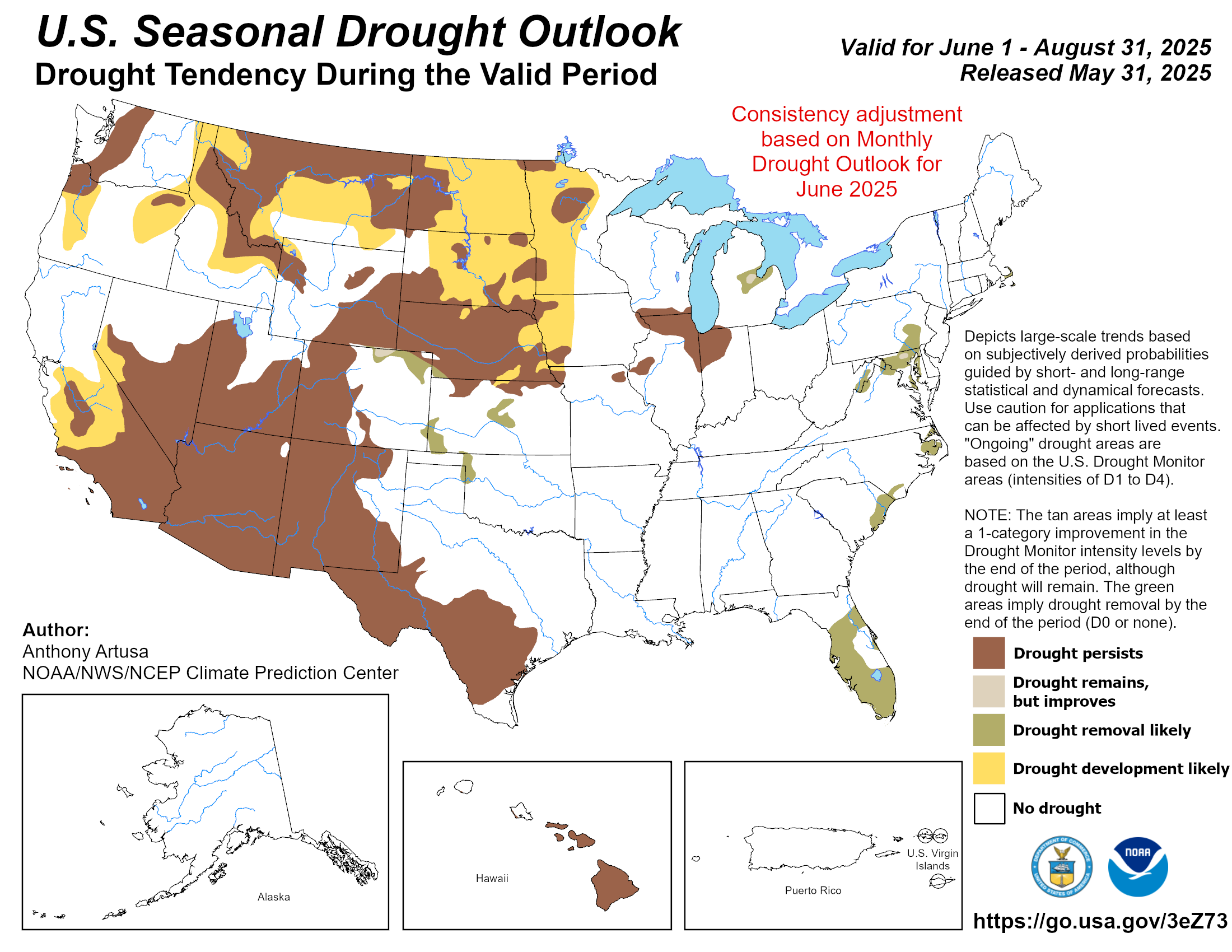
Drought Outlook
Quick Jumps:
Precipitation and Fuel Conditions
Drought Monitor


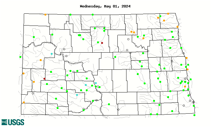
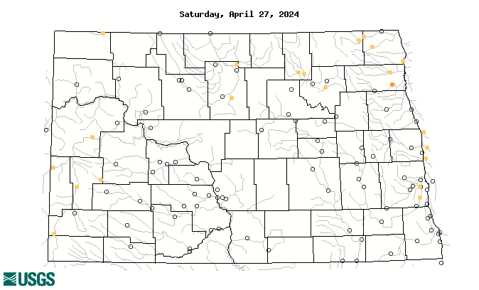
7 Day Streamflow Ranking
7 Day Streamflow to Drought Rating