
Record setting heat is expected over the next several days from the Intermountain West through the northern Plains. Furthermore, fire weather concerns increase with dry and breezy conditions. Meanwhile, heavy rainfall and severe thunderstorm threats for the Ohio/Tennessee Valleys, central Appalachians and Southeast today. The threat shifts to central Gulf Coast and across central Texas this week. Read More >
Overview
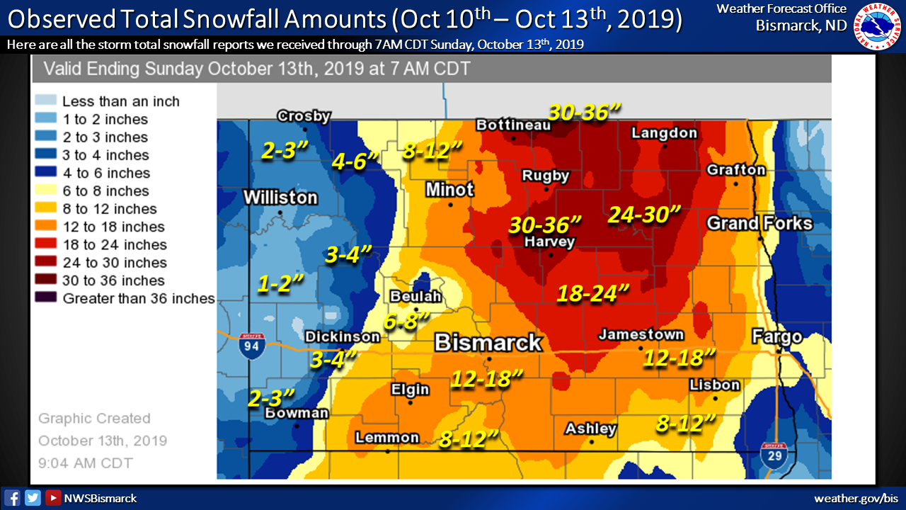
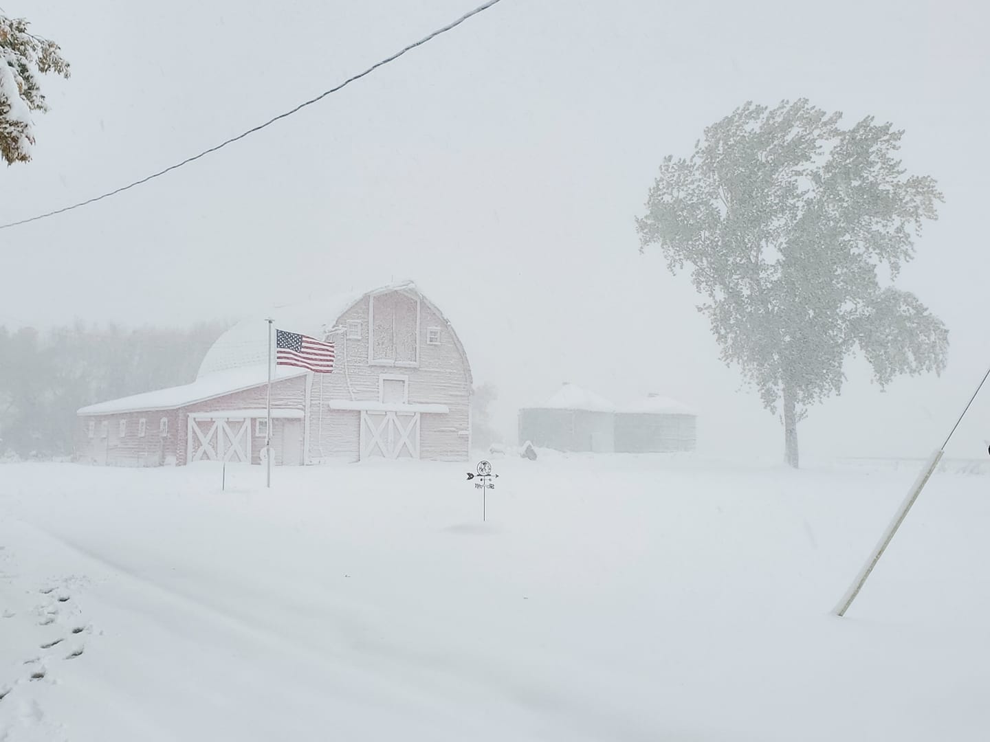
On Wednesday, October 9th, 2019, a large upper level low began intensifying across Montana, Wyoming, and Colorado as a strong surface cold front moved across the Dakotas. Precipitation started as rain for most areas and as cold air rushed in behind the front, it did not take long for the rain to change over to all snow. By Thursday morning, a very large Colorado Low developed downwind of the Rockies and began moving into the Northern Plains. The low stalled over far northwest Minnesota Thursday night in response to a downstream ridge over the northeast United States. This ridge blocked the upper level flow and prevented the low from moving out of the region. This kept the low stalled over the same area through Saturday night, which resulted in a very long duration of high winds and accumulating snow across central and eastern North Dakota. Blizzard conditions developed across portions of central and most of eastern North Dakota Friday and Saturday as winds increased, gusting as high as 64 mph.
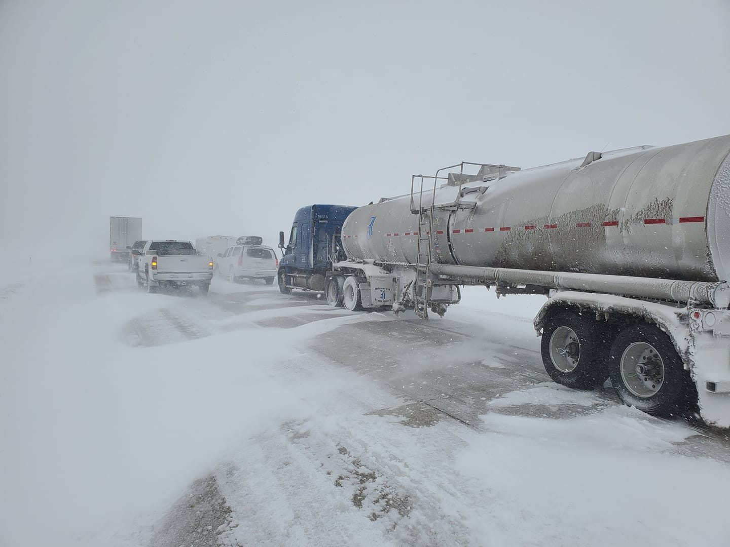
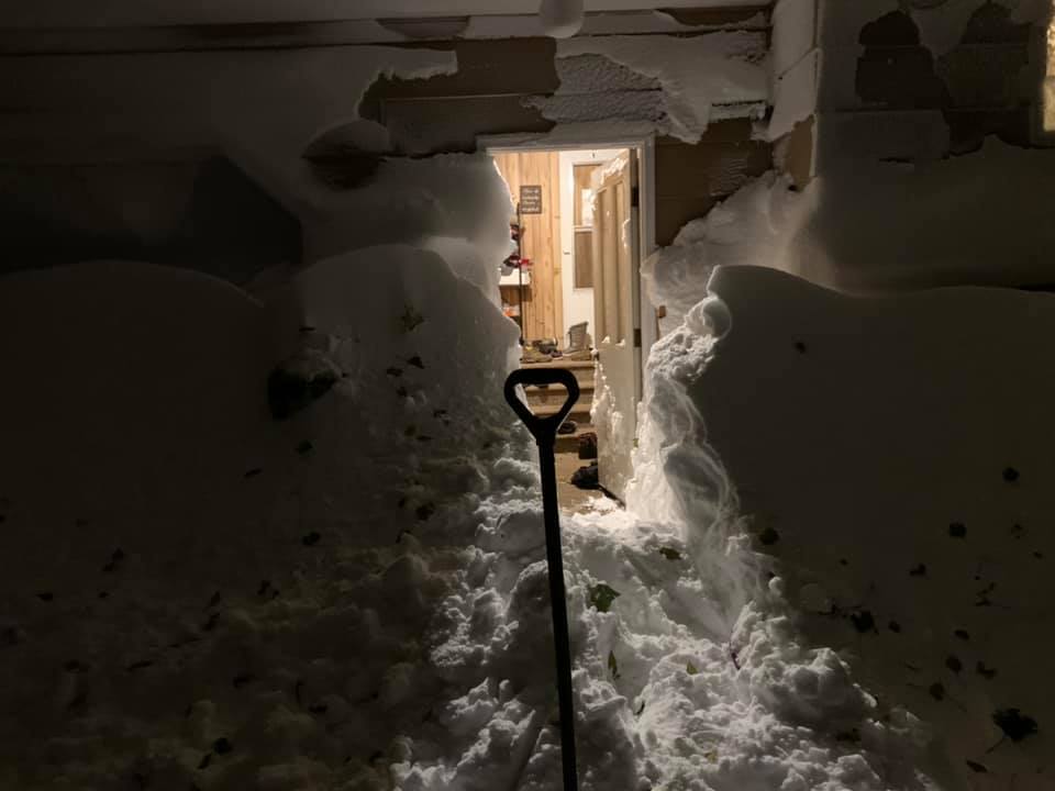
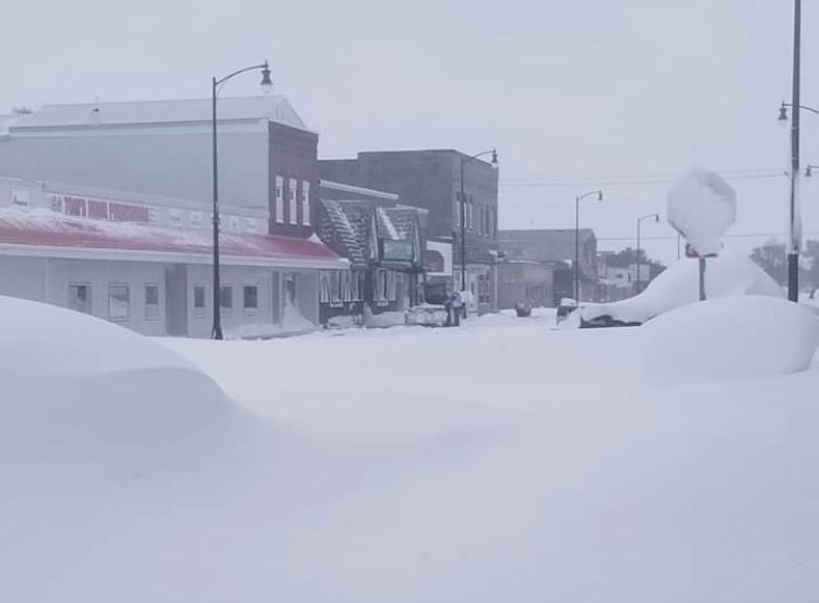
This record-breaking October blizzard certainly left its mark by the time the storm finally began moving out of the area on Sunday. Total snow accumulations as high as 30 inches were observed near Harvey with drifts over 10 feet tall. Widespread snow amounts between one and two feet were observed across nearly all of central and eastern North Dakota. Travel became impossible across much of the area as the interstate and other local highways shut down. Some tree damage was observed across portions of eastern North Dakota, because trees had yet to drop all of their leaves and could not bear the weight of the heavy wet snow. The timing of this blizzard could not have been worse for the agricultural community, which needed a prolonged period of warm and dry weather for a harvest that was already delayed due to a record wet September.
Snow/Ice
Photos
 |
 |
 |
 |
 |
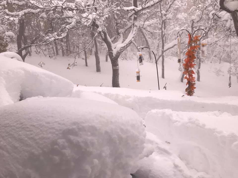
| Photo taken 6 miles west of Jamestown during the storm. Courtesy of Bednar. | Photo taken in Carrington. Courtesy of Anderson. | Photo taken in Harvey. Courtesy of Rick Jensen. | Photo taken in the Turtle Mountains. Courtesy of Jacobson. | Photo taken on State Highway 43. Courtesy of Ann Millerbernd, Rolette County Sheriff's Department. |
 |
 |
 |
 |
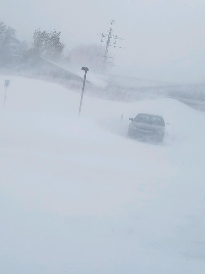 |
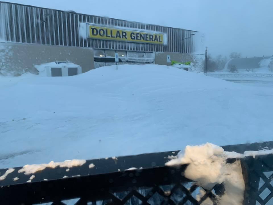
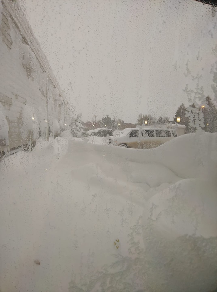
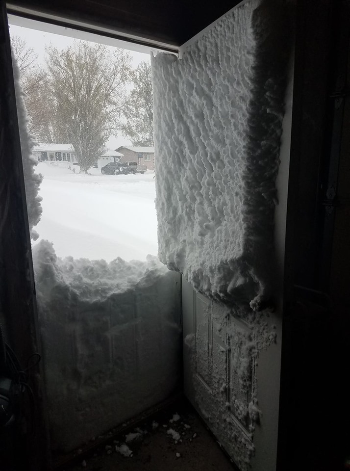
| Photo taken in Rolla at Dollar General. Courtesy of Joe Boehm with Green Cat Services. | Photo taken in Bismarck. Courtesy of Meidinger. | Photo taken in Jamestown. Courtesy of Rick Jensen. | Photo taken in McCanna. Courtesy of Quinn. | Photo taken in St. John. Courtesy of Mike Hanlan, St. John Fire Department. |
Radar/Satellite Loops
.gif) |
| Observed Radar Loop (October 9-12, 2019) |
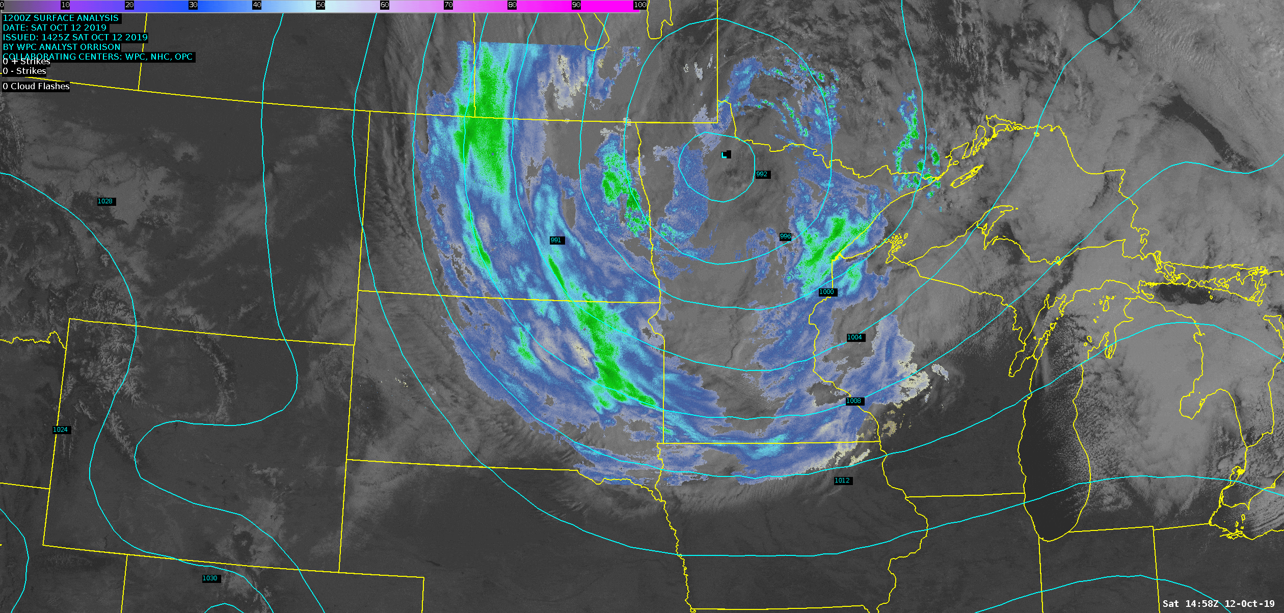 |
| Observed Radar/Satellite Loop from the morning of October 12, when blizzard conditions were occurring. Notice the low was centered over northwest Minnesota where it stalled. Snow-pack is also evident across southwest North Dakota and western South Dakota, along with lake-induced clouds off the eastern end of Lake Michigan. |
 |
Media use of NWS Web News Stories is encouraged! Please acknowledge the NWS as the source of any news information accessed from this site. |
|

